


Skeuvre to Maibelle


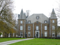
A walk through the woods along quiet paths and country lanes. At the end of the route, enjoy the view of Skeuvre Castle (private), which inspired Franquin to create the Château de Champignac in the Spirou comic strip.
Details
Creation:
Last update:
Last review:
–
–
-
 Activity: Walking
-
 Distance: 3.67 mi
-
 Average duration: 1h 55
-
 Difficulty: Easy
-
-
 Back to start: Yes
-
 Ascent: + 276 ft
-
 Descent: - 269 ft
-
-
 Highest point: 994 ft
-
 Lowest point: 807 ft
 Country:

 City:


Waypoints
- S/E : mi 0 - alt. 814 ft - Skeuvre
- 1 : mi 0.8 - alt. 991 ft - Crossroads
- 2 : mi 1.2 - alt. 955 ft - Fork in the road
- 3 : mi 1.79 - alt. 853 ft - Maibelle
- S/E : mi 3.67 - alt. 814 ft - Skeuvre
Other walks in the area
Skeuvre to Les Tiennes via Maibelle
 Visorando Member5.45 mi
+453 ft
-440 ft
2h 55
Easy
 Departure from Hamois (Province de Namur)
A lovely walk through woods, paths and quiet roads. Suitable for everyone, but there are a few muddy patches if it rains. Don’t forget to take a short detour at the end of the route to visit Skreuvre Castle, which inspired Franquin to create Champignac Castle in the Spirou comic strip.
Farms and castles starting from Natoye
 11.82 mi
+689 ft
-679 ft
6h 00
 Difficult
Departure from Hamois (Province de Namur)
There are more farms than castles: shrewd lords of the manor managed in their day to have them built away from public roads, and their descendants are keen to preserve these privileges.Nevertheless, the delightfully undulating countryside offers walkers the pleasure of discovering a farm here and a castle there, in varying states of repair.
Natoye and Braibant
8.28 mi
+617 ft
-633 ft
2h 50
 Moderate
Departure from Hamois (Province de Namur)
A lovely walk to do in dry weather. It takes you through woods and along quiet roads. You can catch a glimpse of Mouffrin Castle (private) and a few works of art along the way. If it rains, it’s best not to go up into the woods after Braibant station and to stay on Rue de Stée to rejoin the route and avoid two steep climbs.
Around Braibant, starting from Emptinal
 10.01 mi
+617 ft
-614 ft
5h 10
Moderate
Departure from Hamois (Province de Namur)
Emptinal, a hamlet in the former municipality of Emptinne, is unique in that it was split in two during the municipal mergers of the late 1970s: one part became part of Ciney, the other of Hamois. The Sainte-Madeleine Chapel, listed as part of Wallonia’s historical heritage, is part of Ciney, whilst the street running past it belongs to Hamois.This lovely walk winds through the Condroz countryside of Ciney and Hamois, crossing the Bocq river several times and the route of the Bocq Railway between Spontin and Braibant on three occasions.A new artwork entitled *Tressage Absidale* was installed in 2024 on the Sentier d’Arts, just before Reuleau.The *Fourmis* artwork in Stée, on the other hand, is suffering the ravages of time.
Circular in the Bois de Porcheresse
 10.03 mi
+656 ft
-656 ft
5h 10
Moderate
Departure from Hamois (Province de Namur)
Straddling the municipalities of Hamois and Havelange, the magnificent Bois de Porcheresse is mainly populated by deciduous trees that display their most beautiful colours in autumn. The hike alternates between country lanes and forest paths.
The Bois Poncelet, starting from Hamois
5.83 mi
+279 ft
-266 ft
2h 55
Easy
Departure from Hamois (Province de Namur)
Starting from the car park near the Hubinne Chapel, this route takes you partly along tarmac roads through the Condruz countryside on roads with very little traffic, as far as the Haie Jadot and along forest paths in the Poncelet woods.
From Hamois to Barvaux-Condroz and back
15.34 mi
+928 ft
-925 ft
7h 50
Difficult
Departure from Hamois (Province de Namur)
A hike through the Condroz countryside, in the “Pays des Tiges et des Chavées”, covering the municipalities of Hamois and Havelange, with a small section on the Sentiers d’Art (2 artworks) and on various PR® trails, local walks or Grande Randonnée de Pays (GRP® 575 “À travers le Condroz”) routes.Whilst the route from Hamois to Barvaux is mainly on footpaths, the return leg includes a few more tarmac sections, regularly interspersed with sections unsuitable for vehicles.The circular route starts from the car park of the Hamois Office de la Culture (OC) on Rue de la Boverie. Unless an event is announced, this car park is usually empty, or nearly so.
A short walk around Hamois
3.79 mi
+148 ft
-151 ft
1h 50
Easy
Departure from Hamois (Province de Namur)
A route mainly on tarmac and hard surfaces (pavements, Ravel cycle path) based on walks of varying degrees of popularity, including aGR® route, along the Ravel cycle path and on streets of varying sizes in and around Hamois.
A short stretch of footpath, which can be quite muddy in wet weather and impassable with a pushchair, adds variety to this route. An alternative route is suggested in the description, but this reduces the distance covered.
For more walks, use our search engine .
The GPS track and description are the property of this route's author. Please do not copy them without permission.

