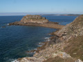
Kérescar Pond in Ploumoguer

A short, peaceful walk around this pond, which covers approximately 4 hectares and serves as the region’s water reserve (Ploumoguer, Le Conquet, etc.).

The banks are very well maintained and adorned with seasonal flowers, providing a good spot for spotting birds such as coots, the ever-present seagulls and a few swans…

Details

n°646404
Creation:
Last update:
–
Last review:
  • Walking
    Activity: Walking
  • ↔
    Distance: 1.09 mi
  • ◔
    Average duration: 0h 30 
  • ▲
    Difficulty: Easy

  • ⚐
    Back to start: Yes
  • ↗
    Ascent: + 20 ft
  • ↘
    Descent: - 20 ft

  • ▲
    Highest point: 121 ft
  • ▼
    Lowest point: 102 ft
  • ⚐ Country: France
  • ⚐ City: Ploumoguer (29810)
  • ⚑
    Start/End: N 48.386092° / W 4.714892°
  • ❏
    IGN map(s): Ref. 0417ET
  • Hour-by-hour weather

Photos

Description of the walk

Access: From the D67, the road linking Saint-Renan to Le Conquet, at a junction marked by a cross, head towards the village of Ploumoguer. The pond is situated approximately 700 metres on the right (iron gate with an information sign).
Park at the side of the road without obstructing the access route to the pond.

(S/E) To the left of the gate, take the designated path and follow the access route to the pond used by the maintenance teams. Turn right onto the wide grassy path to begin your walk around the pond in an anti-clockwise direction. This path is regularly maintained but may be damp in winter.

(1) At the far end of the pond, continue for about ten metres through the wooded area until you reach the wooden footbridge spanning the stream that feeds the pond. Retrace your steps and continue round the pond on the right-hand side to reach the spillway.

(2) Cross the footbridge over the spillway, walk along the earth embankment that encloses the pond and rejoin the access path. Turn right to reach the entrance gate (S/E).

Waypoints

  1. S/E : mi 0 - alt. 102 ft - Entrance gate
  2. 1 : mi 0.53 - alt. 115 ft - Feeding stream and footbridge
  3. 2 : mi 0.93 - alt. 112 ft - Spillway
  4. S/E : mi 1.09 - alt. 102 ft - Entrance gate

Notes

Please respect the area around this body of water, which is a drinking water reserve.

Worth a visit

Observe the birds that find refuge here, as well as the various insects (dragonflies) and aquatic plants.

Reviews and comments

4.7 / 5
Based on 1 review

Reliability of the description
5 / 5
Ease of following the route
5 / 5
Route interest
4 / 5
yann-29
yann-29

Overall rating : 4.7 / 5

Date of your route : Mar 24, 2019
Reliability of the description : ★★★★★ Very good
Ease of following the route : ★★★★★ Very good
Route interest : ★★★★☆ Good

Hello, A lovely walk in the heart of the countryside, sheltered from the wind, around this beautiful pond. The banks are wide and well-maintained. The walk round the pond is 1.6 km. There are always lovely little spots to discover. Thank you for the downloadable map.

Machine-translated

Other walks in the area

For more walks, use our search engine .

The GPS track and description are the property of this route's author. Please do not copy them without permission.