


 Country:
 City:
City:



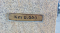
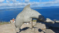
(S) From the campsite, cross the AC-445 with care and head right (west) to leave the town of Estorde, then walk along a footpath that runs alongside this road. Continue until you reach the sign indicating a roundabout.
(1) Follow the path away from the road, passing to the left of the roundabout before rejoining the AC-445 further up the road at the entrance to the village of Sardineiro.
(2) Cross the road carefully, then turn right and then left onto Rúa Pombal. Walk down this street, lined with richly decorated houses, to rejoin the AC-445.
(3) Cross at the pedestrian crossing and continue along the short Rúa Mestre Barrera, which leads onto Rúa da Coruña (AC-445). Carry on south-west and use the pedestrian crossing to reach the house opposite No. 53.
(4) Turn right onto Rúa San Xoán, then immediately left at the grain dryer to continue along Rúa Nova. At the Fork in the road, turn right onto Rúa Fisterra and begin the climb that takes you out of the town to a viewpoint overlooking the bay. Continue uphill until you reach the Fork in the road.
(5) Turn slightly left onto a stony path that winds its way between pine and eucalyptus trees before heading downhill. Ignore the cross-paths and join the AC-445.
(6) Cross the road very carefully: be careful, as you are coming out of a bend. Carry on along the path opposite, which descends and leads to the junction for Talón Beach, tucked away amongst the rocks and trees.
(7) Do feel free to head down to this superb fine-sand beach for a refreshing dip (15 mins there and back).
(8) From the beach, head back up to rejoin the path.
(7) Continue to the left (west) to rejoin the AC-445, which you’ll need to follow south-westwards to Corredoira de Don Camiloune, where you’ll find a memorial dedicated to Camilo José Cela.
(9) Turn left onto the dead-end road leading to Langosteira Bay. At Calcoba, begin the long and pleasant Langosteira seaside promenade. You’ll leave the beaches behind as you pass behind the Restaurante Tira do Cordel before reaching Rúa Cruz de Baixar.
(10) Continue left (south-east) as far as the Baixar cross, then carry on along the A Coruña road (AC-445), following the coast to enter the town of Fisterra. Stay on the AC-445 until the right-hand bend at the Coviran supermarket.
(11) Carry on straight ahead along A Coruña Avenue to find your hostel and drop off your bag. At the post office, turn slightly right onto Rúa Sta. Catarina and continue to the ‘Stop’ sign.
(12) Turn left towards the harbour. At the monument honouring immigrants, which serves as a roundabout, turn right onto Paseo Ribeira, which runs alongside the harbour. Pass a building shaped like an aeroplane wing and head towards the lighthouse (faro). Walk past the small Ribeira Beach, then take the small uphill path to the right of the Froiz supermarket. Continue along Rúa Manuel Lago País until you reach the give-way sign at the junction with the AC-445.
(13) Turn left, walk past the Church of Santa María das Areas and carry on straight ahead (south-east). Please be aware that it is busy with people and traffic: take care. Continue uphill until you reach the monument honouring the walkers who have made it this far.
(14) Carry on until you reach a junction where campervans turn off into a dedicated car park.
(15) Carry on until you reach a large car park where the Faro de Fisterra Cross is located.
(16) Walk to the right of the souvenir shop to reach the Finisterre lighthouse at the summit of Monte Facho, which rises 238 metres above the sea.
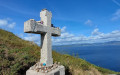
(17) Walk to the left of the lighthouse, then, taking care on the rocks, walk past the Botte de Finistère, followed by the cross (E) – a magical spot symbolising your arrival at the End of the Earth.
For the return journey, you have two options:
- Either take the path in the opposite direction to return to Fisterra.
- Or, instead of returning by the same route,
(16) you can turn left onto the small road leading up to the Mirador do Solpor – ‘a superb sunset awaits you’. Then head towards the telecoms mast and take the track on the left which leads you to Monte Facho and the Piedras Santas: shifting rocks, a key site in pre-Christian mythology.
Further down, join a path that heads off to the right; then, taking a track to the left at a water reservoir, you’ll reach the road near the Church of Santa Maria das Areas.
 Association / Club / Walk leader
 Visorando Member
 Difficult
