Between the Sancerre vineyards and the Loire by bike

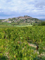
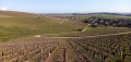
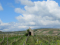
This walk takes you on a journey through the Sancerre vineyards and along the Loire. Starting from Saint-Satur, you’ll walk through the vineyards at the foot of Sancerre before reaching the Loire by bike by crossing the Canal Latéral.
This walk is easier than the one called “In the heart of the Sancerre vineyards – Chavignol and its surroundings”. The elevation changes are less significant. The final four kilometres are on flat ground.

Details

21085440
Creation:
Last update:
Last review:
  • Walking
    Activity: Walking
  • ↔
    Distance: 6.45 mi
  • ◔
    Average duration: 3h 25 
  • ▲
    Difficulty: Moderate

  • ⚐
    Back to start: Yes
  • ↗
    Ascent: + 522 ft
  • ↘
    Descent: - 515 ft

  • ▲
    Highest point: 883 ft
  • ▼
    Lowest point: 482 ft
  • ⚐ Country: France
  • ⚐ City: Saint-Satur (18300)
  • ⚑
    Start/End: N 47.339559° / E 2.85612°
  • ❏
    IGN map(s): Ref. 2422SB, 2423SB, 2522SB, 2523SB
  • Hour-by-hour weather

Description of the walk

Park in the square on Rue de Commerce in Saint-Satur.

(S/E) Leave the square via Rue du Commerce on the right and walk up this street. At the end of the street, cross Rue Paul Cannier and take Rue du Chemin de Fer opposite you until you reach the old station, now known as the “Maison des Associations”.

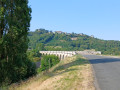
(1) Take the first street on the left between the two ‘mounds’ towards the viaduct. Continue straight on and cross the viaduct.

(2) As you approach the first junction, take the path on the right between the hedges. At the road, turn right onto the white path leading uphill. The path first winds through a small wood before reaching the vineyards. Continue straight on until you reach the road. Cross it and take the path leading uphill opposite. Continue along this path, leaving a footpath on your right.

(3) The path becomes a small road again near a house. At the junction, turn left onto the path that descends between the vineyard and the D7E road. At the next junction, follow the road opposite, then take the first path on the right.

(4) Cross the D920 and carry on straight ahead along this track. At the next junction, turn left onto theGR®31. Leave theGR® and take the first track on the right which climbs between the vineyards. Carry on straight ahead until you reach a road.

(5) Follow the road to the left and, at the bend, take the first track on the left. Follow it straight on until you reach the junction with theGR®31.

(6) Turn right onto theGR® and follow it until you reach the entrance to Ménétréol-sous-Sancerre. Cross the D307 to take the street opposite, then turn left into the first street. Pass under the viaduct. Continue straight on, past the church, until you reach the D9.

(7) Cross the D9, then the Canal Latéral à la Loire. At the end of the path, turn left towards Les Aubelles. Continue along theGR® until you reach the ‘Loire à vélo’ cycle route.

(8) Turn left and follow theGR®31(La Loire à vélo) to the entrance to Saint-Satur.

(9) Take the first street on the left, go round the stadium, then follow the Canal Latéral à la Loire towards the silos. At the bridge, cross the canal and continue straight on to return to the starting point (S/E).

Waypoints

  1. S/E : mi 0 - alt. 502 ft - The square is on Rue de Commerce
  2. 1 : mi 0.28 - alt. 587 ft - Former railway station
  3. 2 : mi 0.9 - alt. 597 ft - After the viaduct
  4. 3 : mi 1.27 - alt. 755 ft - A small road at the foot of Sancerre
  5. 4 : mi 1.49 - alt. 679 ft - Through the vineyards
  6. 5 : mi 2.65 - alt. 866 ft - Road junction
  7. 6 : mi 3.13 - alt. 722 ft - GR31
  8. 7 : mi 3.97 - alt. 486 ft - Cross the Canal Latéral à la Loire, then the - Vauvise (rivière) - Affluent de la Loire
  9. 8 : mi 4.62 - alt. 486 ft - The Loire by Bike - La Loire
  10. 9 : mi 5.86 - alt. 486 ft - Saint-Saturé. Near the - La Loire
  11. S/E : mi 6.45 - alt. 502 ft - The square is on Rue de Commerce, just past the - Canal latéral à la Loire

Notes

There is very little shade on this walk, so remember to bring a hat if the sun is out.
All shops are in Saint-Satur.
Bars and restaurants are open in season in Ménétréol-sous-Sancerre.

Always be cautious and plan ahead when you're outdoors. Visorando and the author of this route cannot be held responsible for any accidents occurring on this route.

The GR® and PR® markings are the intellectual property of the Fédération Française de Randonnée Pédestre.

Reviews and comments

4.1 / 5
Based on 4 reviews

Reliability of the description
4 / 5
Ease of following the route
4 / 5
Route interest
4.3 / 5
Randoclo89
Randoclo89

Overall rating : 4 / 5

Date of your route : May 28, 2026
Reliability of the description : ★★★★☆ Good
Ease of following the route : ★★★★☆ Good
Route interest : ★★★★☆ Good
Very busy route : Yes

The only downside is the signposting on the GR 31: there are gaps in the markings where you need to leave or rejoin the trail, especially as there are plenty of places to use as landmarks (vine stakes, posts, trees, cycle route signs, etc.)
But the Viso Rando route is good, thankfully we didn’t get lost...

Machine-translated

Pascale72
Pascale72

Overall rating : 4.7 / 5

Date of your route : Jun 18, 2024
Reliability of the description : ★★★★★ Very good
Ease of following the route : ★★★★★ Very good
Route interest : ★★★★☆ Good
Very busy route : No

A popular route: a walk we went on one Thursday during term time; so we didn’t see a soul!

Machine-translated

rand@23
rand@23
• Edited:

Overall rating : 4 / 5

Date of your route : May 10, 2024
Reliability of the description : ★★★★☆ Good
Ease of following the route : ★★★★☆ Good
Route interest : ★★★★☆ Good
Very busy route : No

A very interesting route; the walk is not very busy.
We particularly enjoyed the first section through the vineyards, which was very peaceful and pleasant, and at times surprising.
Highly recommended!

Machine-translated

Po
Po

Overall rating : 3.7 / 5

Date of your route : Jul 28, 2022
Reliability of the description : ★★★☆☆ Average
Ease of following the route : ★★★☆☆ Average
Route interest : ★★★★★ Very good
Very busy route : No

Beautiful scenery. Challenging climbs. The directions for points 3 and 4 are unclear.

Machine-translated

Other walks in the area

For more walks, use our search engine .

The GPS track and description are the property of this route's author. Please do not copy them without permission.