Country:
 City:
City:


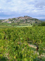
Park on Rue Rempart des Dames; parking is free.
(S/E) Go to the end of the street, take the small road heading southwards and continue along the path until you can go no further straight on.
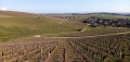
(1) Cross a road and walk alongside the vineyards for about one kilometre.
(2) Turn right, then right again, and you’ll reach the D307.
(3) Follow it to the right until you reach the entrance to the woodland.
(4) Turn right to stay amongst the vineyards.
(5) At the first track, take the track going uphill to the left (steep towards the end).
(6) At the top of the climb, turn right and then keep to the left-hand side of the track. Join the D307.
(7) Follow it to the left until you reach a bend.
(8) Carry on straight ahead into the woods, then take the path on the left.
(9) Keep to the right until you reach the mobile phone mast.
(10) Then take the small path on the right.
(11) After the descent, take the sharp left-hand bend and carry on until you reach the entrance to a vineyard.
(12) Turn left. Be careful, as the path is barely visible once you reach the woods. Join another path.
(13) Turn right until you reach the entrance to the hamlet of Véry. At the ‘private property’ sign, go round to the left until you reach the D202.
(14) Then turn right and follow the road to the entrance to Bannon.
(15) Turn right to head up into the vineyard.
(16) At the end of the track, turn left, then, at the next junction, turn slightly right onto a small road.
(17) Follow it to the right until you reach the D10.
(18) Turn right; at the Fork in the road, leave the departmental road and take the first track on the left. Halfway along the track, head up to the right until you reach a farm track.
(19) Take this to the right, then left before a hut.
(20) Turn left and then immediately right as you go downhill. At the end, turn right and carry on until you reach the D307.
(21) Turn left, then right at the roundabout to reach the car park on the left (S/E).
 Visorando Member
 Association / Club / Walk leader
 Easy
Easy 
 Tourist office