Country:
 City:


The walk starts along the road, with parking available about 100 m from the water collection well.
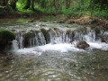
(S/E) Take the small path leading towards the Suzon. Cross it via a bridge consisting of a concrete pylon. Enter the woodland a little further on and walk alongside the river, following the GR®2 on the right. Continue in this way until you reach the sign for the Combe des Vaux de Roche.
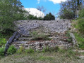
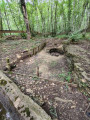
(1) Continue following the Suzon valley, along the edge of the woodland. Further on, you’ll emerge onto the Val Courbe estate. The ruined mill is 30 metres further on, on the left.
(2) Retrace your steps, leaving the GR®2, and begin a winding ascent through the woods. The gradient is steady. You’ll reach the plateau after three bends and, once there, take the correct path which veers slightly to the left. Follow it across the plateau, ignoring all the other paths you come across, until you reach a junction.
(3) Carry on straight ahead along the path, which climbs a little further through a clear-cut area before descending again.
(4) At the large, slightly uphill junction at the edge of the woods, at elevation 497, take the wide, straight path straight ahead and follow it south-west for just over 2 km. You’ll reach a fork in the path.
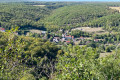
(5) Turn left onto the path marked in yellow, which descends towards the village of Pasques (lovely view as you emerge from the woods). Continue in this direction until you reach the new sports grounds.
(6) From there, you can walk on to the village of Pasques a little further on; there is a rest area at thefirst junction, with benches by the pond.
(7) Return by turning left onto the yellow path, passing by the houses and along the edge of the fields to reach the sports grounds again.
(6) Follow the yellow markings northwards, looking out slightly over the fields and the Combe Morte, until you reach a large junction at the edge of the forest.
(8) Turn right and follow the signs for “Le Creux Percé and the village of Val Suzon” on the Yellow trail. After about 600 m, you’ll come to another junction. The geological feature known as Le Creux Percé is 50 m to the right, with information boards.
(9) Retrace your steps and then continue northwards on the Yellow Trail towards Val Suzon. Descend the wild valley to the 467-metre mark, then turn right. At the next junction, turn left onto the uphill path and you’ll reach the Grottes des Célerons: access is possible (difficult and slippery path!).
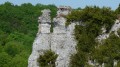
(10) Alternatively, continue to the right along the path offering views of the cliffs opposite. Follow this balcony-like path to reach a junction. Turn left to reach the Roche Beudon, which overlooks this part of the Combe des Vaux de Roche.
(11) Retrace your steps, rejoin the path overlooking the Combe Beudon and turn left at the end. You’ll reach a large junction at the end of the valley.
(12) Ignore the Yellow Way markings and turn left, staying on the plateau for the time being without descending into the valley. Continue in this direction until you reach a marked bend to the right.
(13) This marks the start of the descent, which is straight and steady, but watch out for stones and tree stumps. This will take you to the bottom of the Combe de Vaux de Roche, where there is a signpost.
(1) Turn right and, following the route back in the opposite direction to the way out, return to the car park (S/E).
 Visorando Member

 Easy
 Difficult