In the forest between Herbeumont and Chiny, starting from Les Épioux

Explore the forest to discover the Roche Perette and then the Rocher du Chat viewpoint, follow the Semois twice and finish at the château and the Épioux pond.

Details

25523349
Creation:
Last update:
Last review:
  • Walking
    Activity: Walking
  • ↔
    Distance: 12.80 mi
  • ◔
    Average duration: 7h 05 
  • ▲
    Difficulty: Difficult

  • ⚐
    Back to start: Yes
  • ↗
    Ascent: + 1,358 ft
  • ↘
    Descent: - 1,375 ft

  • ▲
    Highest point: 1,444 ft
  • ▼
    Lowest point: 912 ft

Photos

Description of the walk

Car park alongside the Étang des Épioux.

(S/E) With your back to the pond, and the Château des Épioux on your right, take the forest path to the left of the Ruisseau des Tamijan (where the water flows out of the pond), marked by an information sign at the entrance.

GR® signposting

Walk until you reach a fork in the road.

(1) Continue to the left. Head uphill and follow this path for 1.2 km. Join another path and continue to the right. Then ignore a path on your right. Emerge from the trees and pass close to an electricity pylon. View of Florenville church in the distance. Walk to thesecond pylon.

Red Rectangle Triangle Marker 24

(2) Take a sharp right onto this stony track. Head downhill and pass under the railway line. Take thesecond track on your right to see the Étang de Tamijan; stay at the entrance as the land beyond is private property. Retrace your steps and continue along the track to the junction. Turn right and look out for the path on the left near the pond.

Unmarked

(3) Turn left and head uphill. At the crossroads (not fully marked on maps), continue to the left for about 500 m. At the Fork in the road, take the right-hand path and, at the next Fork in the road, keep to the left and walk until you reach the road.

(4) Turn right and then immediately left to join the path close to the road, well before the red and white barrier. The track, at the bottom of the valley, becomes a footpath and winds through the ferns.

(5) Walk alongside the fir forest and discover the Roche Perette. The path turns left and leads to a forest track. Continue along this track to the right and descend to the Semois.

Signpost: Red Triangle and Red Rectangle 17

(6) Carry on to the right and, a little further on, pass the Roche Perette stream. Then walk for about 1.5 km until you reach a path on your right, near a stream with a standing dead tree serving as a signpost.

(7) Turn right and follow the stream until you rejoin a path. Turn right, wade across the stream and continue uphill. Wade across again and carry on for about 300 m. When the climb levels off and the stream moves away from you, look out for the path on your left.

Unmarked

(8) Turn left and head uphill. At the road, turn right and walk carefully alongside it for 300 m. At the open stretch, turn left onto the forest track. Keep to your left, ignoring the two forest tracks in quick succession (only one shown on the maps) leading off to your right. Look out for the path (not shown on IGN maps) just after this, still on your right.

(9) Take the path. It bends slightly to the right and joins a forest track. Follow it to the left. Walk for about 650 m until you reach a junction with a forest track.

(10) Take a sharp right-hand bend, then keep an eye out for a clear space with a tree stump forming a roundabout. Turn left to head for the Rocher du Chat viewpoint. Marked with a Yellow Rectangle 16 for the round trip to the viewpoint.
Retrace your steps and continue to the left until you reach a Fork in the road.

(11) Carry on to the left, then ignore a path on your right and continue. Further on, ignore another path on your right and follow the main track for 700 m until you reach the road.

Red Rectangle 15 signpost

(12) Take a sharp left-hand bend towards Les Mauleux. Stay on the most clearly marked path and head down to the Semois. Turn right and follow the Semois for 800 m. When the path turns sharply to the right to climb back up the valley, look out for the path leading off under the trees.

(13) Take the path to the left of the marked tree.

Unmarked

Wade across the stream and follow the Semois for 1 km until you reach a wide forest track.

(14) Take a sharp right-hand bend.

GR® signposting

Climb for just over 2 km. At the crossroads, with a dark wooden signpost, turn right and walk to the road.

No signposting

(15) Turn left onto the track, which becomes a path. Given the condition of the main track, take the path on the left – there will be fewer ruts. Join the track again further on. Walk on and repeat the process of taking the alternative path before returning to the main forest track until you reach a crossroads.

(16) Turn right and, at the next junction (not shown on IGN maps), carry on straight ahead until you rejoin a track (not shown on maps).

(17) Carry on straight ahead. Stay on the main track until you emerge into the open and reach a stony track. Turn right, then ignore the offshoots and paths on your right for about 850 m until you reach a junction.

(18) Keep left onto the ascending track. Follow the main track for over 1 km. Go round the red and white barrier and you’ll come out onto the road.

(19) Turn left and walk carefully along the road. Cross the bridge over the railway line, then walk past the Château des Épioux and return to your car park (S/E).

Waypoints

  1. S/E : mi 0 - alt. 1,273 ft - Car park at the Étang des Épioux
  2. 1 : mi 0.13 - alt. 1,253 ft - Fork
  3. 2 : mi 1.27 - alt. 1,214 ft - 2nd pylon
  4. 3 : mi 1.73 - alt. 1,168 ft - Path
  5. 4 : mi 2.26 - alt. 1,286 ft - Road
  6. 5 : mi 2.75 - alt. 1,129 ft - Roche Pèrette
  7. 6 : mi 2.92 - alt. 981 ft - Semoy (rivière)
  8. 7 : mi 3.96 - alt. 984 ft - Standing dead tree trail with signposts
  9. 8 : mi 4.34 - alt. 1,237 ft - Path on the left after crossing the ford
  10. 9 : mi 4.7 - alt. 1,342 ft - Path after 2 forest tracks
  11. 10 : mi 5.11 - alt. 1,352 ft - Forest track
  12. 11 : mi 5.6 - alt. 1,427 ft - Fork
  13. 12 : mi 6.12 - alt. 1,417 ft - Road
  14. 13 : mi 7.68 - alt. 965 ft - Path around a bend
  15. 14 : mi 8.31 - alt. 915 ft - Forest track
  16. 15 : mi 9.85 - alt. 1,371 ft - Road
  17. 16 : mi 10.84 - alt. 1,434 ft - Crossroads
  18. 17 : mi 11.21 - alt. 1,378 ft - Path not shown on maps
  19. 18 : mi 11.91 - alt. 1,339 ft - Junction
  20. 19 : mi 12.57 - alt. 1,280 ft - Road
  21. S/E : mi 12.8 - alt. 1,273 ft - Car park at the Étang des Épioux

Notes

Picnic tables at (12) and (15).
Bench at (14).

From October to December, please be aware of hunting dates.

You can shorten the route by 4.4 km at (15) by continuing straight ahead along the road.

Worth a visit

During
The Étang des Épioux: the Épioux estate comprises five ponds and various types of woodland, forming a 10-hectare nature reserve. The main pond is situated next to the Château des Épioux.

The Étang de Tamijan: private property.

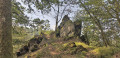
Roche Pérette: A rock partly hidden by large trees. At its base is a cave opening onto a cluster of sheer rocks with menacing jagged edges. Legend has it that the cave once sheltered a poor young girl named Pérette. Unloved by her parents and constantly mistreated, she settled there, far from everyone, to escape her father’s authority. When her mother grew old and infirm, sensing that death was approaching, she regretted having treated her daughter so cruelly. She demanded that her husband call Pérette back and restore her rights.
After her death, the father set out in search of his daughter. He found her sitting in front of her cave, nonchalantly leaning over the edge of the precipice, holding in her arms a young fawn she had tamed. But, upon hearing his voice, Pérette was terrified and tried to flee as quickly as possible. She stumbled, fell into the precipice before her and was smashed to pieces. Only then did her father, for the first time, take pity on her and give her a proper burial.

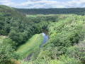
Viewpoint of the Cat Rock: Legend has it that long ago a tyrant named Monseigneur du Chat lived there. He tried to seduce the beautiful nymph Semois, who remained indifferent to him. The lord sought revenge for this affront: he summoned his friends, the cats, and sent them to swarm over the Semois. Outraged, the young nymph sent herons circling around the rock. Monseigneur du Chat decided to climb down from the rock to a stone in the middle of the river. But pike seized him and dragged him to the bottom of the water. Legend has it that ever since then, cats have been afraid of water!

The Château des Épioux: a listed site (including the main pond) where Pierre-Napoléon Bonaparte stayed for a few years, but which was subsequently left completely to ruin.

Nearby
The ruins of Herbeumont Castle.
Chiny, the village of the Count.

Always be cautious and plan ahead when you're outdoors. Visorando and the author of this route cannot be held responsible for any accidents occurring on this route.

The GR® and PR® markings are the intellectual property of the Fédération Française de Randonnée Pédestre.

Reviews and comments

4.4 / 5
Based on 3 reviews

Reliability of the description
4.3 / 5
Ease of following the route
4.3 / 5
Route interest
4.7 / 5
User 4132260

Overall rating : 4.3 / 5

Date of your route : Jul 15, 2026
Reliability of the description : ★★★★☆ Good
Ease of following the route : ★★★★☆ Good
Route interest : ★★★★★ Very good
Very busy route : No

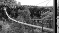
A brilliant route through dense woodland and along the banks of the Semois! You can take a short 2-kilometre detour to see the new Himalayan footbridge at St Cécile before reaching the ‘Rocher du Chat’; the path is signposted and the route joins busier paths at this point.
It’s a bit tricky to follow the route on some unmarked sections; the paths aren’t very clearly marked and are a bit overgrown with brambles.
Otherwise, a lovely walk! 4.5

Machine-translated

horizon.2017
horizon.2017
• Edited:

Overall rating : 5 / 5

Date of your route : Oct 30, 2023
Reliability of the description : ★★★★★ Very good
Ease of following the route : ★★★★★ Very good
Route interest : ★★★★★ Very good
Very busy route : Yes

We cut the walk short at waypoint 15; perhaps 150 or 200 metres before waypoint 14, the path was under water due to the rising waters of the Semois. We climbed up the cliff face to reach the path just above (we’re used to this sort of thing in the Alpine Club). This is not a walk to undertake at the moment.

Machine-translated

Pegase
Pegase

Overall rating : 4 / 5

Date of your route : Nov 14, 2022
Reliability of the description : ★★★★☆ Good
Ease of following the route : ★★★★☆ Good
Route interest : ★★★★☆ Good
Very busy route : No

A lovely walk, not too difficult. The climbs are quite long and therefore manageable. There are a lot of fallen leaves at this time of year, which sometimes makes it difficult to follow the paths. We only came across one other person at the end of the route, as well as a doe, a heron and a flock of egrets (?) on the Semois.

Machine-translated

Other walks in the area

For more walks, use our search engine .

The GPS track and description are the property of this route's author. Please do not copy them without permission.