Country:

 City:
City:


The walk starts at the car park near the church in Marcilly-en-Villette.
(S/E) From the car park, head towards the church square, walk past the town hall on your right, then turn left at the first junction onto the Route d’Orléans (D108). Ignore any side roads.
(1) At the fork in the road where there is a cross, 200 metres after the last houses, leave the departmental road by keeping to the right onto the wide, straight, gravelled track heading towards Les Landes and La Budâne. Ignore the track leading to La Budâne.
(2) Turn right onto the next track, just after a tall hedge. Ignore any side roads.
(3) At the junction, cross the Route de Jargeau. Opposite, the lane passes through a wooded strip. At the crossroads, cross the D7 and continue straight ahead towards Le Gué Renard and La Royauté. The lane, which crosses the Bourillon, is followed by a wide, stabilised track.
(4) When you reach the D64 (Route de Sennely), turn left carefully onto the side path running alongside the departmental road, which you will follow as far as the Mille Mottes crossroads.
(5) Turn right onto the wide, stabilised track, then right again onto the Chemin des Bretonnières, avoiding the track leading towards Les Petites Landes. Follow the path, which becomes tarmac as you approach the Quartier de la Brosse.
(6) Cross the D108. Opposite, a wide, compacted track – the Chemin de la Brosse – becomes tarmac. It curves to the right and then crosses the Bourillon twice.
(7) Cross the D921. Opposite, the grassy track passes through wooded areas. Ignore the various side paths.
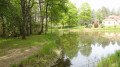
(8) Turn left about forty metres before joining the D7 on a grassy track. Keep left again at the Fork in the road. The track on the right leads to the dyke of the (private) pond, with no further route. The grassy path is usually flooded for about ten metres where it runs alongside the embankment. You must either wade across or go round the wet area by taking a detour through the heath to keep your shoes (almost) dry.
(9) At the hamlet known as Les Grottes de Farges, cross the Route de Farges heading towards Les Coudreaux and Vert Tendre. Opposite, the track soon enters the forest, then runs along the edge of a copse. Leave the straight track to the right at the hamlet known as La Rabolière. Shortly after the hamlet known as ‘Le Chêne à la Mouche’, the hard-surfaced track gives way to a grassy path.
(10) Turn right at the first junction (400 metres after the hamlet of Le Chêne à la Mouche). The open track leads to the edge of a copse, heading to the right.
(11) At the junction, do not continue along the grassy path opposite but turn right, staying on the well-marked path. This is followed by a gravel track which crosses the D7 (Route d’Ardon) in the direction of Les Usages de Chilly. This straight track leads to this hamlet, veering to the right.
(12) At the fork in the road, keep to the right to walk alongside the beautiful Les Haies estate.
(13) At the next crossroads, leave the gravel track and take a grassy path on the right. Follow this well-marked path until you come to a wide, gravel track crossing it.
(14) Turn right onto the gravel path, which you’ll leave after 200 metres by turning off onto a grassy track to the left. Follow this track, ignoring the various side paths. It becomes the ‘Rue de Chilly’ as you enter the village of Marcilly-en-Villette.
(15) Turn left onto Rue de la Blenerie about fifty metres before the junction with the main road, Rue des Relais. Rue de la Blenerie leads to Route d’Orléans, where you’ll turn right towards the town hall and the church, the starting point of the walk (S/E).


 Visorando Member
 Moderate
 Easy
Easy