Between the sea and the marshes at Plomeur

A circular route that begins by following theGR®34along the coast, then heads north towards the Lescors Marshes.

Details

41043228
Creation:
Last update:
Last review:
  • Walking
    Activity: Walking
  • ↔
    Distance: 13.21 mi
  • ◔
    Average duration: 6h 05 
  • ▲
    Difficulty: Difficult

  • ⚐
    Back to start: Yes
  • ↗
    Ascent: + 56 ft
  • ↘
    Descent: - 56 ft

  • ▲
    Highest point: 75 ft
  • ▼
    Lowest point: 7 ft
  • ⚐ Country: France
  • ⚐ City: Plomeur (29120)
  • ⚑
    Start/End: N 47.836613° / W 4.346783°
  • ❏
    IGN map(s): Ref. 0519OT
  • Hour-by-hour weather

Photos

Description of the walk

Park at the Torche car park.

(S/E) Leave the car park via the sandy path that heads due south to a crossroads.

(1) Follow theGR® 34 route (well signposted) opposite. Join a road.

(2) Follow it to the right, then leave it heading west after the picnic tables. Walk along the seafront; take care in some places as it’s quite narrow. You’ll rejoin the road (Rue Scrafric).

(3) Follow it to the right and rejoin the path that runs alongside the sea. You’ll come out onto Rue des Embruns, which leads to the harbour.

::4: Go round the harbour (no entry) and continue along Rue Lucien Le Lay until you reach the path (Promenade Scuiller).

(5) Turn right towards the south and head for the Notre-Dame de la Joie Chapel.

(6) Go round it on the left and, immediately afterwards, turn slightly to the right to rejoin the seafront as far as the Eckmühl Lighthouse.

(7) Go round the lighthouse via a smallGR® path between two buildings (poorly signposted) to reach the Promenade Baptiste Dupuis, which you then leave to follow the road running alongside the sea. Continue along the coastal path.

(8) Turn off onto Rue de Kervily and, at the end, turn right and then right again onto Rue de la Corniche, which leads to a roundabout.

(9) Turn right onto Quai du Général de Gaulle and follow it to the large sea wall.

(10) Turn left onto Rue Victor Hugo, then right onto Rue Kerandraonon and left onto Rue Ernest Renan. Turn right into Venelle Danton, then onto Rue Dupleix. Turn left onto Rue Émile Zola to reach Rue du Port de Kérity; follow this to the right for about a hundred metres until you reach a Fork in the road.

(11) Take the narrow path between the houses (Venelle Rolland), cross Rue Du Guesclin and continue straight ahead until you reach the greenway.

(12) Follow it to the left past the riding school, then leave it shortly afterwards at a gate.

(13) Turn right, join Rue de Ketsaudy and reach a side street.

(14) Carry on northwards along the path, then take Rue du Pont Nevez as far as the sewage treatment works.

(15) Turn right onto the small path, which becomes quite narrow and runs alongside a stream. Pass behind a business.

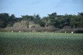
(16) Cross the D53 with care and continue along the path through the marsh (where cows roam freely to help maintain the area) until you reach a road.

(17) Cross Rue du Loc’h, continue through the marsh and then cut across Route de Kerloch. Carry on, gradually leaving the marsh behind, until you reach a road.

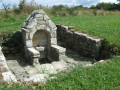
(18) Follow it to the right for about a hundred metres and turn left onto the path that cuts across a road. Continue straight ahead until you reach a road. Follow it to the right to reach the Fountain and the Chapel of La Madelaine.

(19) Turn left and go round them on the left, cross the hamlet to take the path that heads east and joins a cross-country track.

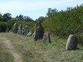
(20) Turn left to follow the megalithic alignment as closely as possible. At the end, turn right.

(21) Cross the Pont an Denved road, pass by a large equestrian centre and continue straight on until you reach a road.

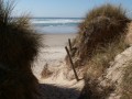
(22) Carry on straight ahead along the path that crosses the dune.

(1) Carry on straight ahead to reach Pointe de la Torche.

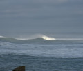
(23) Turn left to walk round the headland. Take care at the tip in bad weather – there is a risk of high waves.

(24) Turn back.

(23) Carry on straight ahead until you reach the car park on the right (S/E).

Waypoints

  1. S/E : mi 0 - alt. 20 ft - parking de la Torche
  2. 1 : mi 0.11 - alt. 30 ft - Crossroads
  3. 2 : mi 1.39 - alt. 20 ft - Junction with the road
  4. 3 : mi 1.72 - alt. 26 ft - Rue Scrafic
  5. 4 : mi 2.79 - alt. 16 ft - Saint Guénolé harbour
  6. 5 : mi 3.07 - alt. 16 ft - Scuiller Walk
  7. 6 : mi 3.9 - alt. 7 ft - Chapelle de Notre-Dame-de-la-Joie (Penmarch)
  8. 7 : mi 4.58 - alt. 16 ft - Eckmülh Lighthouse - Pointe de Penmarch
  9. 8 : mi 5.22 - alt. 13 ft - Junction
  10. 9 : mi 5.68 - alt. 13 ft - Roundabout
  11. 10 : mi 5.9 - alt. 13 ft - Large sea wall
  12. 11 : mi 6.33 - alt. 20 ft - Rolland Lane
  13. 12 : mi 6.61 - alt. 16 ft - Greenway
  14. 13 : mi 7.12 - alt. 10 ft - Gate
  15. 14 : mi 7.5 - alt. 10 ft - Rue du Pont Nevez
  16. 15 : mi 7.69 - alt. 13 ft - Wastewater treatment plant
  17. 16 : mi 7.97 - alt. 16 ft - Crossing the D53
  18. 17 : mi 8.55 - alt. 16 ft - Crossing the road
  19. 18 : mi 9.21 - alt. 23 ft - Junction with the road
  20. 19 : mi 9.91 - alt. 46 ft - Chapelle de la Madeleine (Penmarch)
  21. 20 : mi 10.46 - alt. 75 ft - Junction - Alignements de la Madeleine
  22. 21 : mi 11.24 - alt. 46 ft - Crossing the road
  23. 22 : mi 12.15 - alt. 36 ft - Crossing the road
  24. 23 : mi 12.51 - alt. 23 ft - La Torche crossroads
  25. 24 : mi 12.85 - alt. 36 ft - Pointe de la Torche
  26. S/E : mi 13.21 - alt. 20 ft - parking de la Torche

Notes

This route is not difficult, apart from its length and a few sections along the coast (rocks). Check the marine weather forecast: some coastal sections may then prove risky. Remember to protect yourself from the wind.
In the marsh, please ensure you keep the gates closed; free-roaming livestock must not be disturbed and poses no danger. You must stay on the path whilst in the marsh.
The section leaving Penmarch is the least pleasant part (industrial estate) but does not last long.
There is a picnic area after the (2).

Worth a visit

Make the most of the seaside:
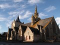
- the Notre-Dame de la Joie Chapel (7).
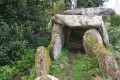
- in the countryside: the Chapel of La Madeleine and the megalithic alignment (20).
The Loc’h nature reserve on the outskirts of Penmarc’h.
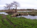
Walking through the marsh gives the impression of being in a mini Camargue!

Always be cautious and plan ahead when you're outdoors. Visorando and the author of this route cannot be held responsible for any accidents occurring on this route.

The GR® and PR® markings are the intellectual property of the Fédération Française de Randonnée Pédestre.

Reviews and comments

4.5 / 5
Based on 2 reviews

Reliability of the description
4.5 / 5
Ease of following the route
4.5 / 5
Route interest
4.5 / 5
JM.lambert
JM.lambert

Overall rating : 5 / 5

Date of your route : Feb 24, 2026
Reliability of the description : ★★★★★ Very good
Ease of following the route : ★★★★★ Very good
Route interest : ★★★★★ Very good
Very busy route : No

Done today in strong winds and sunshine. Superb view at La Torche and all along the coast. Magnificent.
At point 13, there is no longer a barrier but a wooden bench.
Unfortunately, it was impossible to cross the marshes due to flooding.
From point 13, I turned back and took small roads through Kerguidan, Kergantan, Méjou Braz, Lescors and Lestrigou to return via the alignments to La Chapelle de la Madeleine and back to La Torche.
It was still a beautiful day.
At point 20, head towards the main road for 50 metres to discover the covered walkway on the right.
Public toilets at point 4 and after point 9.
Thank you for this route.

Machine-translated

Maxime 53
Maxime 53

Overall rating : 4 / 5

Date of your route : Jan 29, 2024
Reliability of the description : ★★★★☆ Good
Ease of following the route : ★★★★☆ Good
Route interest : ★★★★☆ Good
Very busy route : No

I ran this hiking route, starting from Saint Guénolé. A lovely circular route taking in coastal paths and marshes, with plenty of points of interest along the way.

I did, however, avoid a few sections through the marshes, as the paths were quite waterlogged at the end of January.

Machine-translated

Other walks in the area

For more walks, use our search engine .

The GPS track and description are the property of this route's author. Please do not copy them without permission.