


 Country:
 City:
City:


Park in the spaces provided for this purpose at the entrance to the track.
(S/E) With your back to the main road, head straight on, joining the track. About 70 m further on, a path appears on your left.
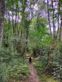
(1) Take this narrow path, which zigzags through the woodland, keeping to the right at all times. After a gentle descent, you’ll reach a junction of paths.
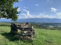
(2) Turn right. Continue to keep to the right and carry on until you reach another junction where you rejoin the track you started on (Sentier des Marlères). Turn left and climb gently for about 450 m until you reach a small plateau offering a lovely view of the town of Oloron, with a picnic table as a landmark. Carry on straight ahead, ignoring the path that branches off to the left, until you come to another junction.
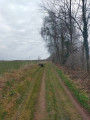
(3) Take the path leading down to the right, towards Le Faget. Follow it for about 1 km, skirting the fields on your right. You’ll come to a small country lane called Chemin de Manechal.
(4) Turn right. Follow this small tarmac road straight on for about 1 km, ignoring all the roads branching off to your left, until you reach another T-junction with a sort of central reservation (D503).
(5) Turn right: be careful, as the next bend is dangerous and the road widens. It is also busier and vehicles travel at speed. Take care. A little further on, after passing above a wash house, cross a bridge.
(6) Shortly after the bridge, turn right onto a small path that climbs into the woods. Follow it, keeping to the left, and you’ll then rejoin the track where you’ve parked (S/E).

 Visorando Member

 Moderate
 Difficult
