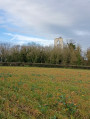
Through fields and woods to the south-east of Amiens

A walk through the fields south-east of Amiens, with a start and finish point accessible by car (with parking) or by bus. The scenery changes with the seasons and the crops in the fields.
The route passes through the woods opposite Cagny cemetery, which provides a bit of cool shade during the walk.
Enjoy your walk.

Details

23257212
Creation:
Last update:
Last review:
  • Walking
    Activity: Walking
  • ↔
    Distance: 6.51 mi
  • ◔
    Average duration: 3h 20 
  • ▲
    Difficulty: Moderate

  • ⚐
    Back to start: Yes
  • ↗
    Ascent: + 400 ft
  • ↘
    Descent: - 404 ft

  • ▲
    Highest point: 328 ft
  • ▼
    Lowest point: 92 ft
  • ⚐ Country: France
  • ⚐ City: Amiens (80090|80000|80080)
  • ⚑
    Start/End: N 49.867068° / E 2.322755°
  • ❏
    IGN map(s): Ref. 2308E, 2308O, 2309E, 2309O
  • Hour-by-hour weather

Photos

Description of the walk

Park in the car park at the Stade Soufflot Virgile Dufossé, also known as the Stade Soufflot. Accessible by bus route N4, alight at the Frédéric Mistral stop, a two-minute walk from the stadium.

(S/E) Take the straight dirt track to the five-way junction.

(1) Continue straight ahead and you’ll soon reach the junction with Rue Wasse.

Turn left, then ignore the dirt track on your left and continue along the grassy path on your right. Walk alongside a woodland until you reach Rue de la Fontaine in Cagny. Turn right onto the pavement to reach a four-way junction at Cagny Cemetery.

(3) Carry on straight ahead between the cemetery and the woodland. After the cemetery, take the path slightly to the right which runs parallel to the road above, and continue until you are near the A29 motorway bridge, then rejoin the road straight ahead. Caution: take care on this country road.

(4) Carry on straight ahead, pass under the motorway and, several hundred metres further on, you’ll come to a T-junction with a dirt track.

(5) Leave the road and turn left onto this dirt track. Begin a gentle climb through two bends; at the top, carry on straight ahead until the next junction, then turn 90° to the left and continue in a straight line until you reach the motorway again.

(6) Follow the path to the right; a few steps further on, take the bridge over the motorway. At the end of the bridge, turn right. Then follow the road to reach the Garenne football pitch.

(7) Follow the road to the left, walk alongside the football pitch, then continue along a path to reach the edge of the woods.

(8) Enter the woods and pass the archaeological site. Carry on through the woods until you reach the crossroads by the cemetery that you passed on the way out.

(3) Turn left onto the street running along the north-western side of the cemetery. Turn left and begin the short climb to reach the top of Les Vignes. Enjoy the interesting view from here.

(9) Continue downhill, turn right at the crossroads and return to the junction with Rue Wasse that you passed on the way out.

Follow the route back in the opposite direction to reach the original junction.

(1) Turn right onto Chemin des Vignes and, a few hundred metres further on, you’ll come to a fence between two fields.

(10) Turn left and follow this fence; at the end of the path, turn left onto the grassy track that runs alongside the housing estate. Continue straight on between the field and the school, following the fence around the school and the stadium to return to the Stade Soufflot car park (S/E).

Waypoints

  1. S/E : mi 0 - alt. 210 ft - Soufflot Stadium car park
  2. 1 : mi 0.22 - alt. 197 ft - Junction of the northern circular loop
  3. 2 : mi 0.49 - alt. 121 ft - Junction of the central circular loop
  4. 3 : mi 1.28 - alt. 138 ft - Junction of the southern circular loop – Cemetery
  5. 4 : mi 1.83 - alt. 180 ft - Shooting range
  6. 5 : mi 2.22 - alt. 220 ft - Saint-Fuscien path
  7. 6 : mi 3.26 - alt. 243 ft - A29 motorway
  8. 7 : mi 3.8 - alt. 125 ft - La Garenne football stadium
  9. 8 : mi 4.11 - alt. 151 ft - Edge of the woodland
  10. 9 : mi 4.88 - alt. 249 ft - Les Vignes
  11. 10 : mi 5.99 - alt. 207 ft - Country lane
  12. S/E : mi 6.51 - alt. 210 ft - Soufflot Stadium car park

Notes

Easy walk: do, however, take care when crossing the road without a pavement between Cagny (4) and Saint-Fuscien. (5)
Time reference: Completed by Nordic walking (fast) in 1 hour 45 minutes (6 km/h)

Worth a visit

(4) Shooting range on the left
(8) Between 100 and 200 m after this point, on your left, you’ll see the Garenne de Cagny Archaeological Park
(9) 360° panoramic viewpoint, with a bench to rest on if needed.

Reviews and comments

4 / 5
Based on 4 reviews

Reliability of the description
4 / 5
Ease of following the route
3.8 / 5
Route interest
4.3 / 5
mariedolly
mariedolly

Overall rating : 4.7 / 5

Date of your route : Oct 05, 2025
Reliability of the description : ★★★★★ Very good
Ease of following the route : ★★★★★ Very good
Route interest : ★★★★☆ Good
Very busy route : No

Beautiful views of the Picardy countryside. A

Machine-translated

REDANC
REDANC

Overall rating : 4 / 5

Date of your route : Oct 04, 2023
Reliability of the description : ★★★★☆ Good
Ease of following the route : ★★★★☆ Good
Route interest : ★★★★☆ Good
Very busy route : No

A pleasant route in mild weather, with good views over the south-east of Amiens.
Best avoided when it’s very hot or very windy.

Machine-translated

hsportemer
hsportemer

Hello,
As mentioned, the start is at the Virgile Dufossé Stadium in Amiens, also known as the Soufflot Stadium.

https://g.co/kgs/49HEjZ

Machine-translated

tibibou
tibibou

Overall rating : 2.5 / 5

Date of your route : Apr 10, 2023
Reliability of the description : ★★★☆☆ Average
Ease of following the route : ★★☆☆☆ Disappointing
Route interest : Not used / Not applicable
Very busy route : No

Couldn’t find the start…

Machine-translated

Vercors80
Vercors80

Overall rating : 4.3 / 5

Date of your route : Nov 10, 2022
Reliability of the description : ★★★★☆ Good
Ease of following the route : ★★★★☆ Good
Route interest : ★★★★★ Very good
Very busy route : No

A walk taken on a lovely autumn afternoon, offering beautiful views over the city of Amiens, as well as some very pleasant stretches through the woods.
One slight downside concerns the danger posed by the stretch of road from Cagny to Saint Fuscien after passing under the motorway bridge. You need to be extra careful given the fairly heavy traffic and the narrowness of the road (this warning was already included in the original description, but I’d like to emphasise it again) Caution: danger!!!

Machine-translated

Other walks in the area

For more walks, use our search engine .

The GPS track and description are the property of this route's author. Please do not copy them without permission.