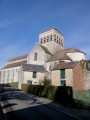
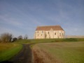
Medieval churches south of Provins

A lovely circular route through the valleys and plateaus south of Provins, culminating in the gem that is Saint-Loup-de-Naud and its extraordinary carved gateway.

Details

2913609
Creation:
Last update:
Last review:
  • Walking
    Activity: Walking
  • ↔
    Distance: 11.43 mi
  • ◔
    Average duration: 6h 00 
  • ▲
    Difficulty: Moderate

  • ⚐
    Back to start: Yes
  • ↗
    Ascent: + 810 ft
  • ↘
    Descent: - 810 ft

  • ▲
    Highest point: 489 ft
  • ▼
    Lowest point: 249 ft
  • ⚐ Country: France
  • ⚐ City: Lizines (77650)
  • ⚑
    Start/End: N 48.526999° / E 3.178116°
  • ❏
    IGN map(s): Ref. 2516E
  • Hour-by-hour weather

Photos

Description of the walk

The route starts from the car park in front of Lizines church (limited spaces). There are parking options on Rue des Garennes, not far from the water tower.

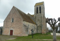
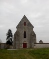
(S/E) From the church in Lizines (with its beautiful gateway and bell tower), take Rue des Vignes heading north-east. Continue straight on along the path through the fields after the last building. At the end of the gentle climb, turn left.

(1) Turn right at the next junction. At the T-junction, turn left to reach the edge of the woodland. Then turn right and stay along the edge of the woodland. The path then heads south, still hugging the edge of the woodland, before turning left. You’ll come to a series of fences.

(2) Turn left into the woods, following a gentle descent between two rows of fences. Pass under the railway line and note the church of Saint-Loup-de-Naud perched on the edge of the plateau opposite. You’ll arrive near the enclosure surrounding a working fountain.

(3) Turn right into Rue des Vieux Moulins. About 200 metres further on, go up a street on the left. Continue up two flights of steps. At the top, turn right and you’ll reach the gate of Saint-Loup Church.

(4) Then continue along the same street, which descends into the valley, ignoring the side streets. At the bottom, turn left. Cross a stream and turn left again.

(5) Take the path on the left, then immediately take the path leading uphill to the right into the woods. At the next Fork in the road, keep left.

(6) At the junction, turn sharply right. Head uphill, ignoring a path branching off to the right, and make your way to the plateau. At the crossroads, continue straight ahead. At the next crossroads, take the path on the left.

(7) As you approach the edge of the woods, with the Granges farm in sight, follow the edge of the woods to the left; the path skirts round the woods in a triangular loop (going straight on leads to the same place anyway…). Then continue straight on (east). Carry on along the tarmac road and enter Courton Le Haut. Take thesecond street on the left.

(8) At the end, take a path on the right. Ignore a turn-off on the left and wind your way through the gardens. You’ll come to a street; follow it to the right for a few dozen metres.

(9) Just before the main road (D106), turn left onto a narrow path. At the end, follow the road to the right. Then turn right and then left onto Rue Sainte-Marie. Next, take thefirst street on the right. At the end, first turn left then right and go down a path. Ignore a street coming from the right.

(10) Shortly afterwards, take a path on the right. Then turn left and then right onto the main road in Courton le Bas.

(11) Turn left onto Rue du Moulin. Cross a stream (wash house) then walk alongside the mill. At the end of the path, turn left. The path follows the course of the Vallon du Dragon (south-east). Pass a path on the right and you’ll come to a junction.

(12) Then turn right onto a wide path that climbs towards the railway bridge. Pass under the railway line and turn left immediately. Walk alongside the railway line through the woods.

(13) As you emerge from the woods, near a reservoir, turn right. Go round the reservoir and a mast on the right and head back up into the woods.

(14) On the plateau, at a crossroads, veer to the right, leave the woods and continue along the edge. Carry on through the fields. The path joins a tarmac road; carry on straight ahead. At the next junction, turn left towards Savins. Continue along this street, ignoring the side streets and alleys as you head downhill.

(15) At the bottom, cut across the main road and head diagonally uphill to the right along Rue aux Prêtres. At the end (church on the left), turn right. Walk down to the wash house and take the path on the left. Turn left again; you’ll come out onto a street and follow it to the right. At the end, turn left. Then take thefirst right.

(16) Cross the D209 and continue along a small road opposite. After about 250 m, take a path on the right. Cross a small road and continue along the path. At the end, turn left. The path enters a woodland and joins a road.

(17) Follow this road to the right, then immediately take the path downhill to the left. Carry straight on until you reach a stream and wade across it. Pass the sewage treatment plant on your right and turn left.

(18) When you reach the first houses, take a path on the right. At the next junction, turn left. Cut across a road and carry on to the shed. Then turn left and immediately right. When you reach the tarmac road, turn right and carry on straight ahead along a path. At the next junction, go straight on until you reach a road.

(19) A few metres before you reach it, turn right at the edge of the woods. Then turn left and head down into a small valley. Return to the road and follow it to the right. At the Fork in the road, take the left-hand road. At the next Fork in the road (elevation 143), take the right-hand road, towards the water tower (Rue des Garennes). Take thefirst left, Rue des Glycines. This leads onto the D209; follow this road to the left and head for the church (S/E).

Waypoints

  1. S/E : mi 0 - alt. 423 ft - Lizines Church
  2. 1 : mi 0.56 - alt. 427 ft - Junction
  3. 2 : mi 1.26 - alt. 397 ft - Crossroads – Metal fences
  4. 3 : mi 1.77 - alt. 292 ft - Rue des Vieux Moulins
  5. 4 : mi 1.97 - alt. 348 ft - Église Saint-Loup à Saint-Loup-de-Naud
  6. 5 : mi 2.24 - alt. 285 ft - Crossroads
  7. 6 : mi 2.46 - alt. 335 ft - Junction
  8. 7 : mi 2.85 - alt. 440 ft - Edge of the woodland at Courton
  9. 8 : mi 3.24 - alt. 466 ft - Path in Courton
  10. 9 : mi 3.53 - alt. 436 ft - Narrow path
  11. 10 : mi 3.94 - alt. 292 ft - Start of the footpath
  12. 11 : mi 4.08 - alt. 269 ft - Rue du Moulin
  13. 12 : mi 4.62 - alt. 249 ft - Crossroads
  14. 13 : mi 5.31 - alt. 266 ft - Edge of the woodland near a reservoir
  15. 14 : mi 6.16 - alt. 453 ft - Crossroads
  16. 15 : mi 7.35 - alt. 361 ft - Crossroads
  17. 16 : mi 8.16 - alt. 486 ft - D209 road
  18. 17 : mi 9.22 - alt. 446 ft - Small road
  19. 18 : mi 9.59 - alt. 413 ft - Start of the path
  20. 19 : mi 10.41 - alt. 449 ft - Path at the edge of the woods
  21. S/E : mi 11.43 - alt. 423 ft - Lizines

Notes

There are few parking spaces in front of Lizines church. You can park on Rue des Garennes, not far from the water tower. Alternatively, you can start the walk at Courton-le-Haut, where there’s a car park at the junction of Route de Provins and Route de Vulaines (after the ‘9 ’).

This walk follows the route of the walks created by the local Community of Communes: Communauté de communes Bassée-Montois
Please note that thePR® route shown on the IGN map does not correspond to the actual route on the ground:
- on the climb to Saint-Loup-de-Naud
- between Courton-le-Haut and Courton-le-Bas
- as well as in Savins

The green signposting is fairly comprehensive, but a few markers are missing here and there, although the route is fairly obvious (and the green markings are not always clearly visible...).

There’s a bench for picnics in front of the church in Savins.

When I was there, the path alongside the railway line was particularly bumpy… (electrification work on this railway line and/or work in the woods).

Worth a visit

Saint-Loup-de-Naud Church: one of the earliest Gothic portals, very well preserved.

Always be cautious and plan ahead when you're outdoors. Visorando and the author of this route cannot be held responsible for any accidents occurring on this route.

The GR® and PR® markings are the intellectual property of the Fédération Française de Randonnée Pédestre.

Reviews and comments

3.9 / 5
Based on 3 reviews

Reliability of the description
3.7 / 5
Ease of following the route
3.7 / 5
Route interest
4.3 / 5
lyllatsrando
lyllatsrando

Overall rating : 5 / 5

Date of your route : Feb 05, 2024
Reliability of the description : ★★★★★ Very good
Ease of following the route : ★★★★★ Very good
Route interest : ★★★★★ Very good
Very busy route : No

A lovely walk – though it’s a shame I did it in overcast, damp weather; I’ll definitely be doing it again in the spring. The signposting is excellent; the churches, and in particular St Loup de Naud Abbey, are magnificent; there’s a nice bit of elevation gain to make it fun, and some lovely villages
Thank you for this lovely route – I highly recommend it.

Machine-translated

Tee51
Tee51

Overall rating : 3.3 / 5

Date of your route : Mar 21, 2023
Reliability of the description : ★★★☆☆ Average
Ease of following the route : ★★★☆☆ Average
Route interest : ★★★★☆ Good
Very busy route : No

In St-Loup-de-Naud, the section of the PR trail through the woodland is very poorly signposted (sporting activities are damaging the paths)
In Lizines, people say that ‘the church is very beautiful but always closed’

Machine-translated

ovil
ovil

Overall rating : 3.3 / 5

Date of your route : Sep 29, 2020
Reliability of the description : ★★★☆☆ Average
Ease of following the route : ★★★☆☆ Average
Route interest : ★★★★☆ Good
Very busy route : No

A walk starting from Sainte Colombe station under overcast skies with a light drizzle in the morning.
Despite the rain over the last few days, the paths weren’t very muddy.
It’s a shame that Lizines Church is cordoned off due to the risk of falling rocks and that we couldn’t visit it.
At point 14, on the small road, there was a constant stream of articulated lorries travelling in both directions. Perhaps they were delivering beetroot to a sugar factory.
I didn’t understand the route to follow in Courton between the end of the footpath and Rue du Moulin. I followed the green signposts, which took us zigzagging through the village, whereas the guide says to turn left then right.
The same applies when crossing the woods after Saint Loup de Naud, where the signposting makes us go round in circles far more than indicated.
The map isn’t detailed enough to help you find your way in the woods.
All in all, a lovely walk and an interesting visit to the church at Saint Loup.
To round off the practical information, there are two picnic tables at the washhouse in Saint Loup de Naud and walnut trees at several points along the route; at the moment, the walnuts are falling and just waiting to be picked up.

Machine-translated

Other walks in the area

For more walks, use our search engine .

The GPS track and description are the property of this route's author. Please do not copy them without permission.