Country:
 City:
City:


Provins SNCF station can be reached from Paris, Gare de l’Est (line P), or from Chessy-Marne-la-Vallée station by bus 7705 (formerly 50-Express).
(S/E) Exit to the west of the coach station, cross at the pedestrian crossing, and take the small bridge over the canal opposite. Take the first street on the right, which continues as a shaded promenade along the ramparts overlooking the canal.
(1) About 300 metres further on, leave the promenade via a few steps on the left, take the first right, then the first left: Rue du Colonel Arnaud Beltrame, which continues as Rue Victor Arnoul.
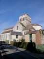
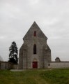
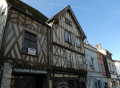
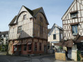
(2) When you reach a beautiful half-timbered house, turn left onto Rue Hugues le Grand, then take the second on the right, Rue du Poncelot, followed by the first on the right and finally the first on the left. You will arrive at Rue de la Cordonnerie. Turn right until you reach Saint-Ayoul Church. After your visit, head south to enter the priory of the same name.
(3) Leave the Priory, go round the building to the left and return to Place Saint-Ayoul. Turn right to pass under the Notre-Dame-de-Val Tower. Turn right into Rue du Temple, then left onto Rue de Courloison until you reach the bridge over the canal.
Yellow PR® signposting
(4) Turn left before the canal onto Boulevard d’Aligre (which is actually a promenade lined with chestnut trees). Turn right onto the first bridge over the canal, continue straight ahead, then take the first right and the first left into Rue du Barreau. After about 250 m, when the street bends sharply to the left, continue along the path that climbs straight ahead until it ends.
(5) Carry on up the street to the right, then take the first left. Further on, walk along the left-hand side of a boundary wall. When you reach the corner, take the path on the left and continue along this wall until you reach the Couvent des Cordelières, which is unfortunately hidden behind high walls (but it will be visible from the ramparts in an hour’s time).
(6) Walk alongside the wall on your left and continue along the path until you reach a road. Turn right, then, after the first house, turn right again onto a path that leads uphill.
(7) When you’re almost at the top, at the fork, take the path on the left. At the T-junction, turn right, and at the next one, turn left to walk alongside the cemetery and pass by the foot of the water tower. In La Bretonnière, head left towards the church.
(8) Walk down the main street, then turn immediately right into Rue du Pressoir. At the end of the street, take the path on the left, then turn right when you reach the road. At the crossroads, turn left.
(9) Finally, take the first path on the right which leads into the forest. After the bridge, turn left straight away and continue along this path for just under 2 km until you reach the tarmac road.
End of the yellow PR® signposting
(10) Turn left, cross the bridge and turn right into Rue des Coudoux. About 500 m further on, take the path on the right that runs between the sports grounds and the community gardens.
(11) Cross the canal via a footbridge, then cross the stream, and head towards the ramparts.
(12) (optional) If the weather is fine, before the climb, take the path on the right which leads to a pleasant picnic spot with tables and benches. Return towards the ramparts, and take the steep path inside the ramparts (with the ramparts on your right) which passes under a gate, then past the Tour du Trou au Chas.
(13) Once you reach the Porte de Jouy, continue along the path inside the ramparts as far as the Porte Saint-Jean. Go through the gate, continue to the Tourist Office, and walk round it to reach a huge courtyard with numerous picnic tables.
(14) Retrace your steps, pass back under the Porte Saint-Jean and carry on straight ahead to the Grange aux Dîmes.
(15) Turn right and head towards the Collégiale Saint-Quiriace, with the primary school on your left.
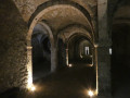
(16) Head back towards the Tour César, then take the small street opposite which leads downwards and continues along a fairly steep path running alongside the remains of fortifications. Once at the bottom, turn left onto the street, then take the first left, and immediately turn right onto a path that climbs steeply alongside a fence. At the crossroads of paths, turn right and walk around the edge of the plateau until you reach an underground reservoir. Turn left, then right, and right again. You will arrive at the Hôtel-Dieu and the entrance to the underground passages.
(17) After the visit, continue downhill, turn left after the bridge over the Durteint, walk past the Sub-Prefecture and then enter the Jardin Garnier to walk around it.
(18) Beyond the garden itself, there is a green space with several picnic tables. Return to the garden entrance, take the first left onto Rue Toussaint Rose and continue to the Church of Sainte-Croix. Walk round the church until you reach Rue des Oignons. Turn right onto Rue du Val, then left onto Rue des Aulx. Carry on to the right into Rue Jules Verne, pass the fountain, then go through the underpass beneath the building to reach Rue Victor Garnier.
(19) Turn right, then left, following the canalised Voulzie. At the junction, turn right onto Rue du Four des Raines, which leads to the station (S/E).


 Visorando Member
 Difficult

 Easy
Easy