


Refine your search for walks in Eclépens
Eclépens walks


 Eclépens – Chavornay via the Entreroches Canal
 Visorando Member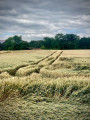
 7.88 mi
 +807 ft
 -820 ft
 4h 20
4h 20
 Average
 Departure from Eclépens (Vaud)
An easy walk through the beautiful forests of the Gros de Vaud. The first part of the route follows the remains of the Entreroches Canal – an attempt in the 17th century to link the Rhine basin with that of the Rhône – and ends by following the River Talent.
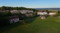
Sarraz Castle from Saint-Loup
 2.54 mi
+194 ft
-213 ft
1h 20
2.54 mi
+194 ft
-213 ft
1h 20
 Easy
Departure from La Sarraz (Vaud)
Easy
Departure from La Sarraz (Vaud)
A short circular loop of about 1½ hours, or a return trip with the option to stop and visit Sarraz Castle (Horse Museum). Start behind Saint-Loup Hospital or from its upper car park. From the top of Sarraz, simply follow the orange sign for the footpath.
You can return via the same path as the outward route to avoid walking alongside the road; please note that the road has a footpath from Sarraz to Pompaples.
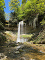
Dard Waterfall starting from Saint-Loup (Pompaples / Le Nozon)
 5.04 mi
+597 ft
-600 ft
2h 50
Average
Departure from Pompaples (Vaud)
5.04 mi
+597 ft
-600 ft
2h 50
Average
Departure from Pompaples (Vaud)
Visit to the Dard waterfall starting from the Diaconat de Saint-Loup, with the option of returning via a short detour above the cliff. No major difficulty apart from the climb when taking the detour. It takes less than an hour at a normal walking pace to reach the waterfall and return via the same route, or 1½ hours via the detour (significant elevation gain at the start of the detour over about 100 m, but accessible to all walkers).
You can park either at the Saint-Loup hospital car park or in the village of Pompaples. If parking in the village, you can park above the cemetery (Rue du Four) and join the path that follows the Nozon stream directly below the cemetery (staircase alongside the cemetery).
The Nozon Gorges
 10.94 mi
+879 ft
-866 ft
5h 50
Average
Departure from Croy (Vaud)
10.94 mi
+879 ft
-866 ft
5h 50
Average
Departure from Croy (Vaud)
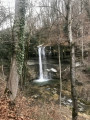
Setting off from Croy, you follow the Nozon, a charming river through its gorges and past the Dard waterfall. You will pass through the pretty village of La Sarraz and its castle before heading to the former abbey church of Romainmôtier, which was founded in the mid-5th century.
 Bottens – Froideville – Montheron – Bottens
10.70 mi
+2,375 ft
-2,375 ft
4 hrs
Easy
Departure from Bottens (Vaud)
Some lovely gallops, beautiful woodland (Bois du Jorat), more tarmac roads at the start but a magnificent route with a lovely shelter by the river halfway along for a picnic.
Be careful to adjust your route and avoid riding along the edges of forests or fields if they haven’t been mowed!
Le Cul, the Nozon Valley and the Source of the Diaz
 11.08 mi
+2,165 ft
-2,165 ft
7h 00
Average
Departure from Vaulion (Vaud)
11.08 mi
+2,165 ft
-2,165 ft
7h 00
Average
Departure from Vaulion (Vaud)
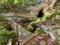
Set off to explore the “Cul du Nozon” site towards Vaulion. There are no signposts, which is a shame, as the spot is superb. There are small bridges, a path along the rock face and a waterfall. It is a truly wild and stunning place. Then head for the former Cluniac Abbey (fortified priory) of Romainmôtier, which is now a Protestant church. It is the oldest monastery in Switzerland. It was founded in the mid-5th century by the Fathers of the Jura, Saint Romain and his brother Saint Lupicin. The door is always open and entry is free. Next comes a visit to the Source de la Diaz and, to finish, the Vallon du Nozon: this site has also remained very unspoilt and is a magnificent place. There are several bridges, waterfalls and information boards about the area.
Orbe Gorges
 5.85 mi
+823 ft
-817 ft
3h 25
Easy
Departure from Les Clées (Vaud)
5.85 mi
+823 ft
-817 ft
3h 25
Easy
Departure from Les Clées (Vaud)
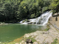
A lovely, easy walk along the Orbe river.
A walk through the Bois du Jorat forest
8.86 mi
+886 ft
-856 ft
5 hrs
Easy
Departure from Froideville (Canton de Vaud) (Vaud)
When it’s hot, the route is perfect – and you’re away from the insects!
Plenty of forest paths, lovely mountain huts, drinking fountains – though not many opportunities for galloping.
There’s one slightly tricky section on this route: a descent along a narrow path towards the river followed by a steep climb, but you can easily go round it.
Ballaigues - Sainte-Croix
 12.53 mi
+3,038 ft
-2,428 ft
8h 25
12.53 mi
+3,038 ft
-2,428 ft
8h 25
 Difficult
Departure from Ballaigues (Vaud)
Difficult
Departure from Ballaigues (Vaud)
Stage 4 From Les Rousses to Lake Constance, via the Jura ridges.
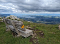
From the southern slopes of the Knoll, above L'Orbe, the climb to the ridge offers a magnificent panorama: Lake Neuchâtel, the plain and the Alps in the background. The trail crosses the peaceful pastures of the Jura before reaching the Col de l'Aiguillon, close to the French border, marked by anti-tank obstacles and bunkers. The hike continues along the Crête des Aiguilles de Baulmes, lined with 80-metre cliffs, with breathtaking views of Mont Blanc, Lake Geneva, La Dôle and Chasseral. The descent leads to Sainte-Croix, renowned for its music boxes and automatons.
The Orbe Gorges from Le Day to Orbe via Les Clées
 8.39 mi
+620 ft
-1,650 ft
4h 25
Average
Departure from Vallorbe (Vaud)
8.39 mi
+620 ft
-1,650 ft
4h 25
Average
Departure from Vallorbe (Vaud)
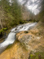
The Gorges de l’Orbe offer magnificent scenery in all seasons. This route, on the left bank, is better suited to the wetter months than the one on the right bank. There are no major difficulties, but some downhill sections can be tricky if you’re walking after rain, with mud and a risk of slipping. Walking poles are not a bad idea, which is why I’ve classified the route as of medium difficulty
This route partly overlaps with the Gorges de l'Orbe route featured on the website.
Vallorbe - Les Charbonnières: Lakes Joux and Brenet
 8.19 mi
+2,398 ft
-1,552 ft
5h 50
Average
Departure from Vallorbe (Vaud)
8.19 mi
+2,398 ft
-1,552 ft
5h 50
Average
Departure from Vallorbe (Vaud)
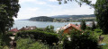
For this fourth stage, after a good hour's walk, you will reach the highest point of the day: the Dent de Vaulion. The lakes of Joux and Brenet will be at your feet. The water from these two lakes flows underground, shaping the karst cave of the Orbe, near Vallorbe. On a clear day, you can see up to eight lakes.
The Aiguilles de Baulmes
 7.46 mi
+2,133 ft
-2,103 ft
5h 15
Average
Departure from Baulmes (Vaud)
7.46 mi
+2,133 ft
-2,103 ft
5h 15
Average
Departure from Baulmes (Vaud)
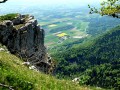
From bright, flower-filled mountain pastures, you will climb towards the ridges through the silent Bataillards forest, skirting its steep limestone cliffs, the first slopes of the Jura, cut into needles that offer views of the Alps, Mont Blanc, Lake Geneva and Lake Neuchâtel. On the other side, the panorama stretches from La Dôle to Chasseral, via the Knoll and the Dent de Vaulion.
Le Suchet
 9.36 mi
+2,070 ft
-2,096 ft
6h 05
Average
Departure from Jougne (Doubs)
9.36 mi
+2,070 ft
-2,096 ft
6h 05
Average
Departure from Jougne (Doubs)
Starting from the ski car park at Entre-les-Fourgs. A beautiful hike towards the Knoll, opening up to 360° views.
Le Knoll
 9.30 mi
+1,995 ft
-1,995 ft
6h 00
Average
Departure from Jougne (Doubs)
9.30 mi
+1,995 ft
-1,995 ft
6h 00
Average
Departure from Jougne (Doubs)
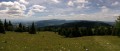
A lovely French-Swiss walk with magnificent views of the Alps and Lake Geneva.
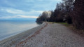
On the shores of Lake Geneva in Morges
 4.64 mi
+26 ft
-26 ft
2h 10
Easy
Departure from Morges (Vaud)
4.64 mi
+26 ft
-26 ft
2h 10
Easy
Departure from Morges (Vaud)
A beautiful walk along the shores of Lake Geneva, passing through the historic centre of Morges in the canton of Vaud. You will discover its magnificent castle and cross the Parc de l'Indépendance, which hosts the Tulip Festival in spring. In good weather, you can also admire the peaks of the French Alps.
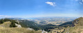
The Aiguilles de Baulmes, passing above Baulmes
 8.45 mi
+2,753 ft
-2,756 ft
6h 15
Difficult
Departure from Baulmes (Vaud)
8.45 mi
+2,753 ft
-2,756 ft
6h 15
Difficult
Departure from Baulmes (Vaud)
The Aiguilles de Baulmes form a range of ridges over 4 km long, running generally north-east to south-west between Mont de Baulmes and the Col de l’Aiguillon. The French-Swiss border runs 700 metres to the west of the western end of the Aiguilles. The altitude of the ridge varies between 1,080 and 1,560 metres. A wooden cross has stood on the summit since 1935. From there, one can enjoy a magnificent panorama stretching out to the south: Baulmes, the Swiss Plateau, Lake Neuchâtel and the Alps. This hike offers the opportunity to explore the ‘Cave Noire’ cave. Access is secured by chains (a head torch is essential).
Le Morond from Les Hôpitaux-Neufs
 5.72 mi
+1,401 ft
-1,401 ft
3h 50
Average
Departure from Les Hôpitaux-Neufs (Doubs)
5.72 mi
+1,401 ft
-1,401 ft
3h 50
Average
Departure from Les Hôpitaux-Neufs (Doubs)
Coming from the north, Morond is the first iconic peak in the Jura to be reached. It rises to an altitude of 1,419 metres. The summit can be reached in half a day from Métabief or Les Hôpitaux-Neufs. The climb offers remarkable views of the region and Switzerland, including Lake Geneva. You can combine this walk with the Métabief summer toboggan run or the tourist train ride starting in Les Hôpitaux-Neufs.