From the Plan Mya Refuge to the Saint-Guérin Chapel via the GTA

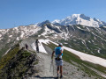
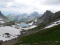
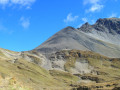
Grand Alpine Crossing from Plan Mya to the Chapelle de Saint-Guérin. The first section takes place in the Beaufortin, famous for its cheese, and after the Col de Bresson, you’ll be in the Tarentaise, a mecca for alpine skiing. The GTA follows theGR® 5. Part of this section is shared with the Tour du Beaufortin, which is aGRP® route and therefore signposted in red and yellow. Where theGR® and theGRP® diverge, be sure to follow the red and white markings of the GR®.

Details

n°45059241
Creation:
Last update:
Last review:
  • Walking
    Activity: Walking
  • ↔
    Distance: 9.95 mi
  • ◔
    Average duration: 7h 15 
  • ▲
    Difficulty: Difficult

  • ⚐
    Back to start: No
  • ↗
    Ascent: + 3,091 ft
  • ↘
    Descent: - 3,996 ft

  • ▲
    Highest point: 8,104 ft
  • ▼
    Lowest point: 5,207 ft
  • ⚐ Country: France
  • ⚐
    Areas: Alps, Beaufortain
  • ⚐ City: Beaufort (Savoie) (73270)
  • ⚑
    Start: N 45.691781° / E 6.664492°
  • ⚑
    End: N 45.605526° / E 6.673716°
  • ❏
    IGN map(s): Ref. 3531ET, 3531ETR, 3531OT, 3531OTR, 3532ET, 3532ETR, 3532OT, 3532OTR
  • Hour-by-hour weather

Description of the walk

Red and white markings ofthe GR® 5

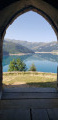
(S) From the Plan Mya lodge, head south-west along the alpine track that crosses the pastures to the UCPA “Le Mora” refuge: the track overlooks Lake Roselend, which lies below on the right.

(1) Continue along the track, then take the path on the right which rejoins it further up. Continue climbing, then turn left to reach the Petite Berge sheepfold.

(2) Follow the path, heading due south, to the junction of several paths at La Grande Berge.

(3) Head down, towards the south, to the junction with the hamlet of Treicol, which you can see on the right.

(4) Continue along the path southwards, ignoring the path leading to the hamlet.

(5) Cut across a track and rejoin it after a few hairpin bends. Follow it to the right, pass two tight hairpin bends and carry on until the start of the next one.

(6) Take the path on the right, which serves as a shortcut, cross the track, then rejoin it further up. Follow it to the left, leave it again on the right and, finally, cross it one last time.

(7) Start the ascent to the Col du Bresson opposite, with a gradient of over 15 per cent. Then follow the much gentler sloping path before leaving it to the left and following a steep slope up to the pass, which marks the entrance to the Tarentaise.

(8) Descend the pass to the Refuge de la Balme, where theGRP® Tour du Beaufortin and theGR® 5 part ways.

(9) Follow the red and white markings carefully to reach the vicinity of Les Plans d’en Haut.

(10) Leave the wide path you have been following and turn off to the left, whilst staying on the GR®. Continue to the junction for the Chapelle Saint-Guérin.

(11) Leave theGR® by turning right onto the path leading to the chapel and the adjacent car park (S/E).

Waypoints

  1. S : mi 0 - alt. 6,112 ft - Gite de Plan Mya
  2. 1 : mi 0.33 - alt. 6,184 ft - Le Mora mountain hut
  3. 2 : mi 1.07 - alt. 6,788 ft - La Petite Berge
  4. 3 : mi 1.85 - alt. 6,742 ft - La Grande Berge
  5. 4 : mi 3.51 - alt. 5,981 ft - Treicol path junction
  6. 5 : mi 4.08 - alt. 5,961 ft - Track junction
  7. 6 : mi 4.65 - alt. 6,542 ft - Shortcut to the right
  8. 7 : mi 4.98 - alt. 6,942 ft - Start of the climb to the Col du Bresson
  9. 8 : mi 5.79 - alt. 8,104 ft - Col du Bresson
  10. 9 : mi 7.2 - alt. 6,591 ft - Refuge Communal de la Balme (2000m)
  11. 10 : mi 9.21 - alt. 5,361 ft - Three-way junction, left
  12. 11 : mi 9.57 - alt. 5,335 ft - Junction for the Chapelle Saint-Guérin, leave the GR®°°
  13. E : mi 9.95 - alt. 5,233 ft - Saint Guérin car park. After the - Ormente (cours d'eau) - Affluent de l'Isère

Always be cautious and plan ahead when you're outdoors. Visorando and the author of this route cannot be held responsible for any accidents occurring on this route.

The GR® and PR® markings are the intellectual property of the Fédération Française de Randonnée Pédestre.

Reviews and comments

4.3 / 5
Based on 1 review

Reliability of the description
4 / 5
Ease of following the route
4 / 5
Route interest
5 / 5
randonnée savoie
randonnée savoie

Overall rating : 4.3 / 5

Date of your route : Mar 09, 2026
Reliability of the description : ★★★★☆ Good
Ease of following the route : ★★★★☆ Good
Route interest : ★★★★★ Very good
Very busy route : Yes

We had taken the Tour des Monts map in Chambéry, but in the end it wasn't any good. After looking around, we finally found another little path that took us to Saint Alban Leysse after the Saint Saturnni chapel.

Machine-translated

Other walks in the area

For more walks, use our search engine .

The GPS track and description are the property of this route's author. Please do not copy them without permission.