Country:

 City:
City:


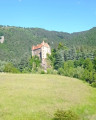
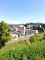
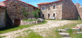
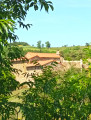
Departure from Le Puy-en-Velay station, arrival at the church in Lavoûte-sur-Loire. You can park in the car park at Lavoûte church, walk to the station via the bridge over the Loire and take a TER train towards Le Puy.
(S) On leaving the station, walk past the coach station and follow the Voie Verte north-eastwards. You will walk alongside the railway line on the left, then on the right. Pass close to the hospital, then follow the path on the right which takes you under the road. Continue along the Voie Verte until you reach Rue de Genebret.
(1) Do not continue along the Voie Verte, but head down the street to the left. Reach the roundabout and continue straight on into Rue du Pont de Chartreuse. Cross this pretty bridge over the Loire. Continue until you reach the road.
(2) Cross the road and head up Rue des Bories. After 200 m, turn left onto the red and white marked path. Go round the housing estate, then follow the 4-lane road leading up to Saint-Etienne below. After about 700 m, take the bridge on the left over the road, then turn right until you reach the entrance to the village of Fay-la-Triouleyre.
(3) Continue to follow the GR® markings (red and white) to cross the village and head down to the sewage treatment plant. There, the tarmac road turns into a path.
(4) Cross the Sumène then turn left. After 50 m, take the path that climbs to the right. Follow the markings to the road.
(5) Take the road on the right and, after about 300 m, take the path on the left. After about 500 m, you’ll rejoin the road. Follow it to the village of Chaspinhac. Take the street on the left at the entrance to the village.
(6) To climb Mont Serre and return, take the next street on the left, then the path that climbs to the left up to the summit.
(7) At the top, the view is lovely; it’s a great spot for a picnic. Retrace your steps. At the bottom of the descent, turn right.
(6) Head straight on to the village square. The square is truly beautiful, with all its well-maintained buildings and a lovely fountain. Head along Rue du Breuil towards the church, leaving the GR® behind.
(8) Keep to the right at the junction to reach the church and back. Then retrace your steps.
(8) Turn right onto Rue de Chassaure. Follow the street until the right-hand bend, then continue straight on along the path which climbs again, following the GR® markings. Follow it for about 800 m until you reach a cross.
(9) At the cross, turn left towards Saint-Quentin. Follow the red and white markings.
(10) Leave the GR® and follow the path leading to the hamlet of Saint-Quentin.
(11) Take the time to visit this hamlet, which is an absolute must-see. Retrace your steps back to the GR® junction.
(10) Continue to the left. Climb this marked path and follow it to the road.
(12) Turn left. Walk along the road for about 300 m, then take the path on the left to Brestilhac.
(13) At the junction, turn right. Follow the road, then, at the hairpin bend, continue straight on along the stony path. Then take the path on the left (still the GR®). Follow the red and white markings.
(14) For a return trip to the Virgin and Child, take the path that descends to the left to reach the statue. There, you’ll enjoy a lovely view of the village of Lavoûte-sur-Loire. Retrace your steps and head down to the village and the Place de l’Église (E).
The station is on the other side of the Loire.
 Visorando Member

 Easy
Easy 
 Moderate