From Prarion to Charousse via the Col de la Forclaz

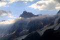
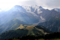
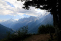
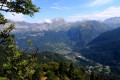
Set off to explore the Prarion plateau (1,900 m) and its incredible 360° panoramic view of the Mont Blanc massif, the Fiz and the Chamonix Valley! The walk ends at the very picturesque site of the Charousse mountain pasture, a reminder of the pastoral life of days gone by.

Details

30850019
Creation:
Last update:
Last review:
  • Walking
    Activity: Walking
  • ↔
    Distance: 4.74 mi
  • ◔
    Average duration: 2h 35 
  • ▲
    Difficulty: Moderate

  • ⚐
    Back to start: No
  • ↗
    Ascent: + 472 ft
  • ↘
    Descent: - 3,196 ft

  • ▲
    Highest point: 6,447 ft
  • ▼
    Lowest point: 3,317 ft

Photos

Description of the walk

You can park at the Chavants car park in Les Houches and then take the Prarion cable car.

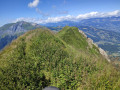
(S) From the top station of the Prarion cable car, at 1,846 m, head towards Vaudagne via theGRP® “Tour du Pays du Mont-Blanc”. The path, which initially runs through woodland, climbs to the summit of Prarion at an altitude of 1,969 m (breathtaking 360° panoramic views).

(1) Take the downhill path (which is sometimes steep and rugged) that gradually levels out as it reaches the Col de la Forclaz.

(2) Turn right onto the path and then, 100 metres further on, turn left towards Vaudagne, staying on theGRP® “Tour du Pays du Mont-Blanc” until you reach a junction.

(3) Turn left, staying on theGRP®. Continue straight on along a fairly wide track which becomes a path and crosses the little Ruisseau de la Fontaine.

(4) At the junction, take the steep path on the right and head for the picturesque village of Charousse.

(5) On exiting, turn left towards Les Houches. The path turns into a road and passes the first houses in the hamlet of La Côte des Chavants. Continue straight on and, just before the cable car, join the Route de la Côte des Chavants.

(6) Turn left onto it for a few metres and follow the path on the right, which then passes numerous chalets and becomes the Chemin de Bovresse. Continue straight on through the village until you reach the Route des S’Nailles.

(7) On the Route des S’Nailles, turn right onto the small Chemin du Régent, which crosses a lovely meadow and leads out near the Prarion cable car and the Chavants car park (S/E).

Waypoints

  1. S : mi 0 - alt. 6,056 ft - Prarion Plateau
  2. 1 : mi 0.64 - alt. 6,440 ft - Le Prarion
  3. 2 : mi 1.86 - alt. 5,062 ft - Col de la Forclaz (1533m)
  4. 3 : mi 2.52 - alt. 4,098 ft - GRP Tour du Pays du Mont-Blanc junction
  5. 4 : mi 3.07 - alt. 3,852 ft - GRP / Vaudagne junction
  6. 5 : mi 3.36 - alt. 3,944 ft - Charousse exit
  7. 6 : mi 4.29 - alt. 3,586 ft - Junction with Route des Chavants
  8. 7 : mi 4.52 - alt. 3,409 ft - Path to Les Chavants
  9. E : mi 4.74 - alt. 3,317 ft - Les Chavants

Notes

Car park near the Prarion cable car and at Les Chavants.
Prarion cable car.

Food and refreshments available:

  • Restaurants and outdoor cafés at the foot of the Prarion cable car and at Les Chavants.
  • "Prarion 1860" Hotel and Restaurant

Worth a visit

Things to see:

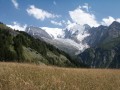
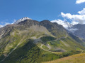
  • The extraordinary views over the Chamonix Valley, the Mont Blanc massif (north and south balconies) and the Fiz massif above Servoz.
  • The magnificent Charousse mountain pasture

Reviews and comments

5 / 5
Based on 2 reviews

Reliability of the description
5 / 5
Ease of following the route
5 / 5
Route interest
5 / 5
lilas74
lilas74

Overall rating : 5 / 5

Date of your route : Aug 19, 2026
Reliability of the description : ★★★★★ Very good
Ease of following the route : ★★★★★ Very good
Route interest : ★★★★★ Very good
Very busy route : No

A lovely route, but with a few tricky and slightly vertiginous sections. Not suitable for young children, and although the elevation change is negative, it does take its toll on your legs. The estimated duration of 2½ hours might be worth reconsidering. On the other hand, there are superb views and the route is mostly shaded, making for a very pleasant walk.

Machine-translated

Sébastien Lesné
Sébastien Lesné

Overall rating : 5 / 5

Date of your route : Aug 02, 2024
Reliability of the description : ★★★★★ Very good
Ease of following the route : ★★★★★ Very good
Route interest : ★★★★★ Very good
Very busy route : No

After taking the cable car up
, we set off on our walk, enjoying some stunning views of Mont Blanc and the Chamonix valley below

Machine-translated

Other walks in the area

For more walks, use our search engine .

The GPS track and description are the property of this route's author. Please do not copy them without permission.