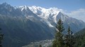
The Prarion circular loop starting from Le Crozat in Bionassay

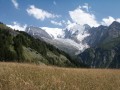
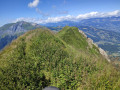
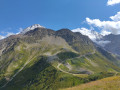
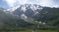
A hike to the summit of Prarion at an altitude of 1,969 metres, offering an incredible 360° view of the Mont Blanc massif, the Aiguilles Rouges and the Aravis, with a short detour to the footbridge over the Bionnassay Glacier.

Details

41967567
Creation:
Last update:
Last review:
  • Walking
    Activity: Walking
  • ↔
    Distance: 8.53 mi
  • ◔
    Average duration: 6h 25 
  • ▲
    Difficulty: Moderate

  • ⚐
    Back to start: Yes
  • ↗
    Ascent: + 2,907 ft
  • ↘
    Descent: - 2,881 ft

  • ▲
    Highest point: 6,444 ft
  • ▼
    Lowest point: 4,610 ft

Description of the walk

Park in the Crozat car park in the village of Bionnassay.

(S/E) As you leave the car park, head left and make your way to the nearby junction. Turn left, towards Les Bettières and the glacier footbridge.

(1) At Le Planet, turn right towards Les Vrets. After a few hairpin bends, you’ll reach a junction opposite the Are building (alt. 1,760 m).

(2) Turn right until you reach the fork.

(3) Turn right again to cross the Bionassay torrent and reach the footbridge from which you can see the end of the Bionassay Glacier.

(4) Retrace your steps.

(3) Turn left to return to the Are junction.

(2) Carry on straight ahead to reach Bellevue, a stop on the Mont Blanc Tramway route.

(5) Turn left, follow the tram line and reach the Col de Voza stop.

(6) Cross the tracks, then keep strictly to the left to follow the wide path towards Prarion. Pass a path branching off to the left and you’ll soon reach a three-way junction.

(7) Turn right, pass under the Kandahar chairlift and head for the top station of the Les Houches–Prarion cable car.

(8) Go round it to continue the climb and reach the junction with the return path.

(9) Carry on straight ahead to reach the summit of Prarion.

(10) Turn back to the junction you passed on the way up.

(9) Turn right to avoid retracing the ascent route. Pass the gondola lift’s top station, then turn right to join the tarmac road to Prarion.

(11) Turn left, walk past the mountain restaurant, then continue, passing under the Kandahar chairlift once more, until you reach a junction you passed on the way up.

(7) Follow the ascent route in the opposite direction to the Col de Voza.

(6) Turn right and head straight down, passing through the hamlets of Le Fioux and Sur le Cart before reaching the car park (S/E).

Waypoints

  1. S/E : mi 0 - alt. 4,639 ft - Crozat car park
  2. 1 : mi 0.72 - alt. 5,049 ft - Le Planet
  3. 2 : mi 1.54 - alt. 5,771 ft - L’Are
  4. 3 : mi 1.71 - alt. 5,827 ft - Junction at the footbridge
  5. 4 : mi 2.03 - alt. 5,554 ft - Bionassay Glacier Footbridge
  6. 5 : mi 3.42 - alt. 5,814 ft - Bellevue
  7. 6 : mi 4.08 - alt. 5,430 ft - Col de Voza
  8. 7 : mi 4.6 - alt. 5,823 ft - Three-way junction
  9. 8 : mi 5.05 - alt. 6,056 ft - Upper cable car station
  10. 9 : mi 5.64 - alt. 6,362 ft - Junction. Round trip to the summit
  11. 10 : mi 5.81 - alt. 6,434 ft - Le Prarion
  12. 11 : mi 6.65 - alt. 6,010 ft - Route du Prarion
  13. S/E : mi 8.53 - alt. 4,642 ft - Crozat car park

Reviews and comments

5 / 5
Based on 2 reviews

Reliability of the description
5 / 5
Ease of following the route
5 / 5
Route interest
5 / 5
User 1205006

Overall rating : 5 / 5

Date of your route : Aug 25, 2026
Reliability of the description : ★★★★★ Very good
Ease of following the route : ★★★★★ Very good
Route interest : ★★★★★ Very good
Very busy route : Yes

A lovely walk; the Prarion is a magnificent viewpoint (like a few others in the area, such as Mont Joly...).
A lovely, fairly easy day out.

Machine-translated

paret
paret

Really beautiful views over a huge part of the route. Picnic on the terrace at the refuge. Royal. A great effort, but well worth it. We added a variation with a return trip to the pass overlooking the refuge.

Machine-translated

smashdc
smashdc
• Edited:

Overall rating : 5 / 5

Date of your route : Aug 30, 2024
Reliability of the description : ★★★★★ Very good
Ease of following the route : ★★★★★ Very good
Route interest : ★★★★★ Very good
Very busy route : No

Stunning panoramic views of the Mont Blanc massif, the Aiguilles Rouges and the Aravis, with a round trip to the Bionnassay Glacier footbridge.
An absolute must in the Cham’ Valley! THE hike to do in Cham’!
360° panoramic views guaranteed at both the Col de Voza and the Prarion ;-)
Three rather impressive Patou dogs, but they stop following you and barking at you after a few metres :-o
The Bionnassay Glacier footbridge is impressive (80 m elevation gain/loss at valley level, return)!
Whilst the view is already brilliant… it’s nothing compared to arriving at the railway line! A panoramic view as far as the eye can see!!
Two sections where you have to climb down rocks using a chain, but nothing too tricky.
The most beautiful part is still at Prarion. The train will whistle three times as we pass by, both on the way up and on the way down ;-)
A gradual but fairly long climb, though the magnificent view is ever-present :-)
On the descent near the railway line, I spot a sign on the right and take that path.
It’s clearly signposted. A lovely descent, then, and it’s not the same route as on the way up ;-)
.
The footbridge is a must-see for me ;-)
If you’re up for a full day’s hike, you could take the TMB from the starting station to Nid d’Aigle, head down to the Col de Voza, then climb up to Prarion and catch the train back. That way, there’ll be more descent than ascent. Depending on how much time you have, you could do a round trip to the footbridge.
.
Mont Blanc Tramway:
The railcars are named Marie, Anne and Jeanne… the first names of a former director’s daughters.
FRANCE’S HIGHEST RACK-AND-PINION TRAIN
Every day, Anne the green, Jeanne the red and Marie the blue – the three TMB trains –
take turns to enable passengers to reach the Les Houches ski area in winter or the many hiking trails in summer.

Machine-translated

Other walks in the area

For more walks, use our search engine .

The GPS track and description are the property of this route's author. Please do not copy them without permission.