From Petit Maroc to the Parc Paysager in Saint-Nazaire

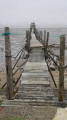
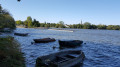
This very easy walk takes you past some of Saint-Nazaire’s most iconic sights: the Loire and the harbour, the Place des Quatre z’horloges, the town hall, the landscaped park, the Jardin des Plantes, the Havane district, the Boulevard de Mer, the Petit Maroc, the outer harbour and its tugboats.

Details

69343529
Creation:
Last update:
Last review:
  • Walking
    Activity: Walking
  • ↔
    Distance: 4.53 mi
  • ◔
    Average duration: 2h 05 
  • ▲
    Difficulty: Easy

  • ⚐
    Back to start: Yes
  • ↗
    Ascent: + 26 ft
  • ↘
    Descent: - 26 ft

  • ▲
    Highest point: 43 ft
  • ▼
    Lowest point: 0 ft

Description of the walk

The meeting point is the Saint-Hubert car park on Avenue Saint-Hubert.

(S/E) Follow the Loire upstream towards the eastern lock of the southern basin. Cross the lock, then follow Avenue des Frégates, which runs alongside the southern basin and turns left. It continues over a bascule bridge, then along Avenue du Pertuis, which joins Boulevard Paul Leferme.

(1) Turn left onto it and keep to the right-hand side. Pass the Carghill silos, then the submarine base. Near the entrance to the base, turn right onto Rue des Caraïbes, which runs alongside the Ruban Bleu.

(2) Turn left onto Rue Henri Gautier. At Place des Quatre z’horloges, turn right onto Avenue du Général de Gaulle, which leads past the town hall.

(3) Go round Place François Biancho, then turn diagonally left onto Rue Pierre Mendès France. Cross Boulevard Léon Gambetta, then continue straight ahead along Rue Auguste Cheneveaux, which leads to the heart of the Parc Paysager.

(4) Turn left to enter the park. Walk past the miniature golf course and emerge onto Rue de Pornichet. Cross the road to enter the Parc du 19 Mars 1962, and head back towards the seafront.

(5) Take Boulevard Albert Ier to the left and continue as far as the Jardin des Plantes. Take a detour to the left to visit it, then exit to the left and follow Rue de Santander. Take a short stroll through this neighbourhood of Saint-Nazaire, which evokes the Belle Époque and grand voyages, and which survived the Second World War. Of particular note are the street lamps, each one different, which light up the front doors of the early 20th-century-style houses.

(6) Turn left onto Avenue de la Havane, then right onto Rue de Vera Cruz. Avenue Villebois-Mareuil, which you then take to the right, leads back onto Avenue du Président Wilson.

(7) Turn left again and follow the boulevard along the promenade to the very end.

(8) Head right, towards the southern lock of the port’s southern basin. Cross this lock via the lift bridge, and follow Rue Joseph Hippolyte Durand.

(9) At the end of the street, turn right towards the Quai des Marées, where the tugboats are moored.

(10) At the end of the quay, turn round to head back towards the Quai du Vieux Môle, then towards Avenue Saint-Hubert where you’ll find the cars (S/E).

Waypoints

  1. S/E : mi 0 - alt. 16 ft - Saint-Hubert car park
  2. 1 : mi 0.63 - alt. 13 ft - Boulevard Paul Leferme
  3. 2 : mi 0.99 - alt. 23 ft - Rue Henri Gautier
  4. 3 : mi 1.58 - alt. 39 ft - Place François Biancho
  5. 4 : mi 2.09 - alt. 16 ft - Landscape Park
  6. 5 : mi 2.45 - alt. 20 ft - Boulevard Albert Ier
  7. 6 : mi 3.01 - alt. 30 ft - Avenue de la Havane
  8. 7 : mi 3.19 - alt. 23 ft - Boulevard du Président Wilson
  9. 8 : mi 3.69 - alt. 16 ft - Lifting bridge
  10. 9 : mi 3.82 - alt. 16 ft - Corner of Rue JH Durand and Quai des Marées
  11. 10 : mi 4.08 - alt. 16 ft - The end of the Quai des Marées
  12. S/E : mi 4.53 - alt. 16 ft - Saint-Hubert car park

Reviews and comments

4.7 / 5
Based on 2 reviews

Reliability of the description
5 / 5
Ease of following the route
5 / 5
Route interest
4 / 5
pyreno
pyreno

Overall rating : 4.3 / 5

Date of your route : Apr 27, 2026
Reliability of the description : ★★★★★ Very good
Ease of following the route : ★★★★★ Very good
Route interest : ★★★☆☆ Average
Very busy route : No

This route allows you to discover the contrasts of this city, from the port area with its shipyards to the charm of the town and its beaches.

Machine-translated

Isabelle Cloux
Isabelle Cloux

Overall rating : 5 / 5

Date of your route : Mar 01, 2026
Reliability of the description : ★★★★★ Very good
Ease of following the route : ★★★★★ Very good
Route interest : ★★★★★ Very good
Very busy route : No

A lovely exploration of St Nazaire, mainly around the seafront and the outer harbour.
You can no longer get to point 8; you have to go a bit further up via the bascule bridge.
And the exit to the car park no longer exists, as the town is building a pedestrianised and recreational area. I’d parked almost opposite the submarine base, as it was a Sunday.
Allow a bit more time if you want to stroll along the beach and go up to the roof of the submarine base (free and accessible by lift), which offers a sweeping view of the harbour and the coast.

Machine-translated

Other walks in the area

For more walks, use our search engine .

The GPS track and description are the property of this route's author. Please do not copy them without permission.