


 Country:
 City:


Start at the Rhin-et-Danube roundabout in Boulogne-Billancourt. See the ‘Practical Information’ section for access and parking details.
(S/E) Head towards the Seine (to the west) and take Avenue du Maréchal de Lattre de Tassigny (D507) towards Versailles and La Défense. At the traffic lights, turn left to cross the avenue at the pedestrian crossing.
(1) Then turn right and cross Quai Alphonse Le Gallo in three stages. Take the cycle path on the left-hand pavement of the Pont de Saint-Cloud and cross the Seine.
(2) On the other side, cross at the pedestrian crossing and turn left immediately to join a cycle path situated between two lanes of traffic.
(3) At the traffic lights, turn right to cross a road at the pedestrian crossing, then turn right again opposite a sign for ‘Domaine de Saint-Cloud’.
Take the hairpin bend to the left and head uphill alongside the A13 motorway, which runs higher up. Pass the Grille d’Honneur and then the toll booth at the Parc de Saint-Cloud.
(4) Continue along the cobbled road which climbs, taking a right-hand bend followed by a left-hand bend.
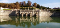
Carry on along a tarmac road, skirting the Terrasses du Château gardens on your left. This will take you to the Bassin des 24 Jets, where the road is lined with statues of Roman gods.
(5) At the foot of the statue of Neptune, turn right towards Marnes and Garches, and head uphill. Go round the Bassin de la Grande Gerbe on the right and carry on straight ahead towards Marnes.
Ride along a slight incline, passing the Stade Français grounds on your left.
(6) When you reach a forest gate, turn left with the road and head back down. Pass the Chalet de Combeval on your right, ignore the road on the right and head back up towards Marnes.
Pass the toll booth, then the Porte Blanche, and head downhill to reach the centre of Marnes-la-Coquette, where you should turn left onto Place de la Mairie.
(7) At the Stop sign (church opposite), turn right. At the traffic lights, go straight on, then turn left following the road towards the Haras de Jardy. Climb a steep hill.
(8) At the Stop sign (with a sign for the state-owned forest opposite), take thefirst road on the right, which has a 20 km/h speed limit. When you reach a forest gate, turn left onto the road. Continue to the next junction (forest gate, plot no. 51).
(9) Turn right and follow the road straight on until you reach a junction with the D182 (traffic lights).
(10) Cross the D182 at the traffic lights. Then take thesecond right onto Avenue de Villeneuve l’Étang. Drive down the road, taking the wide bends.
At the Stop sign, go straight on and continue down the hill more gently. At the next Stop sign and then at the next set of traffic lights, go straight on again.
(11) At the junction, turn right onto Avenue du Général Mangin. At the next junction (traffic lights), turn left onto Avenue du Maréchal Foch and follow the marked cycle path.
Pass a cul-de-sac on your right, then turn right into Rue des Missionnaires. At the end (traffic lights), turn right onto the cycle path running parallel to Boulevard du Roi.
(12) At the end (monument honouring the Gendarmerie Nationale), turn left to cross the boulevard at the pedestrian crossing and go round the roundabout on the left (cycle lane).
Take thefirst exit on the left, a cycle path located in the side lane of Avenue Saint-Antoine, towards Rocquencourt.
Carry on straight ahead, taking care to watch out for traffic at the various junctions. You’ll emerge onto a paved area at the foot of the monumental Porte Saint-Antoine.
(13) Go through the gate to the right of the archway and enter the Parc de Versailles. Follow the wide gravel path running parallel to the cobbled road.
Then turn right and pass through the gate leading to the Trianons estate. Walk past the Petit Trianon and take the cobbled road on the right, which soon becomes tarmac. You’ll emerge onto a cobbled esplanade in front of the Grand Trianon.
(14) Continue straight ahead, pass through a forest gate and go down a cobbled road to reach the banks of the Grand Canal.
(15) Begin your walk around the Grand Canal in an anti-clockwise direction, keeping the water on your left. Stay on the tarmac path, which runs a short distance from the water and consistently follows its contours.
(16) At the end of the southern branch of the Grand Canal, go slightly uphill and then back down again. Continue along the water’s edge.
Pass through a gate and turn left, leaving the Bassin de Neptune on your right (bicycles are not permitted in the château gardens). Pass through a second gate.
(17) Then turn right (leaving the Grand Canal) and take the wide gravel path running parallel to the cobbled road. When you reach a gate on the left-hand side, turn right onto a tarmac path. At a Fork in the road (marked by a small wooden barrier), turn left.
(18) Leave the Palace of Versailles grounds via the Grille de la Reine and continue along the boulevard of the same name.
As soon as it appears, take the cycle path in the side lane on the right-hand side. Keep going straight ahead, taking care of the traffic at the various junctions.
(19) At the junction, cross the D185 at the traffic lights, then turn left and follow the cycle path uphill, running parallel to the road.
At a fork in the road, continue straight on, uphill, along the D185 towards Ville-d’Avray.
(20) As you approach the Pershing-La Fayette monument, there are two options:
- Cross the road at the pedestrian crossing to stay on the cycle path on the left-hand side (in which case you’ll need to cross the road again shortly afterwards, without a pedestrian crossing).
- Carry on along the road or on the gravelly pavement on the right-hand side.
Head downhill for approximately 250 m.
(21) At the junction, turn right onto a road closed to vehicles over 1.5 tonnes.
After a car park on the right-hand side, pass through a forest gate; the tarmac becomes rough but is still passable. Keep going straight on, ignoring all the side paths.
(22) At a crossroads (signpost), turn left onto the tarmac and head down a steep descent.
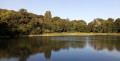
At the bottom, at a fork in the road, keep to the right onto a wide gravel path and you’ll soon reach the Étangs de Ville-d’Avray.
(23) Follow the embankment separating the two ponds. At the end, go through a forest gate and continue up a road.
(24) At the end (traffic lights), turn right into Rue de Versailles.
(25) If you wish, head down Rue du Lac on the right and follow the embankment of the Étang de Corot for another viewpoint. Then turn back.
(25) Continue along Rue de Versailles and walk down to a junction (traffic lights, church on the right).
(26) Cross the junction and follow Rue de Saint-Cloud straight ahead. Head uphill and leave Ville-d’Avray.
(27) At the top of the hill, turn right, pass the entrance gate to the Parc de Saint-Cloud and then the toll booth. After a gentle climb, you’ll reach the Rond de Chasse.
(28) Take thethird tarmac track on the left (signposted ‘Toutes directions’; the top of the Eiffel Tower can be seen in the distance). Head downhill.
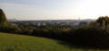
(29) At the junction, turn right towards Sèvre and Meudon onto a tarmac side road that runs alongside a large lawn on the left-hand side. At the end, go round a roundabout and you’ll reach a balustrade (offering sweeping views over Paris).
(30) Complete the circuit of the roundabout and turn right, heading towards Saint-Cloud along a side path running parallel to the previous one.
(29) Back at the junction, turn right towards the Fer à Cheval. Head downhill, ignore a road on the left and continue along a cobbled section.
(31) At the crossroads, turn left, go through a gate and head for the Bassin du Fer à Cheval.
Go round the basin on the right and follow a rectangular basin below on the right. Go through a wooden barrier and, at the fork in the road, keep left towards the exit.
(4) At the Stop sign, turn right, pass the toll booth then the Grille d’Honneur and head downhill. Take a hairpin bend to the right then keep to the right on a paved section.
(3) At the traffic lights, you have two options:
- Take the cycle path on the left between the two lanes. At the end, cross the road on the right at the pedestrian crossing (which has no traffic lights).
- Stay on the road and follow the D907 to the left towards Boulogne-Billancourt, keeping level with the bridge.
In both cases, just after a bus stop, you’ll rejoin the Pont de Saint-Cloud cycle path.
(2) Cross the Seine and, on the other side, cross the quay in three stages.
(1) Continue along Avenue de Lattre de Tassigny on the marked cycle path. This will take you to the Rhin et Danube roundabout (S/E).

 Tourism professional
 Easy

 Visorando Member

