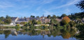
From the Bazouge-Cré-sur-Loir marsh to the Croix de Cré

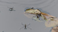
This route begins with an exploration of the flora and fauna in the protected marshland within the Marais de Cré and La Flèche Nature Reserve.
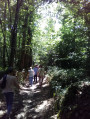
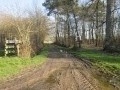
Leaving the marshland behind, this walk continues along beautiful paths and/or small roads, pleasantly lined with woodland. A carved and engraved cross adds to the charm of the route.

Details

n°4210870
Creation:
Last update:
Last review:
  • Walking
    Activity: Walking
  • ↔
    Distance: 3.22 mi
  • ◔
    Average duration: 1h 35 
  • ▲
    Difficulty: Easy

  • ⚐
    Back to start: Yes
  • ↗
    Ascent: + 128 ft
  • ↘
    Descent: - 128 ft

  • ▲
    Highest point: 223 ft
  • ▼
    Lowest point: 79 ft
  • ⚐ Country: France
  • ⚐ City: Cré (72200)
  • ⚑
    Start/End: N 47.678038° / W 0.153364°
  • ❏
    IGN map(s): Ref. 1620SB, 1621SB
  • Hour-by-hour weather

Photos

Description of the walk

Start from the marsh car park.

(S/E) Head to the bank of the Loir and follow it to the right. The path, marked with yellow signposts, winds through the reed beds before leading to the right along a wooden walkway towards an observation point.

(1) End point of the family discovery trail (1 km, 45 mins).
Return to the banks of the Loir and turn right onto the Route des Marais (3.2 km, 1 hr 30 mins).
A little further on, the ‘immersion trail’ opens up on the right (1 km, 45 mins).
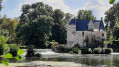
On the opposite bank of the Loir, the Château des Champs can be glimpsed through the vegetation, followed by the Ferme des Guérêts.
Continue to a private property, which you go round to the right via the Chemin des Épinettes.

(2) There are two options depending on the route chosen:
To the right, a wide grassy path opens up, running parallel to the road. This allows you to complete the Circuit des Marais in a circular fashion, taking you back to the car park where you started.
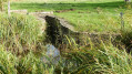
To the right of this path, you’ll pass through the various habitats of the marsh: reed beds, water channels, etc.
About 400 m on, a viewing point, situated below, offers a sweeping view of a stretch of water.

Alternatively, continue along the Chemin Bois et Marais, heading straight on towards the small uphill road.
At a place called Le Harteloup, carry on straight ahead along the forest track until you reach the track/road junction.

(3) Turn right onto the Chemin Bois et Marais, signposted in yellow, and follow this track (take care) as far as the Croix de Cré

(4) At the cross, turn right onto the path.

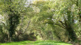
(5) At the next junction, turn left. The path widens into a lovely tree-lined avenue. At the end of the path, there is a crucifix.
Head back to the car park opposite (S/E).

Waypoints

  1. S/E : mi 0 - alt. 95 ft - Marsh car park
  2. 1 : mi 0.36 - alt. 82 ft - Observation point. Walk along the - Loir (rivière)
  3. 2 : mi 1.32 - alt. 89 ft - Crossroads
  4. 3 : mi 2.11 - alt. 223 ft - Crossroads
  5. 4 : mi 2.47 - alt. 213 ft - Croix de Cré
  6. 5 : mi 2.63 - alt. 177 ft - Path on the left
  7. S/E : mi 3.22 - alt. 95 ft - Marsh car park

Notes

Binoculars for observation
Please note: the Marias de Cré and La Flèche Nature Reserve may become partially or completely flooded during prolonged periods of rain.

Suitable footwear (wellies) may be essential.

Worth a visit

Cré-sur-Loir
11th- and 12th-century church:
- Oak pulpit (1700) decorated with garlands of fruit, flowers and onions.
- Painting: ‘The Last Supper at Emmaus’.

Place Saint-Martin:
A portico used by the farrier to restrain animals whilst shoeing them.

Along the route:
The Marias de Cré and La Flèche Nature Reserve:
Designated in 2018, this site covering approximately 65 hectares – the largest alluvial marshland area in the department of Sarthe – offers walkers the chance to explore a typical marshland environment: wet meadows, a network of canals, reed beds, aquatic fauna, insects, birds and plant species.

Note: Numerous information boards explain the flora and fauna of this protected area.

Within the marsh, there are three complementary trails, some of which overlap with this route:

  1. Marsh Route (3.2 km, 1 hour 30 minutes)
  2. Family Discovery Trail (1 km – 45 mins)
  3. Immersive Trail (1 km – 45 mins)

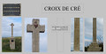
The Croix de Cré: This cross on a plinth marks a grave. It is adorned with similar engraved motifs on the sides. On the front, from top to bottom, one can see a copper heart. In the inscription engraved at the crossbar, a few legible parts can be made out: “Here lies the body of”, and the date “26 February 1817”.

Reviews and comments

4 / 5
Based on 2 reviews

Reliability of the description
4 / 5
Ease of following the route
3.5 / 5
Route interest
4.5 / 5
Antoine4795
Antoine4795

Overall rating : 4 / 5

Date of your route : Aug 05, 2024
Reliability of the description : ★★★★☆ Good
Ease of following the route : ★★★☆☆ Average
Route interest : ★★★★★ Very good
Very busy route : No

A very pleasant journey

Machine-translated

sergio49
sergio49

Overall rating : 4 / 5

Date of your route : Aug 29, 2022
Reliability of the description : ★★★★☆ Good
Ease of following the route : ★★★★☆ Good
Route interest : ★★★★☆ Good
Very busy route : No

A route running alongside one bank of the Loir and, on the other, a designated wetland – well worth exploring

Machine-translated

Other walks in the area

For more walks, use our search engine .

The GPS track and description are the property of this route's author. Please do not copy them without permission.