Family walk around La Flèche

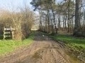
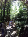
A short family walk along paths, through the forest and along roads. The countryside with its forests, meadows and farms.

Details

20760
Creation:
Last update:
Last review:
  • Walking
    Activity: Walking
  • ↔
    Distance: 3.42 mi
  • ◔
    Average duration: 1h 40 
  • ▲
    Difficulty: Easy

  • ⚐
    Back to start: Yes
  • ↗
    Ascent: + 82 ft
  • ↘
    Descent: - 82 ft

  • ▲
    Highest point: 325 ft
  • ▼
    Lowest point: 240 ft

Photos

Description of the walk

(S/E) Starting point: La Viculière.
At the end of the tarmac road, take the path on the left. Walk alongside La Perrinière, through fields and then into a forest.

(1) At the crossroads in a clearing, turn left then immediately right, skirting the meadow, and enter the forest. Follow the path until you reach a crossroads, then turn right. Follow the path until you reach the road.

(2) Then turn right, follow the road and turn right after the descent. Stay on the main road until you reach the Route de Clermont-Créans.

(3) Then turn right and follow the road again. At a bend, there is a path cutting through the woodland to the right and left; take the one on the right.
Continue along the path until you rejoin the tarmac road you started on at the entrance to La Perrinière. Turn left to make a circular walk (S/E).

Waypoints

  1. S/E : mi 0 - alt. 322 ft - La Viculière
  2. 1 : mi 0.52 - alt. 279 ft - On the left
  3. 2 : mi 1.28 - alt. 295 ft - On the right-hand side of the road
  4. 3 : mi 2.48 - alt. 315 ft - On the right-hand side of the road
  5. S/E : mi 3.42 - alt. 322 ft - La Viculière

Notes

It’s best to wear wellies when it’s rained heavily, as the forest paths get muddy.
If you’re bringing your dog, do make sure to keep it on a lead as there’s a section where you’ll come across a few other dogs.

Worth a visit

Nearby, there is an equestrian centre offering horse rides.

Reviews and comments

4.2 / 5
Based on 3 reviews

Reliability of the description
4.3 / 5
Ease of following the route
5 / 5
Route interest
3.3 / 5
Philarmer
Philarmer
• Edited:

Overall rating : 3.5 / 5

Date of your route : Sep 11, 2018
Reliability of the description : ★★★★☆ Good
Ease of following the route : Not used / Not applicable
Route interest : ★★★☆☆ Average

A nice little route, but it’s a shame that a significant part of it is on the road, especially when it’s really hot. Worth doing once.

Machine-translated

geraldine wilmet
geraldine wilmet

Overall rating : 4 / 5

Date of your route : Nov 01, 2017
Reliability of the description : ★★★★☆ Good
Ease of following the route : ★★★★★ Very good
Route interest : ★★★☆☆ Average

For a first hike, the directions are very straightforward (using a GPS),
the first part of the walk was lovely with the dog (woodland, fields), but it’s a shame there’s such a long stretch along the road,

but one to do again
thanks, Visorando

Machine-translated

xbeaudoin
xbeaudoin

Overall rating : 4.7 / 5

Date of your route : Sep 18, 2017
Reliability of the description : ★★★★★ Very good
Ease of following the route : ★★★★★ Very good
Route interest : ★★★★☆ Good

A short route for a family walk.
There’s quite a bit of road in the second half.

Machine-translated

Other walks in the area

For more walks, use our search engine .

The GPS track and description are the property of this route's author. Please do not copy them without permission.