From Lake Vaivre to Camp César, returning via the ridges

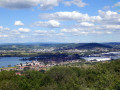
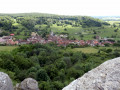
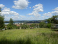
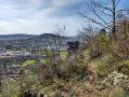
I often do this route because it’s very close to home and I never tire of it. Le Camp de César and its view over the village of Chariez – everyone here knows the summit with its view of Montigny, Lake Vaivre-et-Montoille and La Motte de Vesoul – is truly the highlight of this route. It’s a shame because, whilst much of this route used to be signposted, very few traces of the markings remain now.

Details

22321083
Creation:
Last update:
Last review:
  • Walking
    Activity: Walking
  • ↔
    Distance: 5.18 mi
  • ◔
    Average duration: 2h 55 
  • ▲
    Difficulty: Easy

  • ⚐
    Back to start: Yes
  • ↗
    Ascent: + 604 ft
  • ↘
    Descent: - 610 ft

  • ▲
    Highest point: 1,257 ft
  • ▼
    Lowest point: 705 ft
  • ⚐ Country: France
  • ⚐ City: Vaivre-et-Montoille (70000)
  • ⚑
    Start/End: N 47.637503° / E 6.107755°
  • Accessible from the train station Gare de Vaivre.
  • ❏
    IGN map(s): Ref. 3321SB
  • Hour-by-hour weather

Photos

Description of the walk

Park in the car park at the water sports centre.

(S/E) Start from the windsurfing centre (water sports centre) in Vaivre-et-Montoille. From there, turn right when facing the lake, taking the path that goes round the lake.

(1) Just after the skateboard area, turn right towards the football ground, cross the road at the pedestrian crossing and walk along the left-hand side of the ground towards the railway bridge via Rue de la Prairie. Walk under the bridge.

(2) When you reach the pedestrian crossing (a little further up), cross the road and take Rue Nouvelle just a little further up on the left. Leave this street when it bends to the right and continue straight on along Rue de sous le Château until you reach Grande Rue. Turn right and cross at the pedestrian crossing, then turn right again to join Rue du Moulin on the left.

(3) Follow this street for a few dozen metres before turning right into Rue des Auges, which rejoins it a little further up. When you return to Rue du Moulin, carry on almost directly opposite into Rue des Vignes and continue straight up the hill. Ignore the first path branching off to the right after the Croix Jean le Bon, though you can still take it and turn round to enjoy a lovely view of the lake.
As the road continues to climb, a second path branches off to the left. Ignore this and carry on climbing straight ahead along the dirt track, which further up becomes a footpath. When you finally reach a level stretch at a Fork in the road, take the middle path.

(4) At the car park, as you emerge from a lovely stone-lined path between two pastures, head up to the right towards Camp de César (Camp de César is a rocky escarpment overlooking the village of Chariez).

(5) From there, carry on straight ahead along the ridge until you reach a very well-marked path facing a line of trees.
Follow this path to the right, slightly uphill. The path runs alongside the trees, which now block the view. Soon, the trees become sparser and are replaced by a fence.

(6) An IGN marker, followed by a wide gap in the fence, invites you to cross through; there is a stone bench from which you can admire the view. (Vaivre-et-Montoille, Chantereine Mill, Lake Vaivre and La Motte de Vesoul).
Continue along the path for a few dozen metres and, shortly afterwards, don’t miss the path that branches off to the left between two rocks and leads into the copse. This path is steeply downhill for the first few metres but levels out fairly quickly. There are several paths on this descent, but they all join up except for one which veers sharply to the left shortly after the descent becomes less steep (do not take this one).
As you emerge from the woods, the path joins a road; turn right here and the path continues almost level. At the end of this road, at the junction, head down to the left.

(7) Cross Rue Saint-Christophe (the Oratoire Saint-Christophe is situated just above the second street at the three-way junction) and continue downhill to the Grande Rue; cross at the pedestrian crossing and carry on along Rue du Parc, which turns at a right angle. At the end of the street, turn right and walk down through the small orchard to the cycle path, which you take on the left to pass in front of the station.

(8) Carry on until you reach Rue de Montoille. Cross the level crossing and turn left onto Rue de la Pommeraie. Continue straight on along Rue des Fleurs, then take Route de Pusey towards the village exit for about 200 metres.

(9) Turn right at the first street (Rue du Many) and follow it straight on. At the end, it becomes a footpath with a barrier blocking the way to all vehicles. Continue along Impasse du Chanois. At the end of the cul-de-sac, turn sharply left onto Rue du Durgeon, which leads onto the lakeside path, with the windsurfing centre and the starting point on the right (S/E).

Waypoints

  1. S/E : mi 0 - alt. 712 ft - Car park at the water sports centre
  2. 1 : mi 0.31 - alt. 709 ft - Skateboard area
  3. 2 : mi 0.5 - alt. 722 ft - Rue Nouvelle
  4. 3 : mi 0.94 - alt. 755 ft - Rue du Moulin
  5. 4 : mi 1.95 - alt. 1,178 ft - Car park
  6. 5 : mi 2.32 - alt. 1,257 ft - César’s Camp
  7. 6 : mi 3.15 - alt. 1,217 ft - Viewpoint
  8. 7 : mi 3.67 - alt. 801 ft - Saint-Christophe Oratory
  9. 8 : mi 4.07 - alt. 719 ft - Gare de Vaivre
  10. 9 : mi 4.67 - alt. 712 ft - Rue du Many. Near the - Durgeon (rivière)
  11. S/E : mi 5.18 - alt. 712 ft - Car park at the water sports centre

Notes

There is a water point, toilets and a motorhome hook-up point next to the water sports centre.
Make sure you have all the usual kit for a good hiker (sturdy walking shoes, a rucksack with a drink and a cereal bar, etc.); I think at least one walking stick is essential for the short downhill section.

Worth a visit

The water sports centre is in itself a hub of interesting activities; as well as sailing lessons for children, in summer you can hire rowing boats, canoes and pedalos there. For other activities, such as hiring Rosalies or the children’s playground, you’ll need to head towards the beach, i.e. on the opposite side of the lake.
There are places to eat on both sides of the lake, not to mention the water play area and the Ludolac swimming pool (open only during the summer months).

Reviews and comments

3.9 / 5
Based on 3 reviews

Reliability of the description
4.3 / 5
Ease of following the route
3.3 / 5
Route interest
4 / 5
Nane T.
Nane T.

Overall rating : 3.7 / 5

Date of your route : Oct 20, 2025
Reliability of the description : ★★★★☆ Good
Ease of following the route : ★★★☆☆ Average
Route interest : ★★★★☆ Good
Very busy route : Yes

Not ideal for finding the descent in what was wasteland and in the woods, no indication of the direction, parish specific to Brittany, very slippery, not suitable for children

Machine-translated

jp.cael
jp.cael

Overall rating : 3.7 / 5

Date of your route : May 20, 2025
Reliability of the description : ★★★★☆ Good
Ease of following the route : ★★★☆☆ Average
Route interest : ★★★★☆ Good
Very busy route : No

A lovely walk.
Some really beautiful scenery.
From Camp César, it’s difficult to find the path.
From point 6, the path between the two rocks is hard to spot and very narrow. The ‘steep’ descent is very difficult, even in dry weather, with a risk of slipping. You have to hold on to the branches.
Despite everything, it’s worth doing – just make sure you’re well kitted out with the right footwear.

Machine-translated

Rinaldo
Rinaldo

Overall rating : 4.3 / 5

Date of your route : Apr 28, 2025
Reliability of the description : ★★★★★ Very good
Ease of following the route : ★★★★☆ Good
Route interest : ★★★★☆ Good
Very busy route : No

A splendid view!

Machine-translated

Other walks in the area

For more walks, use our search engine .

The GPS track and description are the property of this route's author. Please do not copy them without permission.