Country:
 City:
City:


Start at the community hall in Vaivre-et-Montoille. Plenty of parking spaces.
Unmarked route
(S/E) Start on the right, go under the railway bridge and turn right immediately afterwards (the ‘courlis’ trail). After 300 m, leave the tarmac road on the left to take a short grassy path which joins Rue du Parc. Join the Grand Rue and cross it opposite the town hall. Walk up the car park and continue straight ahead along the path (right then left). Leave the path to the left. You’ll arrive at the Oratoire Saint-Christophe.
(1) After the oratory, turn right onto a grassy slope. At the top, by the reservoir, turn right then left and head towards the entrance to Chariez.
(2) Turn left onto Rue sous les vignes; on your left you’ll see the rocks and Camp de César.
After about 500 m, opposite the rocks, take the path on the right, running alongside the vineyards, to descend into the village of Chariez. Cross the Grande Rue and continue to the listed church. Climb the steps from the church square, turn left onto Rue de Chouvrelot and you’ll come to a wash house.
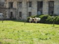
(3) Turn right onto a small path leading to the cemetery. At the end of the cemetery, turn right and, at the end of the cul-de-sac, continue along the path to some natural steps which lead to the Route d’Andelarre. Head left and walk back down towards the village along this road, passing a park where you might spot some animals. This will take you to Château Brault.
(4) Walk past the château and turn right into Rue Sous les Vignes, then immediately right onto the stony path to reach the Croix aux Curés.
(5) Turn left to reach Camp de César. Continue uphill, pass the paragliding launch site and enter Camp de César above the rock formation.
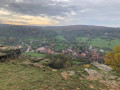
(6) “You can get closer to the rocks for a view of the village.” (Please note, the site is not secured).
Follow the path around the camp, which has been trodden by cattle, without going back down into the forest.
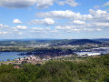
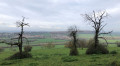
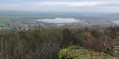
(7) Cross the fence and go through the designated gap on the other side, then continue to the right whilst admiring the view of the lake and the Vesoul Valley. Further on, you’ll come to a stony path.
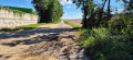
(8) Turn left onto this stony path and, 100 metres further on, turn right onto the narrow path; continue until you reach a wide track.
(9) When you reach this wider track, turn left. 300 m further on, stay on the path straight ahead (do not head down towards Vaivre). Then, after 600 m, take the tarmac road that descends towards the village as far as the Croix Jean Bot.
(10) At this cross, take the grassy path on the left for 150 metres, which leads to the foot of the church. Turn right just past the church towards the car park and, at the far end on the left, take the narrow grassy path (Chemin des Auges). Continue straight on along Rue des Auges and join the Grand Rue on your left. Cross over and, almost directly opposite, take Rue sous le Château as far as No. 26.
(1) After No. 26, take the small path leading towards the railway line. Less than 100 metres on, turn right and then left under the tracks via the small underpass. Just as you emerge, turn left, walk alongside the football pitch and you’ll reach the car park (S/E).


 Visorando Member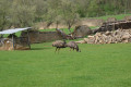
 Easy
Easy