Mont Gerbizon Forest

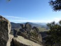
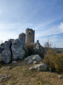
This route through the Mont Gerbizon Forest will treat you to some magnificent panoramic views.
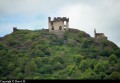
From the viewpoint, you can admire the meandering Loire, Chamalières-sur-Loire, Retournac, the Mont de la Madeleine and Artias Castle...

Details

n°27932724
Creation:
Last update:
Last review:
  • Walking
    Activity: Walking
  • ↔
    Distance: 3.20 mi
  • ◔
    Average duration: 2h 25 
  • ▲
    Difficulty: Moderate

  • ⚐
    Back to start: Yes
  • ↗
    Ascent: + 1,125 ft
  • ↘
    Descent: - 1,132 ft

  • ▲
    Highest point: 3,337 ft
  • ▼
    Lowest point: 2,507 ft

Photos

Description of the walk

Access: From Retournac, drive through Retournaguet and up to the village of Chanoux. Head towards Sagnes, then continue for 1.6 km towards La Fayolle. Park on the large lay-by at La Bessèze by the side of the road.

(S/E) Cross the road to the south and head up the stony path. At thefirst junction, take the path opposite, then turn left at the second. The climb becomes quite steep.

 (1) At the end of the climb, turn left onto the lovely path. After a short while, turn left onto the footpath to reach the viewpoint (wooden sign).

(2) On your return, continue along the track until you reach a large crossroads.

(3) Carry on, taking thefirst track on the right. At the clearing, turn slightly left, then carry on until you turn right, and right again a short while later.

(4) Just before a road, take the path on the right.

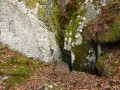
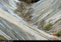
(5) Walk alongside the waterfall of stones.

(6) At the crossroads, keep to the right, then head back down to the left until you reach thefirst crossroads you came across on the way out.
Head back down the stony path to complete the route (S/E).

Waypoints

  1. S/E : mi 0 - alt. 2,513 ft - Car park: large lay-by at La Bessèze
  2. 1 : mi 0.54 - alt. 3,238 ft - Crossroads
  3. 2 : mi 0.62 - alt. 3,264 ft - Carrefour Verdure – Le Belvédère
  4. 3 : mi 1.24 - alt. 3,287 ft - Major crossroads
  5. 4 : mi 2.04 - alt. 2,743 ft - Junction before the road
  6. 5 : mi 2.22 - alt. 2,667 ft - Stone waterfall
  7. 6 : mi 2.28 - alt. 2,621 ft - Crossroads
  8. S/E : mi 3.2 - alt. 2,513 ft - Car park: large lay-by at La Bessèze

Notes

Suitable walking shoes are required.
Please note that the 200-metre elevation gain can cause temperatures to vary: “you lose 1° for every 100 metres climbed.”

Worth a visit

Don’t forget to complete the circular route to the viewpoint.

At the large crossroads (3), you can take the path on the left to climb to the 1,064-metre summit before rejoining the route.

At the clearing, a path winds its way through the broom. It will take you to a paragliding launch pad.

Further on, you’ll come across a waterfall of rocks.

Reviews and comments

3.2 / 5
Based on 3 reviews

Reliability of the description
2.7 / 5
Ease of following the route
3.3 / 5
Route interest
3.5 / 5
User 26270651

Overall rating : 1.5 / 5

Date of your route : Sep 06, 2026
Reliability of the description : ★☆☆☆☆ Very disappointing
Ease of following the route : ★★☆☆☆ Disappointing
Route interest : Not used / Not applicable
Very busy route : No

Hello,
Yes, we’re from the area. Finding the starting point wasn’t easy – there were no signs, even with the route I’d downloaded (thanks to whoever shared it), we were lucky enough to meet someone out for a walk from a neighbouring village who advised us to go via the paragliding car park – which isn’t signposted. With their directions, we were able to head for the orientation table (which was easier) rather than going straight up a 300-metre climb over 1 km. There’s a stunning view of Chamalières, Retournac and Arsiac Castle.
I understand the desire to preserve the wilderness.
MT from Saint-Maurice-de-Lignon.

Machine-translated

User 15003201

Overall rating : 3.3 / 5

Date of your route : Aug 24, 2026
Reliability of the description : ★★★☆☆ Average
Ease of following the route : ★★★★☆ Good
Route interest : ★★★☆☆ Average
Very busy route : No

Very stony, with a fairly steep slope in places … a bit disappointed

Machine-translated

oponcin
oponcin

Overall rating : 4 / 5

Date of your route : Sep 21, 2024
Reliability of the description : ★★★★☆ Good
Ease of following the route : ★★★★☆ Good
Route interest : ★★★★☆ Good
Very busy route : No

A photo gallery of a walk starting from Ventressac, including the climb through the forest
https://youtu.be/5ccFAOU8TKA

Machine-translated

Other walks in the area

For more walks, use our search engine .

The GPS track and description are the property of this route's author. Please do not copy them without permission.