


(S/E) Starting from Theux cemetery on the Route de Mont, the walk crosses the N62 and heads straight into the countryside, passing close to the Coteau de Mont Nature Reserve and continuing on to Juslenville Petite.
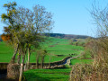
(1) After following the Hoëgne for a short while, the route climbs through woodland towards the hamlet of Les Villers (2) before reaching the hamlets of Raborive (3) and Rondehaie (4), offering splendid panoramic views.
(5) Just before Wislez, the route branches off to the right into the woods towards Banneux.
(6) Just before reaching the road leading to Banneux, the route branches off to the left twice, crosses the N62 and continues through the woods towards Vieux Cortil.
(7) As soon as you leave the woods, you’ll be back in rolling countryside all the way to the finish.
(8) The route branches off to the left at the entrance to Vieux-Cortil to head towards Jevoumont.
(9) Another left-hand turn to descend to La Machine.
(10) Turn right, pass through the valley floor, climb up to the crossroads halfway up the hill and turn right to reach (S/E).
In the countryside around Theux


Whilst Theux is well known to walkers for its magnificent Bois de Staneu, the countryside on the heights of the Hoëgne and around La Reid is equally impressive.
This circular walk takes you through the north-western part of the area, which is hilly and wonderfully green.
Details
Creation:
Last update:
Last review:
–
–
-
 Activity: Walking
 -
 Distance: 10.96 mi
 -
 Average duration: 5h 50
 -
 Difficulty: Moderate
 -
-
 Back to start: Yes
 -
 Ascent: + 935 ft
 -
 Descent: - 935 ft
 -
-
 Highest point: 1,138 ft
 -
 Lowest point: 512 ft
-
 Country:
Belgium
Country:
Belgium
-
 Area: Massif des Ardennes
 -
 City:
Theux
City:
Theux -
 Start/End: N 50.536057° / E 5.803894°
 -


 Hour-by-hour weather
Photos
Description of the walk
Waypoints
- S/E : mi 0 - alt. 705 ft - Mont Cemetery
- 1 : mi 2.02 - alt. 525 ft - Juslenville-Petite
- 2 : mi 3.21 - alt. 794 ft - Les Villers
- 3 : mi 3.73 - alt. 860 ft - Raborive
- 4 : mi 4.28 - alt. 820 ft - Rondehaie
- 5 : mi 4.55 - alt. 807 ft - Wislez junction
- 6 : mi 5.57 - alt. 1,047 ft - Fork in the road before Banneux
- 7 : mi 7.07 - alt. 1,112 ft - Exit from the woods
- 8 : mi 7.75 - alt. 1,056 ft - Vieux-Cortil
- 9 : mi 9.2 - alt. 942 ft - Jevoumont
- 10 : mi 9.74 - alt. 699 ft - La Machine
- S/E : mi 10.96 - alt. 705 ft - Mont Cemetery
Notes
The only picnic table we came across is 200 metres from the starting point, but there are plenty of benches.
Those who dislike tarmac may not enjoy this walk, as a relatively high proportion of the route is tarmac (around 8 km out of the 17+).
Worth a visit
The Banneux Apparitions Site
Tancrémont Fort
Other walks in the area
Around Theux, from Franchimont to Oneux via Le Thier du Gibet
 Visorando Member
 7.48 mi
+738 ft
-728 ft
4h 05
Moderate
7.48 mi
+738 ft
-728 ft
4h 05
Moderate
 Departure from Theux (Province de Liège)
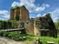
Discover Franchimont Castle, the village of Oneux and the town centre of Theux via country lanes and urban paths.
On the heights of Theux
11.28 mi
+1,490 ft
-1,470 ft
6h 30
 Difficult
Departure from Theux (Province de Liège)
Difficult
Departure from Theux (Province de Liège)
Starting from the ruins of Franchimont Castle, discover Theux and its surroundings, including some remarkable trees, including an impressive sequoia, the Ru de Chawion Nature Reserve, the hamlets of Sassor and Sasserotte, passages along the Wayai and Hoëgne rivers, some beautiful panoramic views, long stretches through the magnificent Bois de Staneux and a " work dedicated to crayfish".
Wooded hills between Theux and Spa.
 11.13 mi
+1,772 ft
-1,762 ft
6h 40
Moderate
Departure from Theux (Province de Liège)
11.13 mi
+1,772 ft
-1,762 ft
6h 40
Moderate
Departure from Theux (Province de Liège)
This beautiful circular forest loop covers some of the countless paths and trails between Theux and Spa. It runs alongside the beautiful Balmoral golf course (Royal Golf Club des Fagnes for purists) and Lake Warfaaz, and offers two lovely views of the spa town of Spa.In terms of nature: lots of deciduous trees, a few areas of pine and spruce, all sufficiently airy so that you don't feel oppressed by overly dense forest. There are many remarkable trees along the route: a few oaks, a beech and a sequoia.
Circular nature loop via Mont
 11.40 mi
+1,102 ft
-1,102 ft
6h 10
Moderate
Departure from Sprimont (Province de Liège)
11.40 mi
+1,102 ft
-1,102 ft
6h 10
Moderate
Departure from Sprimont (Province de Liège)
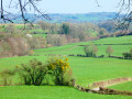
This lovely circular route through the countryside takes a grand tour over hill and dale around the village of Hodbomont (Autre Beau Mont), passing through Mont, Becco and the outskirts of Vieux-Cortil, La Reid, Deigné and Adzeux.Rural in character, with some woodland, this varied and undulating route follows pretty paths, small country lanes and a few footpaths.
Domaine des Bruyères and Hobdomont circular route
6.76 mi
+676 ft
-653 ft
3h 40
Moderate
Departure from Sprimont (Province de Liège)
Starting from the Sanctuary of Banneux, this is a real nature trail, albeit hilly, well ventilated, very pretty and varied. Woods, pretty meadows, open fir forests, breathtaking views: it has it all. The route passes through old firebreaks in the last part from Hobdomont: good walking boots are recommended.
The village of Fays and its countryside
 6.60 mi
+512 ft
-492 ft
3h 30
Moderate
Departure from Theux (Province de Liège)
6.60 mi
+512 ft
-492 ft
3h 30
Moderate
Departure from Theux (Province de Liège)
Discover the village of Fays, situated on the heights of the municipality of Theux. You’ll love the countryside here. Make sure you wear sturdy, mud-resistant walking boots in wet weather.
 Easy
Easy 
For more walks, use our search engine .
The GPS track and description are the property of this route's author. Please do not copy them without permission.

