Le Fond des Trois Bois

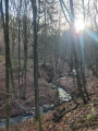
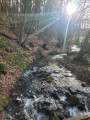
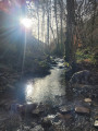
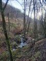
The Fond des Trois Bois stream is very pleasant to walk up when the water is high. The circular route suggested here will take you down towards the Vesdre valley via another stream, the Songnion, then back to the lower reaches of the Fond des Trois Bois before following it upstream in its entirety. A peaceful, quiet route with some lovely stretches through the forest.

Details

n°44718660
Creation:
Last update:
Last review:
  • Walking
    Activity: Walking
  • ↔
    Distance: 4.01 mi
  • ◔
    Average duration: 2h 25 
  • ▲
    Difficulty: Easy

  • ⚐
    Back to start: Yes
  • ↗
    Ascent: + 636 ft
  • ↘
    Descent: - 650 ft

  • ▲
    Highest point: 1,056 ft
  • ▼
    Lowest point: 476 ft

Photos

Description of the walk

At the Banneux football pitch, continue straight along the track for a few hundred metres; there is a car park at the edge of the forest.

(S/E) With your back to the finish track, take the path opposite on the left, blocked by two posts (sign: ‘motor vehicles prohibited’). After about 500 m, on a long, straight lane, look out for a small bridge on the left.

(1) Cross it and continue along the path.

(2) At the end of the path, head down to the right along the left bank of the Songnion (or Songnton, depending on the map). Further down, after a small ford, cross to the right bank and follow the main path, ignoring any side tracks.

(3) When you reach a building (a former fish farm?), take the path that climbs to the right and stay on the main track. You’ll join a wider path at an angle.

(4) Turn left. Beautiful stretches through moss-covered woodland on a clear day.

(5) At the gate, take the track on the right.

(6) Just before a isolated house, look out for a small gate with an arrow pointing left; go through it and make sure to close it properly. You’ll be crossing a private meadow – access is permitted, but keep dogs on a lead as there are sheep. Head straight down towards the river below, go through a gate then over a small bridge, and join a main path which you’ll follow to the right. The climb up the Fond des Trois Bois begins here.

(7) Cross a ford on the right to reach a wider path, which you should follow to the left.

(8) At a Y-junction, turn left to follow the stream as closely as possible. After a few fords, look out for the track on the right which leads back to the main path, which you will follow uphill.

(9) Towards the end of the valley, cross a bridge on the left, then follow the path to the right for a circular route through the Fond Georges. This path leads to a gate situated about a hundred metres below the car park (S/E).

Waypoints

  1. S/E : mi 0 - alt. 1,020 ft - Car park at the edge of the woods
  2. 1 : mi 0.3 - alt. 1,040 ft - Small bridge on the left
  3. 2 : mi 0.57 - alt. 951 ft - Turn right at the fork
  4. 3 : mi 1.11 - alt. 623 ft - Cabanon, on the right
  5. 4 : mi 1.72 - alt. 686 ft - Wide path, on the left
  6. 5 : mi 1.95 - alt. 564 ft - Barrier, track on the right
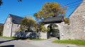
  7. 6 : mi 2.14 - alt. 505 ft - Portico on the left
  8. 7 : mi 2.42 - alt. 568 ft - Ford on the right
  9. 8 : mi 2.76 - alt. 650 ft - There, on the left
  10. 9 : mi 3.51 - alt. 866 ft - Bridge on the left
  11. S/E : mi 4.01 - alt. 1,017 ft - Car park at the edge of the woods

Notes

Some sections of the route can be very muddy after heavy rain. The condition of the path from the car park will help you decide whether to wear wellies or shoes.
We strongly recommend following the clockwise route described here, as the climb up the Songnion is not particularly pleasant.

Worth a visit

The village of Tancrémont, with its tarts that are highly renowned amongst food lovers (rice and macaroon, ‘vaution’, fruit, etc.).
Whilst there, a visit to the chapel is a must to see the ‘Vieux Bon Dieu’, one of the oldest surviving wooden figures of Christ (dating from around the year 900), which is surprisingly simple and modern.

Reviews and comments

3.8 / 5
Based on 2 reviews

Reliability of the description
4 / 5
Ease of following the route
3.5 / 5
Route interest
4 / 5
EricALM
EricALM

Overall rating : 4.7 / 5

Date of your route : Aug 26, 2024
Reliability of the description : ★★★★★ Very good
Ease of following the route : ★★★★★ Very good
Route interest : ★★★★☆ Good
Very busy route : No

A lovely walk through the woods… for those who aren’t put off by uphill and downhill sections.
This walk can easily be completed in under 2½ hours.

Machine-translated

gfeller
gfeller

I’m sorry this walk didn’t live up to your expectations. But as mentioned in the practical information, the condition of the path at the car park gives you an idea of what to expect further along the route. It’s been raining in the region for three months now, and wellies are essential to enjoy the walk (as they are for many walks in the surrounding area). As for finding your way, it’s hard to go wrong with the Visorando app – I probably should have mentioned that.

Machine-translated

Jjwjjw1911
Jjwjjw1911

Overall rating : 3 / 5

Date of your route : Feb 11, 2024
Reliability of the description : ★★★☆☆ Average
Ease of following the route : ★★☆☆☆ Disappointing
Route interest : ★★★★☆ Good
Very busy route : No

The start is clear, but between points 1 and 2, we got lost – there was practically no path.
We headed back down towards the stream and found the track again, which is a path (2–3) that’s completely impassable, full of mud and large boulders – a real struggle.
A lovely stretch between points 3 and 6.
For points 7 and 8, there are three or four fords to cross. And that’s without taking into account the swollen streams. I managed to get across them, but my wife had to wade through water up to her mid-calves and ended up soaking wet by the end of the walk...
In short, lovely forests but some sections are really difficult to navigate.
Kind regards.

Machine-translated

Other walks in the area

For more walks, use our search engine .

The GPS track and description are the property of this route's author. Please do not copy them without permission.