Country:
 City:
City:






Park at the municipal cemetery in Plum.
(S/E) With your back to the car park, turn right and head up the street towards the north-east until you find a path that runs between the trees and follows a large metal fence for several hundred metres. At the end of the fence, the trail markings are easy to spot; they alternate between green dots and green arrows spaced at very regular intervals, so finding your way is not difficult in itself.
This first section of the trail through the valley passes through an area of scrubland before descending into a section of damp woodland where there is a ford.
(1) Cross the river and then follow it to the left for a few metres; the path then veers off to the right. The climb and the technical section really begin here.
Climb until the path splits in two, making sure to follow the green markings at all times.
(2) Do not take the path branching off to your left (the return route); keep well to the right to continue climbing. This section is the most technical and, above all, the most slippery, so it is potentially the most difficult to manage during the descent.
Initially heading north, the path gradually turns eastwards and reaches a junction with a wide track.
(3) Carry on along the track directly opposite. From there, there are no further particular difficulties; simply head up to the entrance to the wind farm. Access to the site is prohibited, but you can still get quite close to the wind turbines, which makes for a rather unusual point of interest. And as a bonus, the view is lovely.
(4) Entrance to the wind farm, no entry. Turn round and head back to the previous junction.
(3) Leave the track and turn left onto the path you took on the way there, heading in the opposite direction until you reach the junction you passed on the way there.
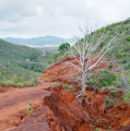
If the weather is dry, you won’t find it any more difficult than the climb, but if the ground is damp, you’ll need to be at your most careful on the descent as the gradient is quite steep, and the laterite can often be treacherous.
(2) Take the path on the right which descends steeply towards Plum. Once you reach Rue Luc Wadé, carry straight on until you pass the secondary school, then turn left twice to reach the cemetery car park (S/E).
 Visorando Member
 Easy
Easy 

 Moderate
  Association / Club / Walk leader