La Maison du Bandit in Feliceto

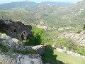
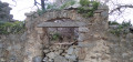
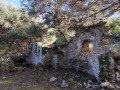
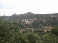
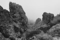
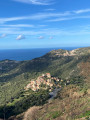
Discover the Maison du Bandit: a project well worth the effort, offering a superb view over the village of Feliceto. An imposing building set against the rock face is sure to catch the visitor’s eye. Built in the 19th century by a local dignitary – most likely the mayor – it is said to have later served as a hideout for passing bandits.

Details

49444945
Creation:
Last update:
Last review:
  • Walking
    Activity: Walking
  • ↔
    Distance: 2.12 mi
  • ◔
    Average duration: 2h 15 
  • ▲
    Difficulty: Moderate

  • ⚐
    Back to start: Yes
  • ↗
    Ascent: + 1,424 ft
  • ↘
    Descent: - 1,424 ft

  • ▲
    Highest point: 2,388 ft
  • ▼
    Lowest point: 1,175 ft

Photos

Description of the walk

The walk starts from the Bar-Pizzeria at the entrance to Feliceto when coming from Muro, on the D71. The walk is signposted with a sign reading ‘Départ pour la Maison du Bandit’. Red markings are used on this first section of the walk

(S/E) Follow the tarmac track, then turn left straight away to head up a lovely path (not shown on the map). You’ll reach a small road.

(1) Turn right, follow it for a few metres, then turn right again, continuing to follow the red markings. Take a stony path that climbs gradually and reaches a junction.

(2) A red arrow and a new orange signpost marked ‘M.B.’ (Maison du Bandit) indicate you should turn left onto a narrow, less well-defined path. The markings then change to orange; they were repainted in early 2024. Follow this path as it curves to the left to go round the rock.

(3) Pass through a metal gate and arrive at the Maison du Bandit, which overlooks Feliceto and offers a superb view.

(4) Retrace your steps along the route you took on the way up to return to the starting point (S/E).

Waypoints

  1. S/E : mi 0 - alt. 1,175 ft - Bar-pizzeria
  2. 1 : mi 0.16 - alt. 1,348 ft - Road junction – Red markings
  3. 2 : mi 0.6 - alt. 2,142 ft - Junction – Orange markings
  4. 3 : mi 0.95 - alt. 2,388 ft - Metal barrier
  5. 4 : mi 1.06 - alt. 2,152 ft - Maison du Bandit
  6. S/E : mi 2.12 - alt. 1,175 ft - Bar-pizzeria

Notes

(S/E) If you cannot park in front of the bar-pizzeria, use the dirt car park alongside the D71 at the entrance to the village. In this case, turn left as you leave the car park and head to the start of the path at the bar.

There are no water sources on this walk, so make sure you bring enough water, especially in summer, as this section has little shade and is quite steep. A circular route is possible, but the descent down the other side is more challenging. Allow between 1 hour 15 minutes and 1 hour 45 minutes for the ascent, and slightly less for the return. Long trousers are recommended. Magnificent spring flowers.

Worth a visit

The Bandit’s House

Several stories circulate about this heritage site: one involves the mayor spying on his constituents, perhaps with a degree of collusion between the local dignitary and the local bandits. Another theory suggests it was a bachelor’s pad… But it is also said to have served as a resting place, a storehouse, a stop-off for farm workers or a hunting lodge. When the owner passed away, the house is said to have been abandoned by the family, becoming a hideout for bandits.

Reviews and comments

3.4 / 5
Based on 4 reviews

Reliability of the description
3.3 / 5
Ease of following the route
2.3 / 5
Route interest
4.5 / 5
Bruno A3.
Bruno A3.

Overall rating : 3.3 / 5

Date of your route : May 14, 2026
Reliability of the description : ★★★☆☆ Average
Ease of following the route : ★★★☆☆ Average
Route interest : ★★★★☆ Good
Very busy route : No

Hello

The start of the hike indicated is now blocked by a gate and therefore inaccessible; we had to set off from the village. Furthermore, the route indicated is difficult to access and is no longer maintained. We had to opt for a different route, going round the high point to the right; the path remains very narrow and overgrown with brambles
The scenery remains magnificent
Best regards
Bruno

Machine-translated

Pierre Quintard
Pierre Quintard

Overall rating : 2 / 5

Date of your route : May 01, 2025
Reliability of the description : ★☆☆☆☆ Very disappointing
Ease of following the route : ★☆☆☆☆ Very disappointing
Route interest : ★★★★☆ Good
Very busy route : No

S/E Follow the tarmac road for about 2 m (do not go through the metal barrier) to reach an unmaintained footpath; note that the description in (1) and (2) does not correspond to the route shown on the map and is impassable.
To reach the ‘bandit’s house’, continue from point ‘1)’ along the signposted Feliceto–Muro route to the 550-metre mark, then take the path on the left which leads to point (2).
Stunning views all the way to the house.

Machine-translated

Fox_HP
Fox_HP

Overall rating : 4 / 5

Date of your route : Jul 22, 2024
Reliability of the description : ★★★★☆ Good
Ease of following the route : ★★★☆☆ Average
Route interest : ★★★★★ Very good
Very busy route : No

It is no longer possible to complete a circular route as part of the route passes through private property; the owner, no longer wishing hikers to pass through his land, has blocked the way. It is therefore necessary to follow the same path both there and back. The starting point is not very obvious as it is difficult to spot; you need to set off near the bar, climb two metres up the concrete ramp and turn immediately left to head up into a copse. Please note that the path is rather overgrown; it is best to wear long trousers and long sleeves to avoid scratches from the low scrub.

Machine-translated

NIRAM
NIRAM

Overall rating : 5 / 5

Date of your route : Jul 21, 2024
Reliability of the description : ★★★★★ Very good
Ease of following the route : Not used / Not applicable
Route interest : ★★★★★ Very good
Very busy route : No

The GPX track does not match the description. If you follow the GPX track, the path is impassable, blocked by vegetation and a barrier. It is better to follow the route leading to Zilia (clearly marked on IGN maps and as described) and then turn left towards the bandit’s house. A remarkable site that deserves to be restored.

Machine-translated

Other walks in the area

For more walks, use our search engine .

The GPS track and description are the property of this route's author. Please do not copy them without permission.