Two circular walks in Puymaurin with views of the Pyrenees

A route consisting of two circular loops starting from Puymaurin, offering a variety of landscapes.
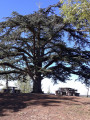
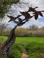
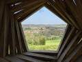
Right from the start, you’ll be treated to lovely views over the valleys to the north, then on the second circular route, stunning views of the Pyrenees.

Details

n°3842432
Creation:
Last update:
Last review:
  • Walking
    Activity: Walking
  • ↔
    Distance: 3.95 mi
  • ◔
    Average duration: 2h 05 
  • ▲
    Difficulty: Easy

  • ⚐
    Back to start: Yes
  • ↗
    Ascent: + 302 ft
  • ↘
    Descent: - 312 ft

  • ▲
    Highest point: 948 ft
  • ▼
    Lowest point: 692 ft

Description of the walk

Parking is available between the church in Puymaurin and the war memorial.

(S/E) Climb the few steps alongside the war memorial. Turn left, then immediately right.

(1) Turn left to walk round the hill. After taking a moment to enjoy the view, continue along the path.
Leave the church on your left. Walk down Avenue des Pyrénées.

(2) Ignore the sign for the castle and carry on straight ahead.

(3) Before the school, turn left. Carry on straight ahead, ignoring the paths branching off to the right and left.

(4) Turn sharp right at the crossroads (elevation 217). Cross the Ruisseau de Lapeyre.

(5) Take the D78 road, veering to the right towards Puymaurin, then, when you see the sports ground, turn left so that it is on your right, overlooking you. Continue left along the D78, with your back to Puymaurin. Reach the next junction on the right.

(6) Turn right at a 90° angle; after a few steps, turn right again onto the grassy path which climbs steeply. Leave the sports ground on your right once more and head back towards Puymaurin.

(3) Carry on straight towards the village.

(2) Turn right towards the castle. Once you reach it, and before the cemetery, turn left towards the church and return to the car park (S/E).

Waypoints

  1. S/E : mi 0 - alt. 922 ft - Church
  2. 1 : mi 0.03 - alt. 932 ft - Towards the viewpoint
  3. 2 : mi 0.25 - alt. 889 ft - Common junction for out-and-back route
  4. 3 : mi 0.3 - alt. 873 ft - School. Common junction for out-and-back route
  5. 4 : mi 1.31 - alt. 702 ft - Le Prince
  6. 5 : mi 1.99 - alt. 856 ft - D78 road
  7. 6 : mi 3.09 - alt. 715 ft - Crossroads near the - Gesse (rivière) - Affluent de la Save
  8. S/E : mi 3.95 - alt. 919 ft - Church

Notes

This route is not signposted, or only minimally so, but the suggested route has been walked. Each path is clear and easily visible. There are a few roads with very little traffic.

There is a tap next to the church.
The route offers little shade, so depending on the weather, bring a cap.
Wear sturdy shoes. Walking poles are optional.

Worth a visit

Beautiful views over the valleys to the north and then to the south: the Pyrenees.

Reviews and comments

4.7 / 5
Based on 1 review

Reliability of the description
5 / 5
Ease of following the route
5 / 5
Route interest
4 / 5
JC Testu
JC Testu

Overall rating : 4.7 / 5

Date of your route : Feb 03, 2025
Reliability of the description : ★★★★★ Very good
Ease of following the route : ★★★★★ Very good
Route interest : ★★★★☆ Good
Very busy route : No

The route and scenery are fairly typical, holding few surprises for anyone familiar with the Gers and the surrounding area. Do take the time to wander around and explore the few streets of the little village of Puymaurin, which is architecturally interesting.

Machine-translated

Other walks in the area

For more walks, use our search engine .

The GPS track and description are the property of this route's author. Please do not copy them without permission.