Meilhan Maquis Memorial, starting from Villefranche

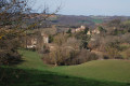
In the Gers countryside, passing by the Meilhan Memorial.

Details

67535045
Creation:
Last update:
Last review:
  • Walking
    Activity: Walking
  • ↔
    Distance: 5.98 mi
  • ◔
    Average duration: 3h 15 
  • ▲
    Difficulty: Moderate

  • ⚐
    Back to start: Yes
  • ↗
    Ascent: + 623 ft
  • ↘
    Descent: - 623 ft

  • ▲
    Highest point: 1,014 ft
  • ▼
    Lowest point: 673 ft

Description of the walk

Park in the village square, opposite the church.

(S/E) From the village square, head down towards the church, turn right onto the D12 (take care – this is a busy road), then left onto the D538 towards Molas to reach the picnic area.

(1) Turn right onto Chemin de Ladamet, then, at the left-hand bend, continue straight ahead along the dirt track running alongside the Gimone until you reach a tarmac road.

(2) Turn right and carry on until you reach the Stop sign.

(3) Cross the D12 (take care – heavy traffic) and head up towards Gaujan via the Chemin de la Hourcade.

(4) In the village, at the statue of the Virgin Mary, turn right. When you reach the junction with Rue de l’Ancienne École, take the road going uphill to the right.

(5) At the last houses, the road becomes a farm track and veers off to the left.

(6) At the junction, turn left. Join the D291 and follow it to the right for about 800 metres, taking care.

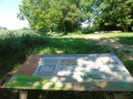
(7) Take a short detour to the right to visit the Meilhan Maquis Memorial.

(7) Continue along the D291 and, at the first junction, head up to the right along the grassy track. At the farm, there are two animal gates to go through: make sure you close them properly. When you reach the tarmac road, turn left and join the D238.

(8) Follow it to the right for 2.6 km, passing a stud farm, and you’ll reach Villefranche d’Astarac (S/E).

Waypoints

  1. S/E : mi 0 - alt. 725 ft - Village square - Église Saint-Vincent (Villefranche)
  2. 1 : mi 0.34 - alt. 673 ft - Picnic area - Gimone (rivière) à finaliser
  3. 2 : mi 1.37 - alt. 692 ft - Path x Road
  4. 3 : mi 1.81 - alt. 732 ft - Crossing the D12
  5. 4 : mi 2.08 - alt. 804 ft - Statue of the Virgin Mary
  6. 5 : mi 2.44 - alt. 876 ft - Path – Left-hand bend
  7. 6 : mi 3.13 - alt. 1,014 ft - Junction of dirt tracks
  8. 7 : mi 3.75 - alt. 892 ft - Memorial - Monument du Maquis de Meilhan (Villefranche)
  9. 8 : mi 4.37 - alt. 938 ft - D238 road
  10. S/E : mi 5.98 - alt. 722 ft - Village square - Église Saint-Vincent (Villefranche)

Notes

Check your route on the IGN map.
The route may be muddy near the Gimone in wet weather.

Worth a visit

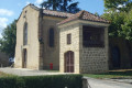
A charming house on Place de Villefranche, with a remarkable bell tower.
The memorial is well worth a visit.

Reviews and comments

4.7 / 5
Based on 2 reviews

Reliability of the description
5 / 5
Ease of following the route
4.5 / 5
Route interest
4.5 / 5
User 13351731

Overall rating : 5 / 5

Date of your route : Aug 08, 2025
Reliability of the description : ★★★★★ Very good
Ease of following the route : ★★★★★ Very good
Route interest : ★★★★★ Very good
Very busy route : No

A beautiful, very shaded hike. The final climb after visiting the Meilhan Maquis memorial is a little tough (information for those who dislike steep climbs!), but it's definitely doable...

Machine-translated

lecbalcaz
lecbalcaz

Overall rating : 4.3 / 5

Date of your route : Dec 30, 2024
Reliability of the description : ★★★★★ Very good
Ease of following the route : ★★★★☆ Good
Route interest : ★★★★☆ Good
Very busy route : No

The route description is very clear, thankfully, as the signposting leaves a lot to be desired. The sat-nav did the rest.
For the section along the banks of the Gimone, it’s best to choose a dry spell.
A visit to the Maquis de Meilhan site serves as a reminder of the atrocities of war and the
murder of the four hostages who were entirely innocent.
A bit too much tarmac, but not much traffic (we only passed three vehicles on the whole route).

Machine-translated

Other walks in the area

For more walks, use our search engine .

The GPS track and description are the property of this route's author. Please do not copy them without permission.