Country:
 City:
City:


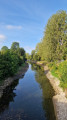
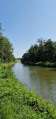
The route starts at Château-Porcien, near the canal and the Voie Verte Sud-Ardennes. There is a welcome area where you can park.
Access by car: head to Château-Porcien, then follow the signs towards the canal and the Voie Verte. The area around the bridge and the canal is the most convenient starting point for the route. The Voie Verte Sud-Ardennes passes through Château-Porcien and then continues on to Rethel and Asfeld.
Access by public transport: it is also possible to travel via Rethel station, served by TER/TGV services on the Reims–Charleville-Mézières line. The station has free car parking as well as cycle parking. From Rethel, head to Château-Porcien via the Sud-Ardennes Greenway or take a short local journey to the starting point.
(S) From the starting point, head to the canal bank and follow the Voie Verte Sud-Ardennes towards Asfeld. The route gradually winds its way through the open landscape of the South Ardennes grain-growing plains, before rejoining the network of canal structures. Continue to Lock 12 at Pargny.
(1) Cross the canal and continue along the opposite bank until you reach the next bridge.
(2) Cross the bridge over the canal and continue along its right-hand side, then turn away from it and you’ll soon reach Blanzy-la-Salonnaise. At the junction,turn right onto Rue Armantine Carlier, then continue along the Voie Verte to Lock 13 and the Asfeld needle weir, a few metres after crossing the canal.
This succession of locks serves as a reminder of the canal’s historic role in transporting goods between the Aisne and Meuse valleys. The Canal des Ardennes stretches for approximately 88 km and features numerous structures designed to overcome differences in water level.
Here, the canal becomes particularly interesting for understanding traditional water regulation techniques. The system of needle weirs, developed in the 19th century by the engineer Antoine Poirée, utilised numerous removable wooden components that allowed the water level to be adjusted rapidly.
(3) Turn round, then turn right onto the Voie Verte and continue along the towpath until you reach Rue du Château on the left. Turn onto this street towards Asfeld, and carry on straight ahead to the Baroque church in Asfeld.
(4) The Church of Saint-Didier in Asfeld, one of the most remarkable monuments on the route. Entry to the church is free. Built at the end of the 17th century, it features an exceptional layout inspired by the shape of a viola da gamba. Its design is attributed in particular to the Dominican friar François Romain and to Fleury. The brick-built structure features a profusion of curves, columns, domes and rounded spaces: it has virtually no long straight walls. Listed as a historic monument in 1913, it is a true architectural curiosity in the heart of a village on the Champagne plain.
After viewing the church from the outside, return to the greenway and follow it to the left until you reach the D966 at the entrance to Neufchâtel-sur-Aisne.
(5) The route leaves the canal briefly via a link road between villages. Continue to the right, passing the village church, then the bridge over the Aisne and, at the other end, turn left onto the cycle path. Follow this towards Condé-sur-Suippe until you reach the roundabout in the centre of Guignicourt. This section offers a transition between the urban and canal-side landscapes of Asfeld and the vast agricultural expanses of the Aisne.
(6) Go round it on the left, and take the second street on the left, Rue Richard Mortimer. At the end of this, turn right, go under the railway bridge, then turn left immediately onto the D62. Join the towpath on the left, just before the bridge over the Canal Latéral à l’Aisne. Follow it to reach Lock 2 at Condé-sur-Suippe.
(7) From this point onwards, a long succession of structures begins, running alongside the route towards Reims. Here, the Canal Latéral à l’Aisne ensures the continuity of the navigable network towards the west. Continue to Berry-au-Bac Lock , which connects the Canal de l’Aisne to the Marne.
(8) Berry-au-Bac is a place where several chapters of regional history intersect. The village is situated near the River Aisne and major ancient transport routes. The canal also played a major economic role here, facilitating the transport of materials and the development of industrial activities. The area was also severely affected during the First World War. Continue to the left and follow the Aisne–Marne Canal as far as Lock 2 at Le Moulin.
(9) Continue along the canal without leaving the waterway.
(10) Passthrough Sapigneul Lock3.
(11) Pass through Lock4 at Alger.
(12) Pass throughGaudat LockNo. 5.
(13) Pass through Lock6 at Loivre.
(14) Pass through Lock7 at Les Fontaines.
(15) Pass through Lock8 at Noue-Gouzaine.
(16) Pass through Lock9 at Madeleine Courcy, then gradually leave the canal landscape behind to reach the Reims conurbation via the Coulée Verte. Pass under two railway bridges, then under the motorway bridge, and arrive at the next one. Take the cycle lift, a facility specifically designed for cyclists. This facility makes it easier to cycle along the route; otherwise, you will need to carry your bike up the stairs.
(17) Then continue to the right towards the centre of Reims and follow Rue de la Vesle to number 46. Turn left onto Rue Marx Dormoy and carry on until you reach the Luchrone sculpture.
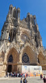
(18) E monumental work by Alain Le Boucher, installed in Reims in 1989. This kinetic sculpture, approximately 7 metres high and composed of hundreds of points of light, has become a distinctive feature of Reims’ urban landscape. Then continue to the right towards the historic centre of Reims, along Rue de l’Étape and Rue du Cadran Saint-Pierre; at the end of Rue de l’Arbalète, turn left onto Rue du Docteur Jacquin and arrive at Place de l’Hôtel de Ville. Cross the square to the right, then, at the far end, turn right onto Rue du Tambour, leading to Place du Forum. First turn right then left, cross the square, then turn right and continue along Rue des Élus. At the tram tracks, turn left and head towards Reims Cathedral.
(19) After taking in the sights, take Rue des Fuseliers, then quickly turn right onto Rue des Tournelles and carry straight on along Rue Hincmar. At the end of the car parks, turn left onto Boulevard Paul Doumer, continue along Boulevard du Docteur Henri Henrot and take the next bridge on the right.
(20) At the end of the bridge, turn onto Rue de la Roseraie, then join the cycle path on the left, which runs alongside the canal until you reach Lock 14 de l’Espérance, the last major landmark on the canal network before the climb up to the vineyards.
(21) Continue to the right, cross the D944 with care, then cross the esplanade and take the road on the left. Then follow the D944 on your left until you reach a junction. Turn right, cross the bridges over the motorway and then the railway line, and arrive at the edge of the vineyard.
(22) Take the track on the right, which is suitable for vehicles . The terrain rises noticeably and the landscape changes: the large cereal fields give way to the vineyard-covered slopes of Champagne. At the next junction, turn left, enter the vineyard, then turn right, reach a cross-track and continue to the left.
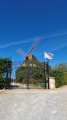
At the road, first turn left then right, then left again at the next junction to reach a cross-track. Turn right, then immediately left, and head straight on, passing to the right of the hill with the windmill, until you reach a road. Turn onto the path on the left and head for the Moulin de Verzenay.
(23) The present mill was built in 1818 and remained in operation until the early 20th century. During the First World War, its commanding position meant it was used as an observation post. Today, it is one of the iconic landmarks of the Montagne de Reims. Make the most of this vantage point to take in the landscape you have just passed through: behind you now lie the agricultural plain, the Aisne valley, the network of canals and the Reims conurbation. Also note the Verzenay Lighthouse, which towers above the vineyards.
Once you’ve taken in the view, turn back and take the track on the left, a few metres before the road. In the village, cross the street then turn right onto Rue de la Cendrière, then immediately left, and carry on straight ahead until you reach the D26. Turn right onto it, heading towards the lighthouse, and head for the Verzenay Lighthouse car park on the outskirts of the village
Built in 1909 by Joseph Goulet to promote his Champagne house, the lighthouse is a striking concrete structure that originally served as an advertising billboard. Its light could be seen as far away as Reims. It was also used as an observation post during the Second World War. Today, it houses an eco-museum dedicated to vines and wine and, after climbing its 101 steps, offers a 360° panoramic view of the vineyards. (E)
 Visorando Member