Country:
 City:
City:


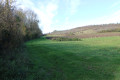
The route starts on the hills above Mortagne, continuing from Rue du Rivallet, near a cross on theGR® 360, close to the road; parking is available at the roadside.
GR®360signposting: white-red
(S/E) Continue straight on along the road towards Boutenac-Touvent, then carry on along a path.
(1) At the bend in the road, turn left for a short round trip to the Fontaine du Pissot, situated a few metres to the left of the road.
(2) A lovely little spot with a natural spring; then return to the bend in the road.
(1) Ignore the route you’ve already taken and continue along the road until you reach a side road.
(3) Head straight ahead along the path to reach the church at Floirac at the end of a small valley – a little village with a beautiful church and a sense of seclusion.
(4) Turn left onto the road heading north. At the 90° left-hand bend, turn right and enter the woods. On emerging from the woods, continue straight on until you reach a road. Turn left and follow the road until you reach thesecond path on the right.
(5) Follow this straight on to the hamlet of Genet, then take the road on the right and you’ll reach a fork at the foot of a watchtower (for fire surveillance).
(6) Turn onto the track on the left and follow it until you reach a road. Turn right, enter Saint-Fort-sur-Gironde and go straight on until you reach the junction after the church.
(7) Ignore the main roads and turn immediately right, towards the Town Hall. Cross the square of the same name and continue westwards between the buildings. Walk past the public works company’s depot, continue along the path heading south-west and reach a small road.
(8) Turn left, then immediately right onto Rue de Civrac. Head up the hillside towards Civrac (Civerac on the IGN map), pass through the hamlet and arrive at a three-way junction.
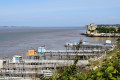
(9) Turn right onto the dead-end road, pass between the houses and continue along a track. Enjoy the beautiful view of the estuary.
(10) At the road, turn right, enter Saint-Romain-sur-Gironde and reach a four-way junction.
No further signposting
(11) Carry on straight ahead along Rue du Marais. At the crossroads, turn right and take the first path on the left.
(12) Follow this track, which is suitable for vehicles. From here, the tracks are straight and flat – and perhaps a little monotonous! However, you can spot storks and enjoy a view of the wilder marshland by walking up onto the dyke.
At the end, turn right and carry on straight ahead until you reach the lock at the port of Mortagne-sur-Gironde.
(13) Cross the lock and turn right to head up towards the upper part of Mortagne-sur-Gironde via the D245, Rue de l’Hermitage, which runs on from the harbour. At the left-hand bend, turn right onto Rue des Goélands, between the houses, and continue along a footpath to reach the esplanade, Place de Bel Air.
(14) Continue uphill along Rue des Douves. At the multi-way junction, turn right onto Rue des Lilas, ignore Rue du Stade, then turn left onto Rue des Mimosas. Walk alongside the stadium and begin the descent.
White-red markings
(15) At the four-way junction, carry on straight ahead, then cross a track and continue along a grassy path. At the next fork, turn right then left to reach the D145.
(16) Walk alongside the road to the right for about 100 metres and take thefirst path on the left through the vineyards. At the four-way junction, turn left and rejoin the road near the cross (S/E).

 Visorando Member
 Easy
Easy 
 Tourist office
 Average