Country:
 City:
City:


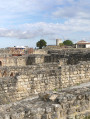
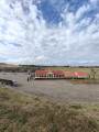
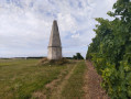

Park at the Barzan-Plage car park.
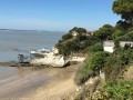
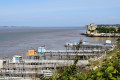
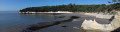
The route starts at Barzan-Plage, in the municipality of Barzan (Charente-Maritime). Parking is available behind the grocery shop/bar/restaurant, near the pétanque courts and the motorhome area between the D145 and the Gironde estuary, or alongside the D145 (Route Verte) at the orientation table opposite the Barzan sewage treatment plant.
The area is served by a bus route. This is route 32, which connects the towns of Royan and Mortagne-sur-Gironde. Along its route, this service also serves the towns of Saint-Georges-de-Didonne, Meschers-sur-Gironde, Talmont-sur-Gironde, Barzan and Chenac. See the Cara’bus website.
(S/E) Heading north-west, take the yellow-marked footpath running parallel to the D145 (Route Verte).
(1) Follow the path on your left (marked in yellow), which joins the GR®360 (marked in white and red) a few metres further on; turn left onto it. At the end of the path, you’ll reach Avenue de l’Estuaire (D145B). Turn left.
(2) Leave theGR®360here and take Rue de la Fond on your right; a little further on, leave this on your left to follow Rue des Porteaux and thus join the D145 (Route Verte). Cross the D145 with care to follow the path directly ahead of you along a long straight stretch of about 750 m through the Talmont marsh.
(3) Turn right, then take thefirst path on your left (Chemin du Marais), which will lead you to the hamlet of Les Grandes Mottes Gachin.
(4) Turn right onto the D114E1 and, about 150 m further on, just before a small building, take the path on your left which will lead you to the hamlet of Les Coutures.
(5) Follow the road on your right until you reach the D114. Cross the road carefully and, almost directly opposite, take the small road which will lead you to the hamlet known as La Brande.
(6) Walk through this hamlet; a little further on, cross a dirt track and continue straight on along the path that climbs to the hamlet known as Les Perrotins.
(7) You’ll come out onto the D114. Leave the small road on your left and follow the D114 straight ahead to the hamlet known as Les Maisons Neuves. Once there, take the first street on the right, called Chemin de Champagne, until you reach a track on the left.
(8) Take this track (Chemin de la Tour), which will take you to the hamlet of Les Piloquets. Be careful: at the end of the track, take the narrow lane on the left; then, as you come out of the bend, turn right; and, at the start of the next bend, turn right again. Leave the track on your right and go up the path that leads to a small road.
(9) At La Garde, near a vineyard, turn right. After about 500 metres, take the path on your left which will lead you to the hamlet of Moulin du Fâ.
(10) At the bottom of the track, when you reach the road, turn left and follow the Route du Fâ downhill for about 500 m.
(11) At the bottom of the road, turn left and take the first path on your right (Chemin de la Brissonnerie), which passes near a campsite and a pond, and joins the D145 (Route Verte).
(12) When you reach the road, turn right until you reach the pedestrian crossing. Cross the road, then take the first street on the left, called Avenue des Anglais.
Go round the back of the grocery shop, bar and restaurant by taking the street on the right and return to your starting point (S/E).

 Visorando Member
 Easy
Easy 
 Difficult