From the EDF reservoirs at Saint-Césaire to the Ponadieu Arch

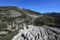
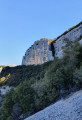
This walk, with its varied landscapes and elevation changes, largely follows the route of the GR®510, passing through both wooded and rocky areas. It starts at the imposing EDF reservoirs at Saint-Césaire and runs high above the Gorges de la Siagne, offering magnificent views of the Grasse Pre-Alps.
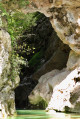
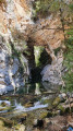
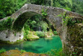
After passing through the Combe valley, we gradually reach our destination: the Ponadieu Arch, a stunning rock formation whose pillars plunge into the green waters of the Siagne.
The return journey begins on a path with a few tricky sections, before rejoining the Bois des Malines path taken on the way out.

Details

32712884
Creation:
Last update:
Last review:
  • Walking
    Activity: Walking
  • ↔
    Distance: 7.23 mi
  • ◔
    Average duration: 5h 00 
  • ▲
    Difficulty: Moderate

  • ⚐
    Back to start: Yes
  • ↗
    Ascent: + 1,972 ft
  • ↘
    Descent: - 1,972 ft

  • ▲
    Highest point: 2,192 ft
  • ▼
    Lowest point: 1,594 ft

Photos

Description of the walk

Reach the start of the route via the narrow Chemin des Bassins de Saint-Césaire. Park by the EDF barrier, where there are two or three possible parking spaces. If these are taken, you’ll need to turn round and park in the wider sections of the route.

(S/E) Take the uphill track suitable for vehicles to reach the EDF buildings.

(1) Take the narrow, unmarked path leading down to the left to walk along the bottom of the reservoirs. Keep as close to the wall as possible.

(2) Cross the spillway with care, then head back up the path on the right – without climbing onto the retaining wall – until you rejoin the GR® 510, marked in red and white.

(3) Follow the GR® easily as it winds up and down. Reach the natural climbing walls, then continue along the switchbacks to reach a level path.

(4) Walk along the flat, narrow GR® path through the Bois des Malines for about 1,500 metres.

(5) Leave the (return) path on your left. Pass over the water intake and reach a small bridge without a parapet

(6) Cross the bridge and keep to the right to reach the Vallon Rousset junction (marker 77).

(7) Go under the track bridge and continue straight ahead through the Bois de Rousset until you reach another junction (marker 78).

(8) Turn left, still following the GR®, pass marker 79 and head down the path alongside the underground pipe at marker 80.

(9) Cross the Vallon de la Combe stream. Head back up the steep path to reach a junction of tracks.

(10) At marker 80, leave the GR® and take a yellow-marked path to the left. This will take you to the Arche de Ponadieu after a long descent through the forest. Take a moment to admire the scenery and the emerald reflections on the waters of the Siagne

(11) For the return journey, head back up the path you took on the way there for about 50 metres to find a track branching off to your right.

(12) Follow this (poorly) marked yellow trail back up. Due to the lack of markings, keep a close eye on your GPS app to avoid straying off the route.

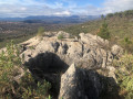
(13) You’ll come to a rocky outcrop. A yellow mark on a rock indicates the direction to take. There are three slightly tricky sections to negotiate before you reach a more passable path that winds its way up to a small plateau. Follow this path, which is no longer marked

(14) At the fork in the road, turn right until you reach a wide track.

(15) Take the track that climbs to the left. At the pumping station, you’ll see a flight of steps in front of you.

(5) Climb the steps, then rejoin theGR®, to the right, heading in the opposite direction to your outward journey.

(3) As you approach the ponds, continue along the GR® to go round them at the top this time.

(1) Then follow the tarmac track to return to the barrier and the car park (DA).

Waypoints

  1. S/E : mi 0 - alt. 1,864 ft - Car park. EDF barrier
  2. 1 : mi 0.11 - alt. 1,932 ft - Junction of the EDF reservoirs circular loop
  3. 2 : mi 0.23 - alt. 1,939 ft - Spillway
  4. 3 : mi 0.35 - alt. 2,005 ft - Common junction with GR. Out and back
  5. 4 : mi 1.52 - alt. 1,965 ft - Start of the flat section
  6. 5 : mi 2.46 - alt. 1,985 ft - EDF water intake
  7. 6 : mi 2.48 - alt. 1,982 ft - Small bridge
  8. 7 : mi 2.53 - alt. 1,972 ft - Marker 77 Vallon Rousset
  9. 8 : mi 3.04 - alt. 1,985 ft - Marker 78. Fork in the path
  10. 9 : mi 3.17 - alt. 1,864 ft - EDF footbridge
  11. 10 : mi 3.27 - alt. 1,988 ft - Marker 80. Trail junction
  12. 11 : mi 3.94 - alt. 1,601 ft - Ponadoieu Arch
  13. 12 : mi 3.97 - alt. 1,654 ft - Junction for the return journey
  14. 13 : mi 4.1 - alt. 1,650 ft - Rocky outcrops
  15. 14 : mi 4.25 - alt. 1,690 ft - Fork in the road
  16. 15 : mi 4.31 - alt. 1,686 ft - Wide track
  17. S/E : mi 7.23 - alt. 1,864 ft - Car park. EDF barrier

Notes

This 12.5 km route is a variation on the “From the Saint-Césaire pools to the Ponadieu arch” walk (no. 12717436). As that walk requires a car at the start and another at the finish, I’ve devised a return route using a circular route that shortens the way back.

In the warmer months, if you set off early in the morning, much of the route is in the shade.
Make sure you take enough water, as the hike has a greater cumulative elevation gain than it appears.
Make sure you have good walking boots and walking poles, as some sections of the path are quite steep.
There’s a tricky section on the way back (point (13)) with small rocky outcrops to climb over. You can avoid these sections by retracing your steps along the outward route from the Ponadieu arch (11), but the route will be several kilometres longer...

Worth a visit

The Ponadieu Arch is an imposing rock formation naturally carved out by the River Siagne, and its name (Ponadieu) is said to mean ‘God’s Bridge’.

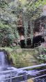
During the walk, you’ll come across quite a few structures built by EDF (dams, pumps, pipes, retaining walls) that form part of the Siagne power station.

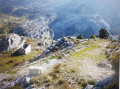
The village of Mons is most clearly visible in the distance on the return journey between points (2) and (3), and on arrival.

Always be cautious and plan ahead when you're outdoors. Visorando and the author of this route cannot be held responsible for any accidents occurring on this route.

The GR® and PR® markings are the intellectual property of the Fédération Française de Randonnée Pédestre.

Reviews and comments

4.4 / 5
Based on 3 reviews

Reliability of the description
4.7 / 5
Ease of following the route
4.3 / 5
Route interest
4.3 / 5
plainemontagne0750
plainemontagne0750

Overall rating : 3.7 / 5

Date of your route : Nov 25, 2025
Reliability of the description : ★★★★☆ Good
Ease of following the route : ★★★★☆ Good
Route interest : ★★★☆☆ Average
Very busy route : No

There were so many ups and downs at that bridge that I stopped at marker 77 and didn't go to the PONADIEU arch.
Next time, I'll start from SAINT VALLIER (but there's a steep descent and then, inevitably, a steep climb).
For your information, I am over 75 years old.

Machine-translated

rumax
rumax

Overall rating : 5 / 5

Date of your route : Apr 26, 2025
Reliability of the description : ★★★★★ Very good
Ease of following the route : ★★★★★ Very good
Route interest : ★★★★★ Very good
Very busy route : No

Reading through the comments, there is indeed a section where you need to use your hands for support and so need to be a bit careful, but it’s nothing to make your head spin.
There was just one short section that had been churned up by wild boars, but with a bit of care there’s no problem (where the path joins a wide track at a hairpin bend).
Vary your route a little from the path as you see fit; there are some lovely viewpoints that are well worth a detour for the views.
Thanks to the author for this lovely walk.

Machine-translated

Bucephale
Bucephale

Overall rating : 4.7 / 5

Date of your route : Mar 29, 2025
Reliability of the description : ★★★★★ Very good
Ease of following the route : ★★★★☆ Good
Route interest : ★★★★★ Very good
Very busy route : No

An ideal off-season route – we didn’t see a soul Lunch break by the banks of the Siagne (it must get far too busy in peak season)
Take particular care on the trail on the way back, as you might miss the new signposting on the sections that have been re-laid...
A lovely outing

Machine-translated

danielaime06
danielaime06

Hello loupiaux
Thank you for taking the time to write this message to warn us about the difficulties or dangers of certain sections of the route. I can’t comment on the details, as I haven’t done this route for over a year.
However, I do have two small comments regarding the return journey:
- Did you follow the return route correctly? Because I don’t recall crossing a 30-metre drop above the Siagne… I’d certainly have remembered that!
- I did make it clear that there were a few tricky sections on the return leg, and that it was possible to simply retrace the outbound route if you didn’t feel up to it, even if it meant extending the walk by a few kilometres.

Wishing you many more great hikes in 2025 and best regards
Danielaime

Machine-translated

loupiaux
loupiaux

Hello,
As you point out, the scenery is stunning, but from a safety perspective, I’d like to highlight two things:
- the return route for the circular loop starting from the Arche de Ponadieu is no longer marked on the Visorando route-planning software. The two rocky outcrops are extremely dangerous (a sheer drop of 30 metres above the Siagne) and I cannot see how a group could be taken along this route without putting the walkers at serious risk. What bothers me most is that at no point is this section prohibited by any sign or marking.
- Furthermore, although of lesser significance, the GR 510 has suffered damage and certain sections may present difficulties for those prone to vertigo.

Machine-translated

Other walks in the area

For more walks, use our search engine .

The GPS track and description are the property of this route's author. Please do not copy them without permission.