Exploring the Vassieux neighbourhood

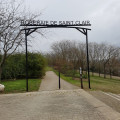
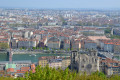
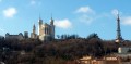
Vassieux is situated between the Vernay neighbourhood to the north and Montessuy to the west. It runs alongside the Rhône to the south. This sloping area offers a beautiful view of Lyon. The Vassieux neighbourhood is primarily residential. It features numerous winding ascents. It is sometimes described as the ‘suburb of fresh air and sunshine’; some houses are surrounded by magnificent parks planted with trees over a century old.

Details

n°60305870
Creation:
Last update:
Last review:
  • Walking
    Activity: Walking
  • ↔
    Distance: 2.11 mi
  • ◔
    Average duration: 1h 10 
  • ▲
    Difficulty: Easy

  • ⚐
    Back to start: Yes
  • ↗
    Ascent: + 230 ft
  • ↘
    Descent: - 236 ft

  • ▲
    Highest point: 856 ft
  • ▼
    Lowest point: 673 ft

Description of the walk

Starting point: Le Méliès cinema (a)
You can park in the cinema car park or take the S5 bus (Vassieux Centre stop).

(S/E) Follow Rue Jean Pellet (north-east). Turn right onto Chemin des Villas, then take the first left onto Chemin du Poète. At the end of this path, turn right onto Chemin des Peupliers, then immediately left onto Montée Gruffaz (b). At the top of the steps, turn left onto Chemin du Panorama. Continue straight on until you reach Chemin des Crépieux.

(1) At the junction with Chemin de Crépieux, the Stade de la Terre des Lièvres (c) is directly opposite. After about fifty metres, turn right onto a small road, Chemin des Bruyères. Walk past the Caluire et Cuire urban farm (d). Then, at the junction with Chemin Petit, turn left. At the traffic lights, cross Chemin de Crépieux and continue straight on along Chemin de Vassieux until you reach the Domaine des Clarisses (e).

(2) Then turn right onto Chemin de Bel-air, then cross Chemin de Combe-Martin to the left and take Avenue des Cottages on the right. At the junction with Chemin de la Cigaline (f), turn slightly left to take Passage de la Cigaline (note the Cigaline on the right, built in the early 15th century). Return to Avenue des Cottages and continue straight on for about forty metres.

(3) Go down the steps on the left. Cross Chemin de Combe-Martin and follow Chemin de Vassieux (g) opposite (to the east). Continue left along Chemin de Vassieux.

(4) Turn right onto Chemin des Genêts. Take the first left, onto Chemin de la Mascotte. Join Chemin de Vassieux and follow it as it continues. Go straight on until you reach the Le Melies cinema (S/E).

Waypoints

  1. S/E : mi 0 - alt. 807 ft - Le Méliès Cinema – Rue Jean Pellet
  2. 1 : mi 0.47 - alt. 850 ft - Chemin de Crépieux – Stade de la Terre des Lièvres
  3. 2 : mi 1.13 - alt. 827 ft - Crossroads – Domaine des Clarisses
  4. 3 : mi 1.48 - alt. 712 ft - Staircase
  5. 4 : mi 1.82 - alt. 768 ft - Chemin de Vassieux x Chemin des Genêts
  6. S/E : mi 2.11 - alt. 807 ft - Le Mélies Cinema

Worth a visit

(a) The Le Méliès cinema
Established in the late 1930s, the Le Méliès cinema was built beneath the Church of Notre-Dame de la Paix.

(b) The valleys of Vassieux
The neighbourhood’s topography is characterised by its small valleys that slope down to the Rhône. Before urbanisation, houses were built on the plateaus or in the valley floors.

(c) The Terre des Lièvres Stadium
This sports complex is home to several of the town’s clubs and sports, including: CRL (Caluire Rugby League), SC (men’s and women’s football club), tennis (AS Caluire Club), archery (ASC), table tennis, fencing…

(d) The urban farm
The farm covers an area of over 5 ha, of which 3.7 ha are dedicated to market gardening. It comprises a 600 m² building and a 2,800 m² composting site. Objectives of the Urban Farm:
- to supply the council’s central kitchen for the preparation of meals for schoolchildren and the elderly.

(e) The Clarisses Estate
The Poor Clares’ monastery and the Church of Notre Dame de la Paix, on the same street, form part of the neighbourhood’s cultural heritage. From 1948 to 2021, the community of Poor Clare nuns was based in Vassieux. The chapel and its dome were designed by the architect Sainte-Marie Perrin. It is a landmark, visible from many other places in the surrounding area.

(f) La Cigaline
Built around 1406, it stands opposite a weathered and decapitated statue, known as the ‘headless woman’ and the subject of a legend! Steep paths and trails surprise visitors with their lush vegetation, leading us to discover beautiful bourgeois mansions, discreetly hidden by immense trees over a century old. A few more modern villas blend seamlessly into this landscape, which is so close to both nature and the town.

(g) The paths of Vassieux
Paths and stairways add to the rural charm of Vassieux. The Montée Gruffaz and the Chemin des Donateurs are fine examples of this. The latter winds its way between garden walls, giving the vegetation centre stage.

Reviews and comments

4.7 / 5
Based on 1 review

Reliability of the description
5 / 5
Ease of following the route
5 / 5
Route interest
4 / 5
Marie-Dominique GIUDICELLI

Overall rating : 4.7 / 5

Date of your route : Oct 21, 2024
Reliability of the description : ★★★★★ Very good
Ease of following the route : ★★★★★ Very good
Route interest : ★★★★☆ Good
Very busy route : No

There were two of us and we didn’t see a soul!
The weather was perfect and the route suited our schedule.

Machine-translated

Other walks in the area

For more walks, use our search engine .

The GPS track and description are the property of this route's author. Please do not copy them without permission.