Exploring the peatland area of Sagnes-et-Goudoulet and returning via Les Coux

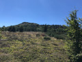
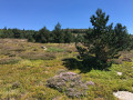
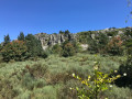
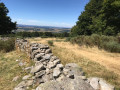
A circular route offering a chance to explore the Ardèche plateau and the pretty village of Sagnes-et-Goudoulet. Discover various knolls along the route, and pass close to Les Coux before heading past the Bourlatier Farm on the way back. A diverse range of landscapes and an insight into the region’s agricultural activities, whilst the area retains its wild character. Definitely worth doing again and again!!!

Details

48933970
Creation:
Last update:
Last review:
  • Horse riding
    Activity: Horse riding
  • ↔
    Distance: 9.30 mi
  • ◔
    Duration according to the author: 3 hrs 
  • ▲
    Difficulty: Easy

  • ⚐
    Back to start: Yes
  • ↗
    Ascent: + 1,030 ft
  • ↘
    Descent: - 1,033 ft

  • ▲
    Highest point: 4,767 ft
  • ▼
    Lowest point: 3,973 ft

Photos

Description of the walk

From Lachamp Raphaël, follow the D122 for about 4.5 km and, at a bend, look out for theGR® which crosses the road and follows a track suitable for vehicles on the left. Park at the entrance to this track.
From Gerbier des Joncs, follow the D378, then the D122 towards Ferme du Bourlatier; drive past it and continue for about 500 m until you reach a bend where theGR® crosses the road and follows a track on the right. Park at the start of this track.

(S/E) Follow theGR® de Pays towards Sagnes-et-Goudoulet and the stone tower visible in the distance.

(1) On theGR®, turn right then left and begin a descent through the meadows. Enjoy the lovely panoramic views. Please note that, depending on the season, you may need to cross pastures that may or may not be occupied; please remember to close the gates behind you.

(2) You’ll come to a tarmac road at a place called Gratteloup; take this road and follow theGR® by heading off to the right. You’ll pass several farms with traditional-style houses. Look out for the Cheylard knoll on your left, then, a little further on to the right, the Plaines knoll. Follow theGR® signposts all along this road, ignore the junction on the left and carry on to the next one.

(3) Carry on straight ahead, following theGR® signposts, until the next junction, just before the entrance to the village of Sagnes-et-Goudoulet.

(4) Ignore the start ofthe GR®7on the left and continue on theGR®420, following the tarmac road into the village. Follow theGR® signposting, which takes you round the centre of the village via the D269; follow this road until the bend at the exit.

(5) TheGR® leaves the road and joins a narrow path on the right: be careful, as the signpost is partially hidden by bushes. Cross a stone bridge over the Ruisseau de la Padelle. The path climbs gently through meadows and offers a lovely view of the village.

(6) Continue to follow theGR®, which takes a sharp right-hand bend and, further on, crosses a pasture. Make sure you close the gates properly. As you leave the meadow, theGR® turns left and then joins a tarmac road.

(7) Follow it to the right for about twenty metres to reach anotherGR® junction. Take theGR® on the right, leaving the tarmac road. Follow it until you reach another junction with a tarmac road.

(8) Follow theGR® which continues along the road opposite and passes near the hamlet of Suchasson.

(9) Continue along theGR®, pass through the hamlet of La Vestide and come out onto the D122.

(10) Cross with care and continue straight ahead. Carry on to the nextGR® junction, at the foot of Les Coux.

(11) Take theGR® to the left until you reach a fork.

(12) Whilst theGR® heads off to the left, continue – off the marked trail – along the path on the right-hand side, which skirts Les Coux, for approximately 1.3 km. You’ll reach a junction of paths.

(13) To the right, the path is blocked by a fence and to the left, the path joins the D378. Turn back to return to the junction of the twoGR® routes.

(11) Continue to go round Les Coux by following theGR® to the left, which joins the D378 further on.

(14) Cross a wooden footbridge to reach a car park and then the D378. Turn right onto theGR® which follows the D378. Please note that, depending on the season, the road can be quite busy and there is no hard shoulder.

(15) Turn left, walk past the Bourlatier farm, then head back up along the road to reach the car park at the bend (S/E).

Waypoints

  1. S/E : mi 0 - alt. 4,603 ft - Junction of the D122 and the GR°°®°°7–GR°°®°°420
  2. 1 : mi 0.22 - alt. 4,580 ft - Turn right, then left
  3. 2 : mi 1.04 - alt. 4,180 ft - Gratteloup
  4. 3 : mi 1.5 - alt. 4,121 ft - Crossroads
  5. 4 : mi 1.9 - alt. 4,078 ft - GR junction
  6. 5 : mi 2.2 - alt. 4,042 ft - Path on the right
  7. 6 : mi 2.66 - alt. 4,114 ft - Hairpin bend on the GR trail
  8. 7 : mi 3.1 - alt. 4,072 ft - Road junction
  9. 8 : mi 3.52 - alt. 4,065 ft - Road junction
  10. 9 : mi 3.85 - alt. 4,081 ft - Suchasson
  11. 10 : mi 4.51 - alt. 4,321 ft - D122
  12. 11 : mi 5.01 - alt. 4,688 ft - Junction on the out-and-back route - Les Coux
  13. 12 : mi 5.35 - alt. 4,688 ft - Junction; end of GR signposting - Les Coux
  14. 13 : mi 6.19 - alt. 4,760 ft - Turn back
  15. 14 : mi 8.08 - alt. 4,682 ft - Wooden footbridge on the D378
  16. 15 : mi 8.81 - alt. 4,495 ft - Road junction, on the left
  17. S/E : mi 9.3 - alt. 4,603 ft - Junction of the D122 and the GR°°®°°7–GR°°®°°420

Notes

The Padelle stream is accessible to horses after Sagnes-et-Goudoulet, a peatland area.

Worth a visit

Always be cautious and plan ahead when you're outdoors. Visorando and the author of this route cannot be held responsible for any accidents occurring on this route.

The GR® and PR® markings are the intellectual property of the Fédération Française de Randonnée Pédestre.

Reviews and comments

5 / 5
Based on 2 reviews

Reliability of the description
5 / 5
Ease of following the route
5 / 5
Route interest
5 / 5
CLEMAURIN
CLEMAURIN

Overall rating : 5 / 5

Date of your route : Sep 02, 2025
Reliability of the description : Not used / Not applicable
Ease of following the route : ★★★★★ Very good
Route interest : ★★★★★ Very good
Very busy route : No

Thank you for the magnificent route, which we nevertheless took from Les Sagnes in the opposite direction to that shown on the map. When we reached point 14, we preferred to cross the peatland at the foot of Les Coux via the GR 420 towards point 11, a magnificent setting of blueberry bushes in autumn colours mixed with heather at the peak of its flowering.
Sorry for not commenting on the quality of the description (as a former orienteering competitor and coach, I prefer to read a 1:25,000 map on which the route has been marked). However, it should perhaps be noted that between points 10 and 11, the very rugged track (like a dry mountain stream) is particularly tricky on the descent and certainly quite challenging on the ascent (we met a couple of hikers who seemed to be struggling a lot).
We will do the route again, but we are still wondering which direction to take, as the map shows magnificent views to the south on the descent to the peatland from La Tour à Eau, but the uphill track between 10 and 11 makes us hesitate (we are 78 and 80 years old).

Machine-translated

armelle42
armelle42

Overall rating : 5 / 5

Date of your route : May 13, 2024
Reliability of the description : ★★★★★ Very good
Ease of following the route : ★★★★★ Very good
Route interest : ★★★★★ Very good
Very busy route : Yes

Hello
I did this route a few days ago – not on horseback, but on foot, of course – and it took me more than three hours
The views are absolutely stunning – it’s truly magnificent
Around point 8, you have to cross a stream where I had to wade through the
water as there was no footbridge
Further on, there’s a long climb over pebbles and rocks – the walking sticks came in very handy (how on earth do the horses manage to get through there without any trouble?)
The walk back to the car park is a bit risky as there’s no verge and quite a few cars driving rather fast, to be honest
Fortunately, it wasn’t too long
Otherwise, it was a lovely route – perhaps easier on horseback than on foot – but it was well worth doing

Machine-translated

For more walks, use our search engine .

The GPS track and description are the property of this route's author. Please do not copy them without permission.