Country:
 City:
City:


Red and white markings forthe GR®®145,GR®®655andGR®®800.
(S) With your back to the campsite, turn right onto Rue Charles Voyeux and walk until you reach the signpost opposite the War Memorial. Turn right onto the D32 and walk until you reach the restaurant Le Domaine de l’Arc-en-Ciel.
(1) Turn right towards the fitness trail, walking along the path between the River Somme and the Saint-Quentin Canal, then follow the canal on your left. Walk to the old bridge at Séraucourt-le-Grand.
(2) Carry on to the D1040 bridge and continue until you reach Lock No. 23 at Fontaine-lès-Clercs.
(3) Continue walking along the canal on your left-hand side; then, before the East Bridge at Fontaine-lès-Clercs over the Somme, turn left onto the towpath – against the direction of traffic – to continue along the Saint-Quentin Canal, heading north-east. Walk on to the footbridge in the village of Dallon.
(4) Carry on along the canal to the A26 motorway bridge at Saint-Quentin.
(5) Carry on, passing the Picardie Transports road transport company, and continue to the bridge in the hamlet of Oestres in Saint-Quentin.
(6) Cross the bridge and turn right immediately after it. Look out for the small path leading down towards the Saint-Quentin Canal so that you can walk alongside it on your right. (Please note: the path may be partially obscured by tall grass.) Continue along the grassy path running alongside the canal until you reach the pylon supporting a high-voltage power line.
(7) Continue along the canal to the warehouses of the construction company Comptoirs Minéraux Matières Premières.
(8) After the warehouses, turn left before the disused bridge, then continue left (north-west) to cross a small wood and carry on to Rue de Paris in the town of Saint-Quentin.
(9) Cross the road carefully and continue straight ahead, then turn left, walking alongside the Résidence Saint-Martin. Walk alongside the fence of the Mille et Une Bières brewery and continue along the grassy path known as the Ceinture Verte, until you reach the steps leading up to the Chemin de la Tombelle.
Red and white markings forthe GR®®145.
(10) Cross carefully, then go up the stairs opposite to continue along the Ceinture Verte. Carry on until you reach the Tombelle cemetery. You can stock up on supplies at an Aldi if you turn left into the town.
(11) Continue along the Ceinture Verte to the crossroads in the middle of the fields.
(12) Ignoring thePR®®, carry on north-west. At the Fork in the road, keep left, pass under a high-voltage power line and continue to the bridge over the A26 motorway.
(13) Pass under the motorway and carry on westwards to the junction with Rue de Dallon, in the hamlet of Maison Rouge.
(14) Carry on along the track opposite to reach the D68.
(15) Turn left and carry on, taking care on the D68, heading south-west until you reach the junction with Chemin after the sign warning of bends.
(16) Turn right onto the path running parallel to the road and carry on to the cemetery in the village of Savy.
(17) Walk along the right-hand side of the cemetery and continue along the grassy path to the water tower.
(18) Carry on straight ahead along the path closed to motor vehicles, pass a cross and continue to the pumping station.
(19) Keep heading north-west until you reach the A29 bridge.
(20) After the bridge, carry on north-west until you reach the crossroads at the edge of a wood.
(21) Enter the woodland via the uphill path, then pass a telecoms mast before reaching the entrance to the village of Attily.
(22) Carry on straight ahead along Rue du Prozet and continue to the Stop sign at the junction with the D33.
(23) Turn left, then carry on to the junction and turn right towards Beauvois-en-Vermandois. Leave the village of Attily and continue westwards to the small Bois de La Garenne.
(24) Carry on until you reach the junction with the D73 in the hamlet of Villévèque.
(25) Turn left towards Beauvois. At the Fork in the road, take the right-hand lane, heading south-west, and continue along the D73 until you reach the signpost.
(26) Leave the D73 and turn right onto the small road that runs through the farmland, continuing until you reach the ‘Stop’ sign at the junction with the D34.
(27) Cross carefully and carry on straight ahead towards Trefcon. Continue straight on along the D345, then enter the village of Trefcon. Staying on the Rue Principale, carry on until you reach the junction with Allée Saint-Martin.
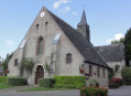
(28) Turn left and head towards the church, where you’ll find a secluded spot to camp. (E)
 Visorando Member
 Easy
Easy  Moderate