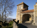
Sauxillanges Circular Route

It’s more of a leisurely stroll than a hike, as it’s so easy to do.
It consists of a discovery walk through the streets of old Sauxillanges, pleasant country lanes and local paths through the woods, across the meadows and along the streams.
This mini-walk is also very enjoyable to do in the opposite direction, and is ideal for children.

Details

63480
Creation:
Last update:
Last review:
  • Walking
    Activity: Walking
  • ↔
    Distance: 1.62 mi
  • ◔
    Average duration: 0h 50 
  • ▲
    Difficulty: Easy

  • ⚐
    Back to start: Yes
  • ↗
    Ascent: + 79 ft
  • ↘
    Descent: - 79 ft

  • ▲
    Highest point: 1,542 ft
  • ▼
    Lowest point: 1,447 ft

Photos

Description of the walk

Park in the car park in front of Sauxillanges Town Hall.
(S/E) Set off due north along Rue des Fossés until you reach the first junction on the right.

(1) Follow this street up to the right – Rue Notre Dame du Secours – for its entire length.
At the end, continue straight ahead onto Route de Condat. Follow this road until the first junction on the right.

(2) Take this turn-off towards “La Coierie”.
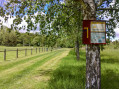
At La Coierie, cross the bridge on the left, opposite the flour mill. Continue past the bus shelter and take the small path that climbs between the houses.
From there, follow the path to the footbridge and cross the river. Then turn right.
At the end of this path, there is a wooden staircase on the right: go down it and follow the path until you reach the bridge over the Eau-Mère. Cross the bridge and continue along the path (there is only one possible route).
After the dirt track section, straight ahead, you’ll reach the Chemin du Breuil.

(3) Follow this path. You’ll reach the fork in the leat on the right, which runs beneath the houses (former mills). Follow it for 30 metres, then head up the street on the right to the town hall (S/E).

Waypoints

  1. S/E : mi 0 - alt. 1,463 ft - Car park in front of Sauxillanges Town Hall
  2. 1 : mi 0.14 - alt. 1,470 ft - Rue des Fossés
  3. 2 : mi 0.54 - alt. 1,542 ft - La Coierie. Towards the - Chaméane (rivière)
  4. 3 : mi 1.23 - alt. 1,473 ft - Chemin du Breuil - Eau Mère (rivière) - Affluent de l'Allier
  5. S/E : mi 1.62 - alt. 1,463 ft - Car park in front of Sauxillanges Town Hall

Notes

No special equipment required.
This short walk is very suitable for children aged three and over.

Worth a visit

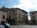
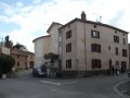
Throughout the village of Sauxillanges, you’ll come across a number of historic buildings.
Starting from the town hall, you follow the route of the old ramparts.
At Place du Marchédial, you can see several Renaissance-style houses and other older buildings.
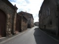
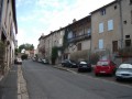
Walking up Rue Notre Dame du Bon Secours gives you a chance to explore what was for a long time the town’s main street.
Here you can see the façades of an old bistro, a fountain and the sign of a former hotel.
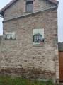
As you reach La Coierie, you’ll pass, on your right and slightly below, the workshop of a former stonemason, with half-cut blocks now surrounded by wild bushes.
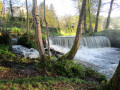
On arriving in La Coierie, you’re greeted on your left by the flour mill (still in operation) and its waterfall.
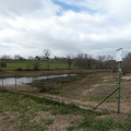
As you make your way up through the woods, you pass a vast meadow below, where horses are often grazing.
On the way back down, you cross the bridge over the Eau-Mère, right at the point where it rises from the confluence of the Coierie and the Chaméane.
At the three-way junction there was once a site of pre-Christian votive offerings, which later became a place of worship dedicated to the miraculous Virgin Mary, ‘Notre Dame du Bois’.
You then reach the Sauxillanges waterfall.
You then walk alongside a large meadow, followed by a residential area, which were once ponds and marshes before being developed.
Many of the houses are well worth a closer look, including some old mills.
The leat that once fed them is visible in several places, and you can still hear the waterfalls beneath the buildings.
Once the walk is over, back in the village, a heritage centre, a church, bars and restaurants invite you to extend your stay.
Heading along the Chemin des Prairies, you’ll also find a pond, a fitness trail, a children’s playground and a swimming pool.
This village is a good base from which to explore the region.

Reviews and comments

4.5 / 5
Based on 2 reviews

Reliability of the description
5 / 5
Ease of following the route
5 / 5
Route interest
3.5 / 5
Morgan93
Morgan93

Overall rating : 4.3 / 5

Date of your route : Aug 21, 2023
Reliability of the description : ★★★★★ Very good
Ease of following the route : ★★★★★ Very good
Route interest : ★★★☆☆ Average
Very busy route : No

The walk through the village isn’t particularly interesting, but the little path along the channelled river, starting from the flour mill, is really lovely!

Machine-translated

freebike
freebike

Overall rating : 4.7 / 5

Date of your route : Jul 02, 2018
Reliability of the description : ★★★★★ Very good
Ease of following the route : ★★★★★ Very good
Route interest : ★★★★☆ Good

40 minutes at a normal walking pace

Machine-translated

Francois_Cournon
Francois_Cournon
• Edited:

Sorry, I haven’t been on the walk yet

Machine-translated

Other walks in the area

For more walks, use our search engine .

The GPS track and description are the property of this route's author. Please do not copy them without permission.