Our villages and their livestock farms, starting from Sauxillanges

On an easy route, marked in yellow after the cemetery, which can be tackled on foot, by running or by bike, come and discover the various farms and the countryside around Sauxillanges.

Details

18570250
Creation:
Last update:
Last review:
  • Walking
    Activity: Walking
  • ↔
    Distance: 7.87 mi
  • ◔
    Average duration: 4h 05 
  • ▲
    Difficulty: Moderate

  • ⚐
    Back to start: Yes
  • ↗
    Ascent: + 505 ft
  • ↘
    Descent: - 509 ft

  • ▲
    Highest point: 1,683 ft
  • ▼
    Lowest point: 1,457 ft

Photos

Description of the walk

Park in the car park at the Sauxillanges Post Office.

(S/E) Cross Place de Verdun, passing the France Service centre. At the junction, turn right onto Rue Notre-Dame du Bon Secours. You’ll reach a junction by the old garage.

(1) Turn left onto Route de Montboissier. Pass the cemetery and continue along the RD263. Go past the junction at the hamlet of La Gardezie, then pass under the power line and emerge at the junction leading to the hamlet of Bord.

(2) Take the road on the left. Pass through the hamlet of Mouteix. At the top of the hill, turn left, staying on the tarmac road. (As theGRP® Autour d’Issoire route has been altered, you will no longer find its signposting).

(3) Continue left along the tarmac road, then reach the hamlet of Soleilhant. Turn right onto the D996 for about 300 m, then turn left. Pass through the hamlet of La Limandie Basse and then reach the hamlet of Château de la Marine.

(4) In this hamlet, turn right at a 90° angle. Keep to the left at the Lospeux pond. Then head up the gravel path to the left to reach the hamlet of Les Ruchers.

(5) Turn right to pass in front of the riding centre. You will then reach the multi-way junction in the hamlet of Lacot.

(6) Take thefirst path on the left and cross Les Grands Champs. You will then reach a wider path; turn right onto it to come out onto the D49 road.

(7) Cross it and continue straight ahead; then, on the uphill stretch, turn left to pass through the hamlet of Montbenoît. Carry on until you rejoin the D49 and follow it to the right. Pass the old egg-producing farm to reach another multi-way junction.

(8) Turn onto the path on the right, passing under the power line. Continue slightly uphill; at the top, turn left onto the wide path. You’ll reach the D49 again near the recycling centre.

(9) Turn right onto the D49 for a few metres, then turn left off it to walk uphill alongside the recycling centre until you reach the car garage. Continue right along the D996 for 30 metres until you reach a junction.

(10) Cross the D996 with care to reach Rue Porte Coche opposite, then at Place Catherine Girerd turn right, passing between the restaurant and the Crédit Agricole to return to the Post Office car park (S/E).

Waypoints

  1. S/E : mi 0 - alt. 1,506 ft - Post Office car park - Musée Pierre le Vénérable, fontaine et cloître
  2. 1 : mi 0.15 - alt. 1,526 ft - Crossroads (former garage)
  3. 2 : mi 1.64 - alt. 1,683 ft - Crossroads at the hamlet of Bord
  4. 3 : mi 2.15 - alt. 1,667 ft - GRP Around Issoire
  5. 4 : mi 3.37 - alt. 1,496 ft - Château de la Marine
  6. 5 : mi 4.16 - alt. 1,578 ft - Les Ruchers - Étang de Lospeux
  7. 6 : mi 4.49 - alt. 1,539 ft - Lacot
  8. 7 : mi 5.23 - alt. 1,499 ft - Junction with the RD49
  9. 8 : mi 6.35 - alt. 1,568 ft - Carrefour de la Ferme
  10. 9 : mi 7.31 - alt. 1,460 ft - Junction leading to the recycling centre
  11. 10 : mi 7.71 - alt. 1,470 ft - D996 junction
  12. S/E : mi 7.87 - alt. 1,503 ft - Post Office car park. Near the - Eau Mère (rivière) - Affluent de l'Allier

Notes

(S/E) In Sauxillanges, you’ll find bars, restaurants, a hotel, a campsite and lodges, a chemist’s and doctors’ surgeries, a bank with a cash machine, a mini-market with petrol pumps, a bookshop, a delicatessen, a butcher’s and other shops and services.
On Rue du Stade, there is a charging point for electric vehicles.
This route is not shaded, so please bring water and suitable clothing.

Worth a visit

- On Route de Montboissier, opposite the cemetery, you’ll see Blonde d’Aquitaine cattle.
- On leaving Sauxillanges, you’ll come across a herd of Salers and Aubrac cattle.
- Near La Gardezie, you’ll see Montbéliarde cattle.
- In Mouteix, you’ll see sheep as well as the greenhouses of a soft fruit grower.
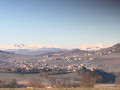
- You’ll then have a view of Sauxillanges and Usson.
- At the junction between the RD996 and the Limandie Basse road, there is a remarkable tree with a circumference of around 4.7 m, estimated to be between 300 and 400 years old.
- Between Limandie Basse and the Château de la Marine, you’ll find a farm breeding Angora goats and Massif Central goats.
- After Les Ruchers Haut, you’ll have a view of the Sauxillanges basin.
- You will then pass the equestrian centre and enjoy a view of the Chaîne des Puys.
- Further on, you’ll pass an old egg-laying farm. After this, on either side of the sandy track, you’ll be able to see horses and Salers cattle.
- On the tarmac descent, before the recycling centre, there is a herd of Limousin cattle.
Elsewhere in the village, you’ll find herds of Montbéliarde, Holstein and Charolais cattle.
You can also visit two fishing ponds and the swimming pool, which is open during the summer. Starting from the post office, there are other routes marked in yellow, blue or green. Starting from the town hall, there are three short walks of around one hour that allow you to explore the village’s heritage.

Reviews and comments

4.2 / 5
Based on 4 reviews

Reliability of the description
4.3 / 5
Ease of following the route
5 / 5
Route interest
3.3 / 5
Lizyanor
Lizyanor

Overall rating : 3 / 5

Date of your route : Mar 24, 2025
Reliability of the description : ★★☆☆☆ Disappointing
Ease of following the route : ★★★★★ Very good
Route interest : ★★☆☆☆ Disappointing
Very busy route : No

A rather uninteresting walk. Too much tarmac (around 95 per cent of the route). Little or no cultural heritage to discover. Very disappointing

Machine-translated

Dionisi Yves
Dionisi Yves

Overall rating : 4 / 5

Date of your route : Aug 02, 2023
Reliability of the description : ★★★★★ Very good
Ease of following the route : ★★★★★ Very good
Route interest : ★★☆☆☆ Disappointing
Very busy route : No

The walk wasn’t particularly interesting. Three-quarters of the route was on tarmac, and there were few sights to see. There were no suitable spots for a picnic. The only appealing aspects were the gentle gradient (we’re 82 years old) and the pleasure of walking.

Machine-translated

J.Ph ALEXIS
J.Ph ALEXIS

Thank you for sharing your views on this route.
Our aim is to share the passion of our farmers, our countryside and our hamlets.
It is certainly a route with a lot of tarmac. We are considering how best to promote it to cyclists and users of other forms of individual transport.
In Sauxillanges, again starting from the post office, we’d be delighted to help you discover other walks along paths marked in blue, yellow or green.
Once again, thank you for visiting our village.

Machine-translated

J.Ph ALEXIS
J.Ph ALEXIS

Thank you for your feedback. I’ll pass it on to the volunteers. There are other marked routes – blue, yellow or green – available, all starting from the Post Office. Easy walks lasting around an hour, allowing you to explore Sauxillanges, start from the town hall.
Thank you once again for visiting our village.

Machine-translated

Monirobe
Monirobe

Overall rating : 5 / 5

Date of your route : Feb 13, 2022
Reliability of the description : ★★★★★ Very good
Ease of following the route : ★★★★★ Very good
Route interest : ★★★★★ Very good
Very busy route : No

A lovely route, well signposted

Machine-translated

Other walks in the area

For more walks, use our search engine .

The GPS track and description are the property of this route's author. Please do not copy them without permission.