From Santiago del Teide to Masca

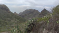
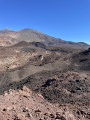
Masca is one of the villages worth visiting in the south of Tenerife. However, there are very few parking spaces up there. It is therefore advisable to get there without a car. And what better way to explore the village than on a short hike starting from Santiago del Teide, which allows you to approach the village from above, as much of the walk is downhill! Sea and mountain views throughout the entire route.

Details

65736071
Creation:
Last update:
Last review:
  • Walking
    Activity: Walking
  • ↔
    Distance: 3.39 mi
  • ◔
    Average duration: 2h 20 
  • ▲
    Difficulty: Easy

  • ⚐
    Back to start: No
  • ↗
    Ascent: + 889 ft
  • ↘
    Descent: - 1,959 ft

  • ▲
    Highest point: 3,451 ft
  • ▼
    Lowest point: 1,926 ft

Photos

Description of the walk

The starting point is on Avenida de la Iglesia in Santiago del Teide. In November, there were plenty of parking spaces near the start of the route, right next to the bus stop which you can use for the return journey.

(S/E) Head south and join the TF-436 road, which leads to Buenaviste del Norte via Masca. Turn right and follow it to the Mirador de Cherfre.

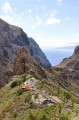
(1) This point marks the junction between the ascent from Santiago and the descent towards Masca. Continue along the road to reach the first beautiful viewpoint overlooking Masca.

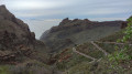
(2) Return to the road and navigate a series of hairpin bends, with a succession of viewpoints overlooking the village.

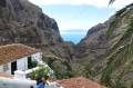
(3) At this point, leave the road and follow the path on the left which goes through the village rather than ending up on the tarmac. Walk through the hamlet of Lomo de Masca. There are some pretty little houses before you reach the village centre.

(4) Turn right to reach the village centre proper. Enjoy the surroundings and the bars on offer. The bus stop for the return journey is located to the north of the village, past the car parks (E).

Waypoints

  1. S : mi 0 - alt. 3,048 ft - Avenida de la Iglesia
  2. 1 : mi 0.88 - alt. 3,451 ft - Cherfre Viewpoint
  3. 2 : mi 1.29 - alt. 3,130 ft - Masca Viewpoint
  4. 3 : mi 2.97 - alt. 2,136 ft - Lomo de Masca Trail
  5. 4 : mi 3.1 - alt. 1,946 ft - Lomo de Masca
  6. E : mi 3.39 - alt. 1,978 ft - Masca

Notes

The route follows the road – it’s impossible to go wrong – so there are virtually no signposted junctions!
The road is quiet and too narrow for cars to drive fast, so the walk remains pleasant despite the tarmac. There are no water points along the route, but it’s a short walk.
The more adventurous can do the round trip.
However, the outward leg has only a slight climb and then offers a lovely descent to the village of Masca. The return journey is more arduous and of little real interest. It is therefore possible to return to Santiago by bus: 15–20 mins for €2.40 in November 2024.

Worth a visit

From Masca, there’s a lovely hike down through a canyon (which we didn’t do due to a lack of time).
However, following numerous incidents, the walk must now be undertaken with a guide and a helmet! It is therefore essential to book in advance before setting off. What’s more, as the walk ends at a beach with no road access, you’ll need a boat to reach the nearest village afterwards! But all this is clearly explained in guidebooks and online!

Reviews and comments

3.7 / 5
Based on 3 reviews

Reliability of the description
3.5 / 5
Ease of following the route
5 / 5
Route interest
2.7 / 5
User 8759740

Overall rating : 2.7 / 5

Date of your route : Feb 07, 2026
Reliability of the description : ★★☆☆☆ Disappointing
Ease of following the route : ★★★★★ Very good
Route interest : ★☆☆☆☆ Very disappointing
Very busy route : No

The route is simply the road from Santiago de Teide to Masca. It has no pavement and is very busy, even in low season. It passes by some beautiful viewpoints, but in dangerous and unpleasant conditions.

Machine-translated

HACKENHEIMER
HACKENHEIMER

A walk you should definitely avoid. You’re on the road the whole time, so you need to be careful. We quickly gave up on it and drove there instead to do the walk to the Cruz de Hilda viewpoint.

Machine-translated

piccolopripri
piccolopripri

Overall rating : 3 / 5

Date of your route : Dec 14, 2024
Reliability of the description : Not used / Not applicable
Ease of following the route : Not used / Not applicable
Route interest : ★★★☆☆ Average
Very busy route : No

We made the journey by car. Doing it on foot certainly allows you to admire this magnificent landscape, but for the most part you’re walking along a narrow road with lots of cars and the occasional bus. There are no pavements, of course.
Cars park on both sides of the road in Masca, taking up one of the two lanes. We were lucky and found a space in the hamlet about 500 metres further up.

Machine-translated

Prunete
Prunete

Overall rating : 4.7 / 5

Date of your route : Nov 21, 2024
Reliability of the description : ★★★★★ Very good
Ease of following the route : ★★★★★ Very good
Route interest : ★★★★☆ Good
Very busy route : No

For the hike from Masca to Masca beach: A fee of 30 euros per person applies.

You can only do the round trip (i.e. going down and back up) with a guide (the guide costs 50 euros per person).
If you do it without a guide, only the descent is permitted. Proper hiking boots are compulsory and will be checked at the entrance. You will therefore need to return by boat (25 euros per person) and then by bus to get back to your car.
Finally, the site is only open on Fridays, Saturdays and Sundays.
The walk isn’t actually that difficult, apart from the elevation gain.
All in all, it’s a hike that’s far from free.

Machine-translated

Other walks in the area

For more walks, use our search engine .

The GPS track and description are the property of this route's author. Please do not copy them without permission.