Country:

 City:


To get to Sankt-Jacob-Im-Walde from Lienz: take the B108 towards Matrei. After about fifteen kilometres, turn left towards Sankt-Johann-Im-Walde (signposted) and park immediately after the bridge, on the right, in the car park between the fire station (Feuerwehr) and the primary school (Volksschule)
(S/E) Retrace your steps and, just before the bridge, take the path on the left that runs alongside the river. Follow the yellow ‘Iseltrail’ sign (which will guide you until just past Huben). Further on, walk between the river and a small lake.
(1) Carry on. On your left, look out for the ruins of Kienburg Castle. Continue until you reach the small tarmac road.
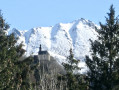
(2) Cross the bridge over a large torrent. Turn right straight away to rejoin the path. Soon, you’ll see the village of Huben. Keep following the yellow “Iseltrail” signs to cross the village, using the church as your guide.
(3) When you reach the church, just before the fire station (Feuerwehr, with a large red gate), take the path on the right (signposted “Iseltrail”), cross the B108 at the pedestrian crossing and take the small footbridge over the Isel.
(4) Leave the Iseltrail and carry on straight ahead for a few dozen metres, then turn right down the small tarmac road. Cross the road leading up to Kals and continue straight ahead until you reach the B108; walk along the left-hand side of this for 50 metres (very wide verge) until you pass three houses on the other side.
(5) As soon as you’ve passed them, cross the road and head straight on along the dirt track that leads back to the river. Follow the river to your right.
(6) Turn right twice to cross the bridge (pavement) and rejoin the track.
(7) Do the same a little further on, but this time you don’t need to rejoin the B108: there’s a small wooden bridge just for you…
(8) Repeat the same procedure: turn right twice onto the pavement alongside the B108. This time, after the bridge, follow the trees to go round the field. Sankt-Johann is at the other end of this same field.
(9) Cross the road and head for the cycle path opposite, which runs parallel to the B108; follow it to the right towards the village until you reach the pedestrian crossing.
(10) Cross at the pedestrian crossing, turn right and then left onto the bridge, which you cross to return to the car park (S/E).

 Visorando Member

 Easy
 Difficult