From Moulins à la Vigne to Mesnil-en-Vallée

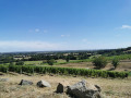
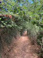
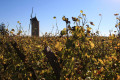
A walk through the appellation’s vineyards in the Anjou Coteaux de Loire region, this footpath allows you to explore the commune’s vineyard landscape, the rose bushes at the Claude Michel nurseries, the mills, and a panoramic view of the Thau valley. A section of the path follows the Grande Randonnée trail, theGR®3.

Details

3715415
Creation:
Last update:
Last review:
  • Walking
    Activity: Walking
  • ↔
    Distance: 6.96 mi
  • ◔
    Average duration: 3h 35 
  • ▲
    Difficulty: Moderate

  • ⚐
    Back to start: Yes
  • ↗
    Ascent: + 430 ft
  • ↘
    Descent: - 407 ft

  • ▲
    Highest point: 272 ft
  • ▼
    Lowest point: 75 ft

Photos

Description of the walk

Start from the car park at the town hall in Mesnil-en-Vallée.

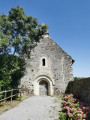
(S/E) Follow the D150 southwards and, after a few dozen metres, turn right onto a footpath. At the end, turn left and walk past the apse of Notre-Dame Church.

(1) Walk through the gardens on your right. You’ll come out onto a street; follow it to the right. Turn right and ignore the alleyway on the left. At the T-junction, follow Rue du Pavillon to the left and cross the Jouquelière.

(2) At the fork, follow Chemin des Galinières to the left. At Les Bréverrières, turn left, then take thefirst path on the right.

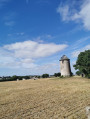
(3) Turn left towards a small farmhouse. At the fork, head slightly to the right and walk alongside the orchards on your left. Keep going round them without stopping and ignore the paths branching off to the left and right. At the end, turn right to reach the Moulin Pineau.

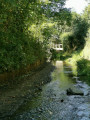
(4) Then head right, then straight right at Charlie la Pomme. Go downhill and cross the Ruisseau de Veillon over a stone bridge. Follow the stream on your right, then turn left to head back uphill.

(5) Enter Saint-Laurent-du-Mottay via Rue des Moulins. At the end, take a short stretch of the D222, then turn left onto the road in front of the Château de la Barre. Carry on straight ahead, ignoring a turn-off on the right. At the next junction, turn left and continue to the hamlet of La Voie.

(6) Cross the stream again, then follow it on your right-hand side. Then move away from the stream and, at the T-junction, turn right along a pond. Then head left until you reach La Grand-Noue.

(7) When you reach La Grand-Noue, take the tarmac road on the left. Cross the D150 carefully and first turn right then left to take a path which you’ll follow for about 1.5 km.

(8) At the end, follow a road to the left (red markings). After passing under a power line, take a dirt track on the left. At the junction, turn right.

(9) At the cross, turn left. Continue straight on (north), following a road past the hamlet of Le Coteau. Ignore two more turnings on the right and you’ll reach the hamlet of Le Haut Puiset.

(10) Continue along a path through the woodland. You’ll come out onto a road (at the hamlet of La Commazière) and follow it to the left. At the junction, veer left.

(11) At the hamlet of La Croix, turn right. Pass under a power line and ignore the turn-offs on the left. When the road bends to the right (Château de Vaugirault on your left), leave it and continue straight on along a path (GR®3, marked in red and white).

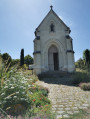
(12) Walk past the Notre Dame de la Salette Chapel on your left, as well as the Chapelle des Anges. Then turn right onto Route de la Peltrie. After about a hundred metres, turn left to reach the car park (S/E).

Waypoints

  1. S/E : mi 0 - alt. 144 ft - Car park at the town hall in Mesnil-en-Vallée.
  2. 1 : mi 0.1 - alt. 171 ft - Jardins
  3. 2 : mi 0.4 - alt. 121 ft - Chemin des Galinières
  4. 3 : mi 0.8 - alt. 161 ft - Intersection
  5. 4 : mi 1.52 - alt. 249 ft - Moulin Pineau
  6. 5 : mi 2.13 - alt. 226 ft - Rue des Moulins in Saint-Laurent-du-Mottay
  7. 6 : mi 2.81 - alt. 135 ft - La Voie
  8. 7 : mi 3.26 - alt. 217 ft - La Grand Noue
  9. 8 : mi 3.87 - alt. 253 ft - Route
  10. 9 : mi 4.69 - alt. 259 ft - Croix
  11. 10 : mi 5.54 - alt. 184 ft - Bosquet
  12. 11 : mi 5.9 - alt. 85 ft - La Croix
  13. 12 : mi 6.7 - alt. 177 ft - Chapelle Notre Dame de la Salette
  14. S/E : mi 6.96 - alt. 144 ft - Car park at the town hall in Mesnil-en-Vallée

Worth a visit

The Cap Loire Discovery Park: Part park, part museum, Cap Loire is a visitor attraction offering a true immersion in the culture of the Loire region. The permanent exhibition explores the evolution of boats. Next, a tour of the Cap Vert barge provides an insight into the lives of the boatmen and their families. What’s more, 11,000 m² of themed gardens offer plenty of space for strolling and discovery!

The Mills of Anjou: In 1793, the mills served as optical telegraphs for the Vendée armies through the positioning of their sails. During the civil wars, the mills were used to inform the Vendéens of the movements of Republican forces and to issue instructions. But when the ‘Bleus’ realised that the position of the mill sails was revealing the movements of enemy troops to the resistance fighters, the mills were destroyed by the enemy and few survived. It is indeed for this reason that the Mauges region now boasts large, modern stone mills, which, following the events of the Vendée uprising, replaced most of the old wooden mills that had been destroyed as a result of the war.

AOC Anjou Coteaux de la Loire: This region extends from Le Mesnil-en-Vallée, covering approximately 30 hectares in the south-east of the Armorican Massif (schist). It is a remnant of the medieval vineyards of Anjou, which were planted along the banks of the Loire, the main transport route at that time. The terroir thus defined comprises well-exposed and well-ventilated hillsides which encourage early growth and allow for the production of overripe grapes, some of which may even be affected by noble rot. The appellation is reserved for sweet white wines made from Pineau de la Loire (Chenin).

Always be cautious and plan ahead when you're outdoors. Visorando and the author of this route cannot be held responsible for any accidents occurring on this route.

The GR® and PR® markings are the intellectual property of the Fédération Française de Randonnée Pédestre.

Reviews and comments

4.6 / 5
Based on 3 reviews

Reliability of the description
4.7 / 5
Ease of following the route
4.3 / 5
Route interest
4.7 / 5
amismarcheurs
amismarcheurs

Overall rating : 4.3 / 5

Date of your route : Nov 18, 2023
Reliability of the description : ★★★★★ Very good
Ease of following the route : ★★★★☆ Good
Route interest : ★★★★☆ Good
Very busy route : No

12 November: a lovely route, with a few steep sections that are a bit of a challenge, especially after the rain in October and November. Well worth a go!

Machine-translated

ryel
ryel

Overall rating : 5 / 5

Date of your route : Oct 08, 2023
Reliability of the description : ★★★★★ Very good
Ease of following the route : ★★★★★ Very good
Route interest : ★★★★★ Very good
Very busy route : No

A very pleasant route, alternating between vineyard paths, orchards, sunken lanes, streams, views over the Loire Valley, and castles...

Machine-translated

Yves JOZEFIAK
Yves JOZEFIAK

Overall rating : 4.3 / 5

Date of your route : Jun 26, 2023
Reliability of the description : ★★★★☆ Good
Ease of following the route : ★★★★☆ Good
Route interest : ★★★★★ Very good
Very busy route : No

A lovely tour and some lovely encounters with the winegrowers.

Machine-translated

Other walks in the area

For more walks, use our search engine .

The GPS track and description are the property of this route's author. Please do not copy them without permission.