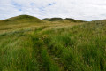
From Milngavie to Drymen

The first stage of the WHW, which presents no difficulty other than its distance, takes us through the Scottish countryside and introduces us to the first hills of the Highlands.

This walk is part of a multi-day hike: The West Highland Way

Details

n°2445290
Creation:
Last update:
Last review:
  • Walking
    Activity: Walking
  • ↔
    Distance: 12.70 mi
  • ◔
    Average duration: 6h 20 
  • ▲
    Difficulty: Difficult

  • ⚐
    Back to start: No
  • ↗
    Ascent: + 564 ft
  • ↘
    Descent: - 528 ft

  • ▲
    Highest point: 472 ft
  • ▼
    Lowest point: 72 ft

Photos

Description of the walk

Starting point and access: MilngavieStation.
- By train, from Glasgow Central or Glasgow Queen Street stations.
- By taxi from Glasgow city centre (ask to be dropped off near the official starting point (1), which is on Douglas Street).

Official WHW signposting: signposts with a thistle symbol + signposts with a yellow arrow for changes of direction + directional signposts.

(S) On leaving the station, head north and pass under the B8030 road. Then turn left and follow Station Road. Cross Ellangowan Road and follow Douglas Street to the small obelisk marking the official start point of the West Highland Way.

(1) Pass under the large metal WHW banner and go down a ramp. Then walk alongside a river on your left and continue through a wooded park.

(2) When you reach a pond, turn right and continue along the river.

(3) When you reach a large building on the opposite bank, at a fork in the road, take the right-hand path uphill. At the top, at a T-junction, turn left and head north-west.

(4) Return to the river and continue north-west along a stony path. You’ll come out onto a road; follow it to the left for about thirty metres.

(5) Leave the road and take thefirst track on the right. Walk north-north-west through a thinned-out woodland. Then walk alongside Craigallian Loch on your right. Continue north through the woodland.

(6) At a fork in the road, take the path on the right. Cross a river, pass some houses on the left and come out onto the B821 road.

(7) Follow the road to the left for about 500 metres.

(8) Then take a path on the right (gate) and cross a meadow.

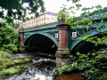
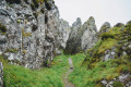
(9) At the edge of a small hillock, veer left and wind your way down through the meadow. Go round a heavily wooded rocky outcrop on the left (Dumgoyach on the map). Pass an old farmhouse that appears to be abandoned. Cross the Blane Water.

(10) Immediately after the bridge, turn left, go through a gate and follow a well-maintained path running parallel to an underground aqueduct marked by small masonry structures. At the various junctions, go straight on (in addition to the WHW, follow the John Muir Way).

(11) Cross the A81 road (take care) and continue along the path opposite, still running parallel to the underground aqueduct. Further on, the path crosses a small road (houses) and continues parallel to the A81. You’ll come out onto a small road; follow it to the right for about twenty metres.

(12) Before a ‘5 mph speed limit’ sign, leave the tarmac, pass a barrier on the left and continue along a path, still alongside the underground aqueduct. Pass under a road and carry on straight ahead.

(13) Cross the A81 again (take care) and continue along the path opposite. When you reach a small road, turn left onto the path. Go through a gate and join the road.

(14) Follow the road to the left and cross a river. Then pass through a hamlet and continue along the road.

(15) At the junction at the top of a hill, carry on straight ahead. Further on, stay on the tarmac and let the John Muir Way branch off to the left onto a track.

(16) At the next fork in the road, take the small road on the right. Pass the Drymen campsite on your left and continue along the road. After a sharp bend to the left, follow the road for a few dozen metres.

(17) Then turn right onto a footpath and cross a footbridge over a stream (take care to spot this turn-off). Climb a small hill. Descend through a meadow and turn left to reach the exit gate. Cross the A811 road (take care, astraffic moves fast) and continue along a footpath.

(18) After a few dozen metres, you’ll come out onto a small road; follow it to the left. At the junction that comes up immediately, carry straight on along the right-hand pavement until you reach the centre of Drymen (E).

Waypoints

  1. S : mi 0 - alt. 164 ft - Milngavie Station (Gare de Milngavie)
  2. 1 : mi 0.17 - alt. 174 ft - Official starting point of the WHW
  3. 2 : mi 0.47 - alt. 203 ft - Pond
  4. 3 : mi 0.81 - alt. 203 ft - Fork in the road
  5. 4 : mi 1.63 - alt. 292 ft - Riverside
  6. 5 : mi 2.25 - alt. 364 ft - Junction
  7. 6 : mi 3.58 - alt. 430 ft - Fork in the road
  8. 7 : mi 4.05 - alt. 427 ft - B821 road - Carbeth Loch
  9. 8 : mi 4.33 - alt. 440 ft - Barrier – Start of the trail
  10. 9 : mi 4.72 - alt. 367 ft - Junction
  11. 10 : mi 5.84 - alt. 108 ft - Dumgoyach Bridge
  12. 11 : mi 7.24 - alt. 92 ft - A81 road
  13. 12 : mi 8.24 - alt. 95 ft - Garden Centre
  14. 13 : mi 9.31 - alt. 102 ft - A81 road
  15. 14 : mi 9.8 - alt. 125 ft - A short drive
  16. 15 : mi 10.21 - alt. 151 ft - Intersection
  17. 16 : mi 10.68 - alt. 82 ft - Fork in the road
  18. 17 : mi 11.93 - alt. 164 ft - Start of the trail
  19. 18 : mi 12.17 - alt. 217 ft - B858 road
  20. E : mi 12.7 - alt. 177 ft - Drymen

Notes

Equipment:
Waterproof walking boots. Rain gear: rain cape, rucksack cover, etc. Cold-weather gear, depending on your sensitivity to the cold. Midge repellent.

Guidance:
The route is relatively straightforward and the route is very well signposted at junctions. A paper map is useful (at the very least the one accompanying this description) or a route track on a smartphone (remember to cache the base map beforehand).

Food and drink:
Make sure you have a supply of water and a packed lunch with you at the start.
Light refreshments are available just before (11) and just after the B834 road between (11) and (12).
(E) In Drymen, there is a mini-market (Stirling Road) and bars and restaurants.

Accommodation the night before departure and access to the starting point (S):
- It is possible to find accommodation in Milngavie, but it is probably better to spend the night before in Glasgow, which offers a wide range of accommodation options (use your favourite search engine). The city of Glasgow is well worth a stroll, even if it doesn’t have all the hallmarks of a major tourist destination. Its motto is“People make Glasgow”: a word to the wise…
- Train timetables between Glasgow and Milngavie: check the ScotRail website. Fares are around £6 per person (August 2019).
- Taxi from Glasgow: expect to pay around £22 for the journey (August 2019). When giving the destination, say “Milngaille”.

Accommodation on arrival (E):
- Drymen Inn, 5 Stirling Road (the road you take to reach the centre). Tel: +44 - (0)1 360 660 123.
- The Winnock Hotel, The Square. Tel: +44 - (0)1 360 660 245.
- Buchanan Arms Hotel, 23 Main Street. Tel: +44 - (0)1 360 660 588.
These establishments also operate as pub-restaurants. Other accommodation options can be found using your favourite search engine.

Worth a visit

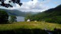
- Between (5) and (6): Craigallian Loch, a lovely, peaceful lake.
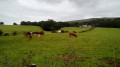
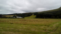
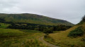
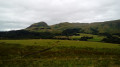
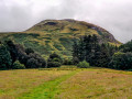
- Between (8) and (10): a pleasant walk through meadows and at the foot of the first hills.

Reviews and comments

4.7 / 5
Based on 2 reviews

Reliability of the description
5 / 5
Ease of following the route
5 / 5
Route interest
4 / 5
nm75
nm75

Overall rating : 3 / 5

Date of your route : Jul 30, 2023
Reliability of the description : Not used / Not applicable
Ease of following the route : Not used / Not applicable
Route interest : ★★★☆☆ Average
Very busy route : Yes

Lots of people at the start of this hike despite the rain! We did the Mingalvie to Fort Williams route this summer. Well, summer is a word that probably doesn't exist in Scotland.
The route is very well signposted and very busy (often an old road) and without difficulties. The scenery could have been beautiful if it hadn't rained the whole way (8 days). Despite everything, I was very disappointed because there are no pretty villages!

Machine-translated

lydie73
lydie73

Overall rating : 5 / 5

Date of your route : May 04, 2023
Reliability of the description : ★★★★★ Very good
Ease of following the route : ★★★★★ Very good
Route interest : ★★★★★ Very good
Very busy route : Yes

The West Highlands Way is a magnificent trek through wild, colourful landscapes.... it's grandiose!
To get to Fort Williams, you have to go to the end of the village square and not to the entrance (the old arrival point).
Take your WHW passport from Milngavie and get the stages stamped as you go along.
Done in May 2023 in 8 days

Machine-translated

Other walks in the area

For more walks, use our search engine .

The GPS track and description are the property of this route's author. Please do not copy them without permission.