From Locquirec to Beg Douar

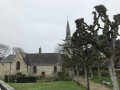
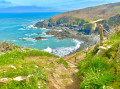
A short seaside walk: you’ll pass by beautiful houses, a campsite, beaches, woods and small harbours, as well as ancient Roman baths.

Details

n°9357720
Creation:
Last update:
Last review:
  • Walking
    Activity: Walking
  • ↔
    Distance: 5.13 mi
  • ◔
    Average duration: 2h 40 
  • ▲
    Difficulty: Easy

  • ⚐
    Back to start: No
  • ↗
    Ascent: + 364 ft
  • ↘
    Descent: - 302 ft

  • ▲
    Highest point: 112 ft
  • ▼
    Lowest point: -16 ft
  • ⚐ Country: France
  • ⚐ City: Locquirec (29241)
  • ⚑
    Start: N 48.690929° / W 3.647273°
  • ⚑
    End: N 48.683576° / W 3.616554°
  • ❏
    IGN map(s): Ref. 0615ET, 0714OT
  • Hour-by-hour weather

Photos

Description of the walk

Car park on Place du Port in Locquirec.

(S/E) Walk along the quays towards the sailing school, following the customs officers’ path.

(1) Go up the stairs on your right and, once at the top, turn left.

(2) Continue along the pavement, past the Fougeraie blocks of flats.

(3) Turn left onto a small dirt track (Chemin de la Falaise) signposted at the entrance. You’ll come out onto a tarmac road; follow it for about 150 metres.

(4) Turn left onto a narrow path between the hedges to avoid crossing the campsite. Once on the beach, walk along it, turning right, and head towards the campsite. At the end of the beach and the campsite, head back up onto the road (Rue du Terrain des Sports) and follow the water’s edge, turning left. When you reach the small car park, take the path on the left which goes round the sports ground and then the manor house.

(5) Turn left onto the small path next to a house (marked with a red and whiteGR® sign on a post).
Cross the bridge marking the boundary between the departments of Finistère and Côtes d’Armor: take care along the road as there is no pavement. Walk along the Quai de Toull Ar Chirri.

(6) Turn left onto the dirt track towards a small car park, go past it and continue along the path.

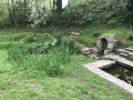
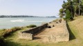
(7) Walk past the ruins of the Hogolo thermal baths and carry on straight ahead to Curés beach.

(8) Head down to the beach, walk along it and, once you reach the end, climb the steps on the left at the edge of the cliff. After the first few rocky steps, continue along the path, keeping to the left as close to the water as possible.

(9) Walk past an orientation board and carry on along the path. Take a short stretch of tarmac road (Rue de Porz Mellec), cross a small car park and continue to the right onto the path that starts just after a no-entry sign.

Follow the path to the Beg Douar car park (E).

Waypoints

  1. S : mi 0 - alt. 23 ft - Place du Port car park
  2. 1 : mi 0.14 - alt. 20 ft - Stairs
  3. 2 : mi 0.27 - alt. 75 ft - Straight on
  4. 3 : mi 0.61 - alt. 95 ft - Chemin de la Falaise
  5. 4 : mi 0.83 - alt. 59 ft - Passage between the hedges
  6. 5 : mi 2.24 - alt. 33 ft - Turn left, following the GR°°®°° signposting. Bridge at - Douron (fleuve)
  7. 6 : mi 2.85 - alt. 20 ft - Dirt track to the left
  8. 7 : mi 3.32 - alt. 46 ft - Roman baths - Thermes du Hogolo
  9. 8 : mi 3.72 - alt. 52 ft - Plage des Curés
  10. 9 : mi 4.46 - alt. 108 ft - Orientation board
  11. E : mi 5.13 - alt. 59 ft - Beg Douar car park

Notes

Please note: this walk does not return to the starting point!
Arrange for two cars: one at the start and one at the finish
If you have no transport waiting at the end, you’ll have to turn back to the start, meaning the walk will be around 16 km (moderate walk).

Also, check the tide times.

(8) If the beach is impassable, continue along the tarmac road. Pass the first car park, then, at the second, take the path on the left which leads to the top of the steps described in the route.

Worth a visit

(7) You can take a break and look at the ruins of the ancient Roman baths at Hogolo.

Always be cautious and plan ahead when you're outdoors. Visorando and the author of this route cannot be held responsible for any accidents occurring on this route.

The GR® and PR® markings are the intellectual property of the Fédération Française de Randonnée Pédestre.

Reviews and comments

5 / 5
Based on 1 review

Reliability of the description
5 / 5
Ease of following the route
5 / 5
Route interest
5 / 5
Mymy14
Mymy14

Overall rating : 5 / 5

Date of your route : Sep 15, 2026
Reliability of the description : ★★★★★ Very good
Ease of following the route : ★★★★★ Very good
Route interest : ★★★★★ Very good
Very busy route : No

It’s really easy to do! It’s great even with a small dog! I’d recommend it

Machine-translated

Other walks in the area

For more walks, use our search engine .

The GPS track and description are the property of this route's author. Please do not copy them without permission.