Country:
 City:
City:



Start from Ladoix, Route de Beaune (at No. 47 if you followed the suggestion from the previous stage).
No signposting
(S) With your back to No. 47, follow the Route de Beaune to the right and cross it at the pedestrian crossing which appears shortly afterwards. Turn left and take the first right onto Rue de la Maréchaude. Walk uphill through the vineyards and, at the T-junction, turn left onto a small road.
(1) At a triangular junction, continue straight on (cycle signs). Enter Aloxe-Corton via Rue de Corton and pass by the foot of a château with a roof of glazed tiles. Shortly afterwards, turn right with the road and reach a junction.
(2) Turn left and cross a small square. At the junction (no entry sign opposite), turn right into Rue des Chaumes.
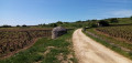
(3) Take the first right onto Rue Charlemagne. Head uphill and pass the water tanks. Continue uphill along the narrow road, ignoring the vineyard paths on either side.
Red and yellow markings + ‘Chemins des grands crus’ signposts
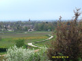
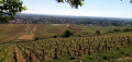
(4) Cross another road on the right-hand side and carry on straight ahead along a gently ascending stretch between two low walls. Pass by the foot of a cross (lovely view) and continue along the road, which soon gives way to a track. Join a small road (lovely view opposite of the village of Pernand-Vergelesses)
No signposting
(5) Follow the road to the left as it descends.
Red and yellow markings + ‘Chemins des grands crus’ signposts
Cross another road and continue straight ahead towards Savigny-lès-Beaune. At the three-way junction that appears shortly afterwards, turn right onto a path. At the end, cross the road carefully and follow it to the left along its right-hand verge.
(6) After a few dozen metres (cross), turn right towards Savigny-lès-Beaune. Ignore a turn-off on the right and follow the small road which climbs gently, winding its way through the vineyards. At a T-junction, turn right, still heading towards Savigny-lès-Beaune.
(7) At the next junction, go straight on; the road is closed to vehicles over 5 t. Enter Savigny-lès-Beaune between two walls. At the first junction, take Rue Péjot opposite. You’ll arrive at the foot of the church and go round it on the right.
(8) Take the first right onto Rue Boulanger et Vallée. At the end, cross a square with a fountain and continue along Rue Guy de Vaulchier. Turn left, then right, following this street.
(9) At the T-junction, turn left. Walk alongside a river on your left and the grounds of the Château de Savigny-lès-Beaune (military aircraft exhibition). Continue straight on and uphill. At a Fork in the road, take the right-hand path, Chemin des Carrières, and continue uphill. Soon, the tarmac gives way to a footpath bordered on the right by a fence.
(10) At the corner of this path, turn right and head uphill through the woodland, following a few bends. At the top, turn left along a low wall separating the path from a road. Pass under the A6 motorway bridge, continue straight on along a fence on your left, then head downhill through a shaded area.
(11) At a signpost, take the second path on the left and head back up a wide path through the forest.
Unmarked
(12) At the junction at the edge of the woodland (signpost), turn right at the edge of the woodland. Note a conservatory of old Burgundian grape varieties on the left. Ignore a path on the left; you’ll come out onto a small road and follow it to the left. Head down between the vineyards towards a pine forest, then enter it.
Red and yellow markings + ‘Chemin des grands crus’ signposting
(13) At the next junction, carry on straight ahead and rejoin theGRP®. At a T-junction, carry on straight ahead along a track. Ignore a stony path on the right and continue along the track, which turns into a gravel track. At the next junction, carry on straight ahead and rejoin the tarmac road. Ignore another road on the right and head downhill.
(14) At the ‘give way’ sign, turn right onto Rue F. Vaillant and head uphill. At the corner by No. 638, turn left onto Chemin du Dessus des Bressandes (a cul-de-sac). At the end of the tarmac road, continue down a path. Note the sweeping panorama of Beaune and its plain on the left. At a three-way junction, turn right and head uphill towards a statue of the Virgin and Child.
(15) At the foot of the statue, turn left and take a grassy path (picnic table; leave the road a short distance to your right). At the T-junction, follow a small road to the left and head downhill. The tarmac gives way to a footpath. Cross a road and turn left onto a path, leaving the gate at No. 24 on your right. At the T-junction, turn right onto a small road.
(16) Immediately, before No. 118, turn left and head downhill. Continue along Rue Mimeur and, at a junction, carry on straight ahead along a one-way street. Head steeply downhill and ignore a small lane on the right. At the T-junction, turn left and you’ll immediately come to another junction (sign saying ‘give way’).
Yellow markings
(17) Turn right (let theGRP® continue straight on) and walk alongside a low wall on your left and a small vineyard on your right. At the T-junction, turn left then immediately right onto a stony path.
No markings
At the next T-junction, turn left onto a path and you’ll soon come to a small road.
Red and yellow markings + ‘Chemin des grands crus’ signposting
(18) Follow the road to the right. At a three-way junction, veer to the right. Follow the winding minor road and ignore the vineyard paths on either side.
(19) At a junction (with a vineyard hut on the right), turn left. At a T-junction, turn right and, after about fifty metres, turn left. Climb gently. When you reach a hut on the left-hand side, the tarmac gives way to a stony track that climbs quite steeply.
(20) Then turn left onto a roughly level dirt track. Ignore a turn-off on the left and continue on level ground. Pass a vineyard hut and head downhill.
(21) At the T-junction, turn right towards Pommard and head uphill. Ignore a turn-off to the left, then one to the right; carry on straight on towards Pommard and climb gently. Just after a left-hand bend, you’ll reach another T-junction.
No signposting
(22) Then turn left and continue climbing gently along a small road. Carry on along the flat (lovely view of the vineyards).
Red and yellow markings + ‘Chemin des grands crus’ signposting
(23) At a T-junction, head downhill to the left and rejoin theGRP®. At the next junction, turn right between two low walls. Ignore two roads on the right and you’ll soon reach another junction.
(24) First turn right then left onto Rue des Chermots. Cross Rue du Pivot on the right-hand side and carry on straight ahead until the next junction.
Yellow markings
(25) Turn left (let theGRP® continue straight on). Take the first right and cross a river. You’ll arrive at Place de l’Église.
Yellow markings + cycle signs
(26) Pass the church on your left and take Rue de la Métairie. At the fork in the road, turn right and leave Pommard via a small road. At the next fork in the road, turn right and head gently uphill.
(27) At the T-junction, turn left and continue uphill. Enter Volnay. At the Stop sign, go straight on.
(28) At the ‘give way’ sign, turn right. At the first Fork in the road, take the left-hand street and ride past the church on your right. Then turn left and, at the next Fork in the road, turn left again.
Cycle signs + Yellow and Blue Santiago de Compostela logo
(29) Take the first left. Walk past a wash house on your left. At the junction (chapel), cross the D973 and continue along the small road opposite.
(30) At the next junction, turn right. At the T-junction, turn right. Immediately ignore a turn-off on the right and turn left. Ignore a turn-off on the left and you’ll soon come to a three-way junction.
(31) Then turn left. At the next junction, keep to the right. At the T-junction, turn left and follow a low wall on your right. Enter the village of Meursault between two walls.
(32) At the crossroads, turn right and, at the Fork in the road shortly afterwards, veer left. At the Stop sign, follow Rue du 11 Novembre to the left. At the Fork in the road, take the left-hand path, passing a school on your right. Shortly afterwards, turn left. Continue straight ahead until you reach Place de l’Hôtel de Ville (church on the left; garden with a fountain and the town hall on the right) (E).

 Visorando Member
 Moderate
 Easy
Easy