From the Bassetta sheepfold (Coscione plateau) to Punta Scaddata

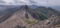
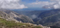
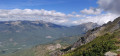
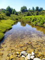
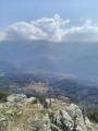
From the Coscione plateau, following a section of the GR® 20, the path initially runs alongside a pretty stream through a lovely beech forest, before gradually reaching the ridge with a magnificent view of the upper Taravo. At the end of the climb, you emerge onto a rocky pass opening out onto the Taravo valley and Ventiseri on the coast. You follow the ridge along the eastern slope to Punta Scaddata, where you can enjoy a unique view of the upper Taravo on one side and the eastern plain on the other.

Details

26973093
Creation:
Last update:
Last review:
  • Walking
    Activity: Walking
  • ↔
    Distance: 7.47 mi
  • ◔
    Average duration: 5h 10 
  • ▲
    Difficulty: Moderate

  • ⚐
    Back to start: Yes
  • ↗
    Ascent: + 1,978 ft
  • ↘
    Descent: - 1,965 ft

  • ▲
    Highest point: 5,942 ft
  • ▼
    Lowest point: 4,259 ft
  • ⚐ Country: France
  • ⚐ City: Zicavo (20132)
  • ⚑
    Start/End: N 41.884672° / E 9.14498°
  • ❏
    IGN map(s): Ref. 4253ET, 4253ETR, 4253OT
  • Hour-by-hour weather

Photos

Description of the walk

Access the start of the walk via the D428, which serves the Coscione plateau. At the Bergerie de Bassetta, parking is available at the side of the road just before the entrance to the sheepfold (private property): maximum three or four cars.

(S/E) Head down towards the sheepfold, take the small path running along the right-hand side of the lodge’s fence, then follow the red and whiteGR® 20 markings at all times.

(1) Cross the path at right angles and continue straight ahead, following the GR®.

(2) Ford the Partuso stream and carry on straight ahead until you reach a crossroads.

(3) Continue straight ahead, following theGR® (red and white markings), until you reach the Bocca di l’Agnone plateau.

(4) Turn left, leaving the path to the right heading towards Croce.

(5) Pass between two rocks at the summit on the ridge to reach the eastern slope. Below Punta Scaddatta, climb up the small ridge to the left to enjoy a 360° panorama.

(6) Follow the route back down the way you came to return to the car park at Bergeries de Bassetta (S/E).

Waypoints

  1. S/E : mi 0 - alt. 4,304 ft - Bassetta sheepfold
  2. 1 : mi 0.56 - alt. 4,423 ft - Crossroads, go straight on
  3. 2 : mi 1.08 - alt. 4,262 ft - Fording a stream
  4. 3 : mi 1.68 - alt. 4,508 ft - Crossroads, go straight on
  5. 4 : mi 2.63 - alt. 5,157 ft - Bocca di l’Agnogne, on the left
  6. 5 : mi 3.53 - alt. 5,922 ft - Passage between two rocks
  7. 6 : mi 3.76 - alt. 5,942 ft - Punta Scaddata, viewpoint
  8. S/E : mi 7.47 - alt. 4,308 ft - Bassetta sheepfold

Notes

There are no water sources along the route. Walking poles are recommended.

Worth a visit

Between (1) and (3), the path runs alongside the pretty Veracolongu stream.

(5) Just before this point, right up to where the slope changes direction, there is a stunning view of the Taravo Valley, its mountains and the villages.

(5) As you pass between the two rocks, there is a magnificent view over the Travo Valley as far as the eastern coast of Corsica, with the village of Ventiséri right at the bottom (the air force runways are visible).

(6) A superb view of the eastern slopes of Corsica.

(5) Climb the small ridge to the left ofthe GR® trail below Punta Scaddatta to enjoy an exceptional 360° panorama of the upper Taravo valley to the west and the eastern slopes to the east.

Always be cautious and plan ahead when you're outdoors. Visorando and the author of this route cannot be held responsible for any accidents occurring on this route.

The GR® and PR® markings are the intellectual property of the Fédération Française de Randonnée Pédestre.

Reviews and comments

4.6 / 5
Based on 3 reviews

Reliability of the description
4.7 / 5
Ease of following the route
4.7 / 5
Route interest
4.3 / 5
alex.serra
alex.serra

Overall rating : 5 / 5

Date of your route : Jun 04, 2026
Reliability of the description : ★★★★★ Very good
Ease of following the route : ★★★★★ Very good
Route interest : ★★★★★ Very good
Very busy route : Yes

A superb hike that starts along the river through the woodland, before climbing up to the entrance to Punta Scaddata through a forest that’s 90% covered in trees. If you only have time for one hike, this is the one to do – the scenery is absolutely stunning, and the view from Punta Scaddata is simply breathtaking. Views over Solenzara. It’s a bit busy, but that’s to be expected – it is the GR 20, after all. It gives you a chance to chat with others, which is really rewarding. Definitely worth doing again 🤣🤣

Machine-translated

Monze30
Monze30

Overall rating : 4.7 / 5

Date of your route : Jun 21, 2024
Reliability of the description : ★★★★★ Very good
Ease of following the route : ★★★★★ Very good
Route interest : ★★★★☆ Good
Very busy route : No

A walk in the fog, wind and rain
No visibility
But very varied and brilliant all the same
The fog gave it a mystical feel
One to do again in fine weather

Machine-translated

bidiman
bidiman

Overall rating : 4 / 5

Date of your route : Mar 05, 2023
Reliability of the description : ★★★★☆ Good
Ease of following the route : ★★★★☆ Good
Route interest : ★★★★☆ Good
Very busy route : No

Machine-translated

Other walks in the area

For more walks, use our search engine .

The GPS track and description are the property of this route's author. Please do not copy them without permission.