From L’Escoubaye to Clot la Cime

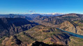
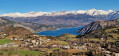
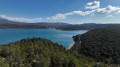
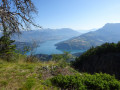
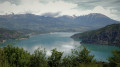
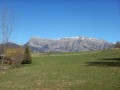
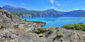
The hike described here is an exceptional experience for lovers of nature and magnificent landscapes. The Escoubaye route offers spectacular panoramic views of the Durance valley, Lake Serre-Ponçon and the surrounding mountains, guaranteeing some truly memorable moments. The ascent to Clot la Cime, through a peaceful and soothing beech forest, adds a touch of serenity to this adventure. At the summit, the reward is priceless: a breathtaking view of natural wonders such as the lake, the Aiguilles de Chabrières, Mont Guillaume and the Grand Morgon. An unmissable hike for lovers of alpine landscapes.

Details

67548932
Creation:
Last update:
Last review:
  • Walking
    Activity: Walking
  • ↔
    Distance: 8.54 mi
  • ◔
    Average duration: 6h 30 
  • ▲
    Difficulty: Difficult

  • ⚐
    Back to start: Yes
  • ↗
    Ascent: + 2,910 ft
  • ↘
    Descent: - 2,920 ft

  • ▲
    Highest point: 5,200 ft
  • ▼
    Lowest point: 2,766 ft

Photos

Description of the walk

On arriving at La Bréole, park in the car park below the municipal swimming pool, near the “Rechastel” village club.

(S/E) Start the walk on the flat road heading north, pass Les Masses and continue along the road until you reach the sign marking the start of the Escoubaye route, which is signposted in yellow.

(1) Leave the road and take the path on your right. As you pass the castle ruins, read the information board recounting its epic history.

(2) Once you reach the clearing, ignore the tracks leading down and continue to the right, heading due north, along the track that climbs. Enjoy the view to your right. Then leave the track leading to the vast pasture and follow the path branching off to your left.

(3) Ignore the path branching off to your left in the opposite direction and continue down the slope to the next panoramic viewpoint, where a bench offers a chance to rest.

(4) Pass the Escoubaye fountain and continue along the path heading south-east.

(5) Ignore the path leading uphill on your right and continue downhill. Walk past the sewage treatment works and join the road (D57).

(6) Follow the road to your right until you reach a barely visible path on your right.

(7) Leave the road to take this path, climb up to the village club – this section is not signposted – pass under the building and return to the starting car park.

(S/E) Turn left onto the road towards the town hall. Join the main street, follow it to the left until you reach the restaurant/pizzeria.

(8) Take the path on your right between the two large buildings and head up to the D900b. Cross the D900b with care and continue along theGRP® ‘Tour du Lac de Serre-Ponçon’.

(9) Leave theGRP® and take the path on your right signposted “Clot la Cime”; the route is marked in yellow.

(10) Turn right, ignoring a path straight ahead; follow a few hairpin bends and pass the newly built hut.

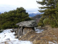
(11) At the crossroads, cross the track and take the path opposite, which climbs steeply. You’ll reach the wayside shrine at an altitude of 1,473 metres.

(12) Carry on straight ahead until you reach the three-way junction about 200 metres further on.

(13) Take either the path on the right or the one on the left; both lead to Clot la Cime.

(14) Enjoy the superb views over Lake Serre-Ponçon, then turn back.

(13) Follow the ascent route in the opposite direction to return to the car park where you started (S/E).


Waypoints

  1. S/E : mi 0 - alt. 3,061 ft - Car park located below the municipal swimming pool
  2. 1 : mi 0.26 - alt. 3,091 ft - Signpost, on the right
  3. 2 : mi 0.78 - alt. 3,133 ft - Clearing
  4. 3 : mi 1.17 - alt. 3,097 ft - Trail junction. View of the - Lac de Serre-Ponçon
  5. 4 : mi 1.31 - alt. 2,943 ft - Escoubaye Fountain
  6. 5 : mi 1.57 - alt. 2,953 ft - Trail junction
  7. 6 : mi 1.98 - alt. 2,782 ft - Crossroads between the track and the D57
  8. 7 : mi 2.14 - alt. 2,867 ft - Path on the right
  9. 8 : mi 2.65 - alt. 3,045 ft - Restaurant-Pizzeria
  10. 9 : mi 3.04 - alt. 3,238 ft - Junction common to both the outward and return journeys
  11. 10 : mi 4 - alt. 4,160 ft - Junction common to both the outward and return journeys
  12. 11 : mi 4.62 - alt. 4,557 ft - Crossroads: track/path (altitude 1,390)
  13. 12 : mi 5.02 - alt. 4,839 ft - The Oratory
  14. 13 : mi 5.18 - alt. 4,993 ft - Junction for both outbound and return routes
  15. 14 : mi 5.38 - alt. 5,200 ft - Clot la Cime (1594m)
  16. S/E : mi 8.54 - alt. 3,058 ft - Car park located below the municipal swimming pool

Worth a visit

Do visit the Ubaye Dairy Co-operative – La Bréole Cheese Dairy.

Reviews and comments

4.7 / 5
Based on 2 reviews

Reliability of the description
5 / 5
Ease of following the route
5 / 5
Route interest
4 / 5
Fred Scavo
Fred Scavo

Overall rating : 5 / 5

Date of your route : Aug 04, 2025
Reliability of the description : ★★★★★ Very good
Ease of following the route : ★★★★★ Very good
Route interest : ★★★★★ Very good
Very busy route : No

A superb walk with lots of forest and magnificent views of the lake.
No particular difficulties. It's a shame you can't make a loop on the way back down.

Machine-translated

User 26547230

Overall rating : 4.3 / 5

Date of your route : Jul 14, 2025
Reliability of the description : ★★★★★ Very good
Ease of following the route : ★★★★★ Very good
Route interest : ★★★☆☆ Average
Very busy route : No

The second part of the walk up to the Clôt des Cimes is really lovely, with an incredible view from the summit. However, the first part is a bit of a… warm-up. You pass close to the lake and there’s a nice viewpoint (though there’s a slightly unpleasant stretch near the sewage treatment works), but for those interested in a bit of a climb, I’d recommend skipping straight to the second part of the walk!

Machine-translated

PapouBertrand
PapouBertrand

Good evening. Generally speaking, yes, and the paths are well signposted, except between point 7 and the start/finish line, but you can carry on along the road to reach point 8 directly. Have a good evening.

Machine-translated

AUDO13
AUDO13

Hello, is the walk fully signposted? Thank you

Machine-translated

Other walks in the area

For more walks, use our search engine .

The GPS track and description are the property of this route's author. Please do not copy them without permission.