From Bridge of Orchy to Kingshouse Hotel

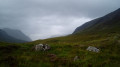
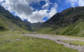
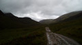
This fifth stage of the WHW takes us through some stunning scenery! The climb up the small hill of Màm Carraigh first offers a beautiful view over Loch Tulla. Then, for about ten kilometres, we follow a very easy-to-walk-on old military road, climbing gently and steadily towards a pass in the middle of the moor. The descent takes place against the backdrop of the distinctive pyramidal silhouette of the summit of Buachaille.

This walk is part of a multi-day hike: The West Highland Way

Details

2445295
Creation:
Last update:
Last review:
  • Walking
    Activity: Walking
  • ↔
    Distance: 12.11 mi
  • ◔
    Average duration: 6h 50 
  • ▲
    Difficulty: Difficult

  • ⚐
    Back to start: No
  • ↗
    Ascent: + 1,496 ft
  • ↘
    Descent: - 1,211 ft

  • ▲
    Highest point: 1,467 ft
  • ▼
    Lowest point: 495 ft

Photos

Description of the walk

Start from the Hotel in Bridge of Orchy, along the A82.

Official WHW signposting: signposts featuring a thistle flower + signposts with a yellow arrow for changes of direction + directional signposts.

(S) At the junction on the corner by the hotel, turn left (west) onto the small road that gently descends towards the River Orchy. Cross the bridge over the river.

(1) At the crossroads just after the bridge, leave the tarmac and take a gravel path diagonally to the right. Climb gently, enter the forest and continue uphill.

(2) Turn left along the path and emerge from the forest. The path continues to climb gently, winding through the meadows (ignore a shortcut that cuts across a hairpin bend). You’ll reach the Màm Carraigh hillock (cairn).

(3) Head back down, enjoying a lovely view of Loch Tulla below on the right. You’ll come out onto a small road; follow it to the left. Cross a river straight away and you’ll soon reach the Iveroran Hotel.

(4) Continue westwards along the small road, which soon turns right (north) after crossing a river. Cross another river via the Victoria Bridge and arrive at Forest Lodge.

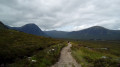
(5) Continue straight on, pass through a barrier and take a good stony track: this is a former military road, which you should follow for 10 km until you reach a pass. Climb gently, first across open ground and then along the edge of the woodland on your right.

(6) After the woodland, continue northwards across the moorland. Follow the edge of a woodland on your left, then descend slightly to a small lake.

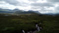
(7) Continue north along the path, at the foot of the peaks on the left. Take the Bà Bridge to cross a river and climb gently.

(8) Cross another river and climb steadily up to the (unnamed) pass, dominated on the left by a hillock on which stands a curious structure shaped like a small mill.

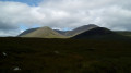
(9) Continue northwards and begin the descent. Note, to the north, the valley through which the A82 road runs, and, to the west, the pyramidal peak of Buachaille.

(10) At a three-way junction (Glencoe ski resort on the left), take the path on the right.

(11) You’ll come out onto a small road; follow it to the right.

(12) Cross the A82 (take care, fast-moving traffic) and continue along the path opposite (barrier). Walk north-west to reach the Kingshouse Hotel (E).

Waypoints

  1. S : mi 0 - alt. 528 ft - Bridge of Orchy Hotel
  2. 1 : mi 0.1 - alt. 502 ft - Crossroads
  3. 2 : mi 0.82 - alt. 830 ft - Turn left and exit the forest
  4. 3 : mi 1.46 - alt. 1,050 ft - Màm Carraigh
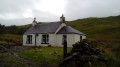
  5. 4 : mi 2.43 - alt. 587 ft - Inveroran Hotel
  6. 5 : mi 3.27 - alt. 587 ft - Forest Lodge
  7. 6 : mi 4.78 - alt. 938 ft - Edge of a woodland
  8. 7 : mi 6.71 - alt. 1,010 ft - Lochan Mhic Pheadair Ruaidh
  9. 8 : mi 8.22 - alt. 1,145 ft - Bridge over Allt Creagan nam Meann
  10. 9 : mi 9.33 - alt. 1,457 ft - Unnamed pass
  11. 10 : mi 10.63 - alt. 1,119 ft - Three-Way Junction
  12. 11 : mi 10.93 - alt. 1,027 ft - Short road
  13. 12 : mi 11.35 - alt. 958 ft - A82 road
  14. E : mi 12.11 - alt. 810 ft - Kingshouse Hotel

Notes

Equipment:
Waterproof walking boots. Rain gear: rain cape, rucksack cover, etc. Warm clothing, depending on how sensitive you are to the cold. Midge repellent.

Guidance:
The route is relatively straightforward and the route is very well signposted at junctions. A paper map is useful (at the very least the one accompanying this description) or a route track on a smartphone (remember to cache the base map beforehand).

Food and drink:
Make sure you have a supply of water and a packed lunch before setting off.
(4) Inveroran Hotel. Tel: +44 - (0)1 838 400 220. Hotel, bar and restaurant.

Accommodation on arrival (E):
Kingshouse Hotel. Tel: +44 - (0)1 855 851 259. It has a bar and restaurant and offers packed lunches for the following day (to be ordered the day before; £10.50 per person in August 2019). It’s the only accommodation on site, but it really is top-notch! Camping is available nearby.

Worth a visit

- At the viewpoint (3) (Màm Carraigh): a stunning view over Loch Tulla.
- Between (5) and (9): a very pleasant, gentle climb up to a pass, through the moorland and at the foot of some beautiful peaks.
- Between (9) and (E): lovely views of the Buachaille massif.

Reviews and comments

Other walks in the area

For more walks, use our search engine .

The GPS track and description are the property of this route's author. Please do not copy them without permission.