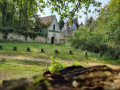
Discovering the Fontaine Sorel

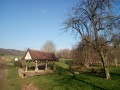
Set off to explore the Sorel Fountain, built during the First World War by French soldiers who had tapped into a spring situated higher up the slope.

Details

932478
Creation:
Last update:
Last review:
  • Walking
    Activity: Walking
  • ↔
    Distance: 8.52 mi
  • ◔
    Average duration: 4h 40 
  • ▲
    Difficulty: Moderate

  • ⚐
    Back to start: Yes
  • ↗
    Ascent: + 899 ft
  • ↘
    Descent: - 879 ft

  • ▲
    Highest point: 574 ft
  • ▼
    Lowest point: 210 ft

Photos

Description of the walk

Start at the Nature and Hiking Centre in Élincourt-Sainte-Marguerite.

(S/E) Take the path on the left towards the Marfontaine Departmental Forest Estate. Follow the Bois d’Élincourt route; it is signposted.

(1) At the first junction (T-junction), turn right. Continue along this path, ignoring the track on the left.

(2) At the junction, turn right. Immediately ignore a path branching off to the right.

(3) At the junction, ignore the path branching off to the right and continue south. Further on, turn left onto the path (east-southeast).

(4) At the junction, carry straight on. At the next junction, turn right (south-east).

(5) At the crossroads, turn right. Immediately ignore a path branching off to the left and carry on south-west. Stay on the main path, ignoring a few side paths. Gradually leave the woods behind and head down into the fields.

(6) At the T-junction, turn left, following signs for “Liaison de la route de la Montagne du Paradis” and “Route des carrières”.

(7) At the next junction, turn left (north-east). Take the first path on the right. At the end, turn right.

(8) Follow the road to the left towards Montagne du Paradis. After about 100 metres, take the next path on the left to return to the woods. rejoin the road and follow it as it continues (north-east). After about 350 metres, leave the road and take a path on the right.

(9) Turn right and follow the Chemin de la Montagne du Paradis. Walk past the remains of the old Élincourt windmill. Continue straight on to the southern edge of the hill. At Terre Allard, go down the sunken path on the right.

(10) At the junction (with a table and benches), turn right and pass under a power line. At the next junction, turn right towards the Route de la Montagne du Paradis and pass under the power line again. Follow the north-north-westerly path to Rue du Rhosne

(11) You are now in the village; turn left, following the yellow markings. Then turn right to reach the Fontaine Sorel (picnic tables and bins for rubbish).

(12) Continue along the path, heading north-north-east.

(7) Turn left. Follow the outbound route in the opposite direction, passing through Montagne Gérémy and the Bois de Thiescourt.

(3) Turn left onto the ‘Petite Suisse d’Élincourt’ alternative route. Ignore a path coming from the right and head down towards the south. At the T-junction, turn right to return to the starting point (S/E).

Waypoints

  1. S/E : mi 0 - alt. 328 ft - Élincourt Sainte-Marguerite hiking centre
  2. 1 : mi 0.24 - alt. 446 ft - T-junction
  3. 2 : mi 0.45 - alt. 535 ft - Junction
  4. 3 : mi 0.7 - alt. 528 ft - Junction
  5. 4 : mi 1.01 - alt. 495 ft - Crossroads
  6. 5 : mi 1.3 - alt. 574 ft - Crossroads
  7. 6 : mi 2.24 - alt. 295 ft - T-junction
  8. 7 : mi 2.4 - alt. 295 ft - Junction
  9. 8 : mi 2.86 - alt. 279 ft - Small road
  10. 9 : mi 3.61 - alt. 558 ft - To the right
  11. 10 : mi 4.76 - alt. 256 ft - Crossroads – Table and benches
  12. 11 : mi 5.7 - alt. 243 ft - To the left
  13. 12 : mi 5.89 - alt. 217 ft - Sorel Fountain
  14. S/E : mi 8.52 - alt. 328 ft - Élincourt Sainte-Marguerite hiking centre

Notes

You’ll find picnic tables along the way. Most of the route is in the shade, but do bring a hat for the unshaded sections.
Take water and snacks for the duration of the walk.

Worth a visit

By car, you’ll pass the Château de Bellinglise before reaching the Élincourt hiking centre.
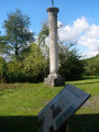
Along the way, you’ll see the remains of the old mill before finally reaching the Sorel Fountain.

Reviews and comments

4.3 / 5
Based on 4 reviews

Reliability of the description
4.5 / 5
Ease of following the route
4.5 / 5
Route interest
3.8 / 5
User 24435596

Overall rating : 5 / 5

Date of your route : Aug 10, 2026
Reliability of the description : ★★★★★ Very good
Ease of following the route : ★★★★★ Very good
Route interest : ★★★★★ Very good
Very busy route : No

A pleasant walk, with a few steep sections but nothing too difficult. The route is mostly in the shade.

Machine-translated

tandemrochri
tandemrochri

Overall rating : 4 / 5

Date of your route : Jun 10, 2024
Reliability of the description : ★★★★☆ Good
Ease of following the route : ★★★★★ Very good
Route interest : ★★★☆☆ Average
Very busy route : No

This route is best tackled in hot weather as it is quite shady (lots of undergrowth) and very cool beneath the canopy.
Bring some VTS refreshments
An interesting starting point: plenty of walks

Machine-translated

annie leonard
annie leonard

Overall rating : 4 / 5

Date of your route : Aug 15, 2019
Reliability of the description : ★★★★★ Very good
Ease of following the route : ★★★★★ Very good
Route interest : ★★☆☆☆ Disappointing

A pleasant walk with plenty of walking through the forest, but the fountain (which is actually towards the end of the walk) isn’t particularly interesting. It’s more of a leisurely stroll through the forest than anything else.

Machine-translated

Other walks in the area

For more walks, use our search engine .

The GPS track and description are the property of this route's author. Please do not copy them without permission.